Gorham Topo Map Kansas
To zoom in, hover over the map of Gorham
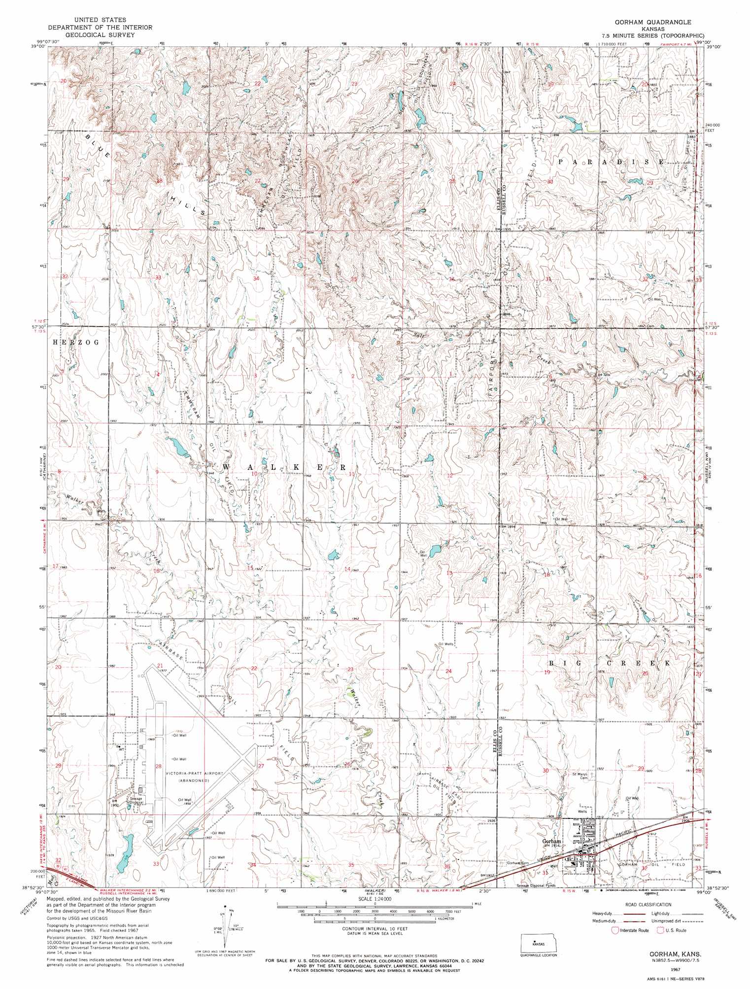
USGS Topo Quad 38099h1 - 1:24,000 scale
| Topo Map Name: | Gorham |
| USGS Topo Quad ID: | 38099h1 |
| Print Size: | ca. 21 1/4" wide x 27" high |
| Southeast Coordinates: | 38.875° N latitude / 99° W longitude |
| Map Center Coordinates: | 38.9375° N latitude / 99.0625° W longitude |
| U.S. State: | KS |
| Filename: | o38099h1.jpg |
| Download Map JPG Image: | Gorham topo map 1:24,000 scale |
| Map Type: | Topographic |
| Topo Series: | 7.5´ |
| Map Scale: | 1:24,000 |
| Source of Map Images: | United States Geological Survey (USGS) |
| Alternate Map Versions: |
Gorham KS 1967, updated 1968 Download PDF Buy paper map Gorham KS 2010 Download PDF Buy paper map Gorham KS 2012 Download PDF Buy paper map Gorham KS 2015 Download PDF Buy paper map |
1:24,000 Topo Quads surrounding Gorham
Plainville |
Codell |
Natoma |
Paradise Nw |
Paradise Ne |
Plainville Se |
Turkville |
Fairport |
Paradise |
Waldo |
Hays North |
Catharine |
Gorham |
Russell Nw |
Russell |
Hays South |
Victoria |
Walker |
Russell Sw |
Homer |
Liebenthal |
Pfeifer |
Otis Ne |
Galatia |
Susank |
> Back to 38099e1 at 1:100,000 scale
> Back to 38098a1 at 1:250,000 scale
> Back to U.S. Topo Maps home
Gorham topo map: Gazetteer
Gorham: Airports
Victoria Pratt Airport elevation 600m 1968′Gorham: Oilfields
Airbase East Oil Field elevation 583m 1912′Airbase Oil Field elevation 598m 1961′
Blue Hill Southeast Oil Field elevation 554m 1817′
Emmeram Northeast Oil Field elevation 603m 1978′
Emmeram Oil Field elevation 602m 1975′
Fairport Oil Field elevation 584m 1916′
Kune Oil Field elevation 563m 1847′
Reich Oil Field elevation 560m 1837′
Gorham: Populated Places
Gorham elevation 583m 1912′Gorham: Ranges
Blue Hills elevation 618m 2027′Gorham digital topo map on disk
Buy this Gorham topo map showing relief, roads, GPS coordinates and other geographical features, as a high-resolution digital map file on DVD: