Ellis Topo Map Kansas
To zoom in, hover over the map of Ellis
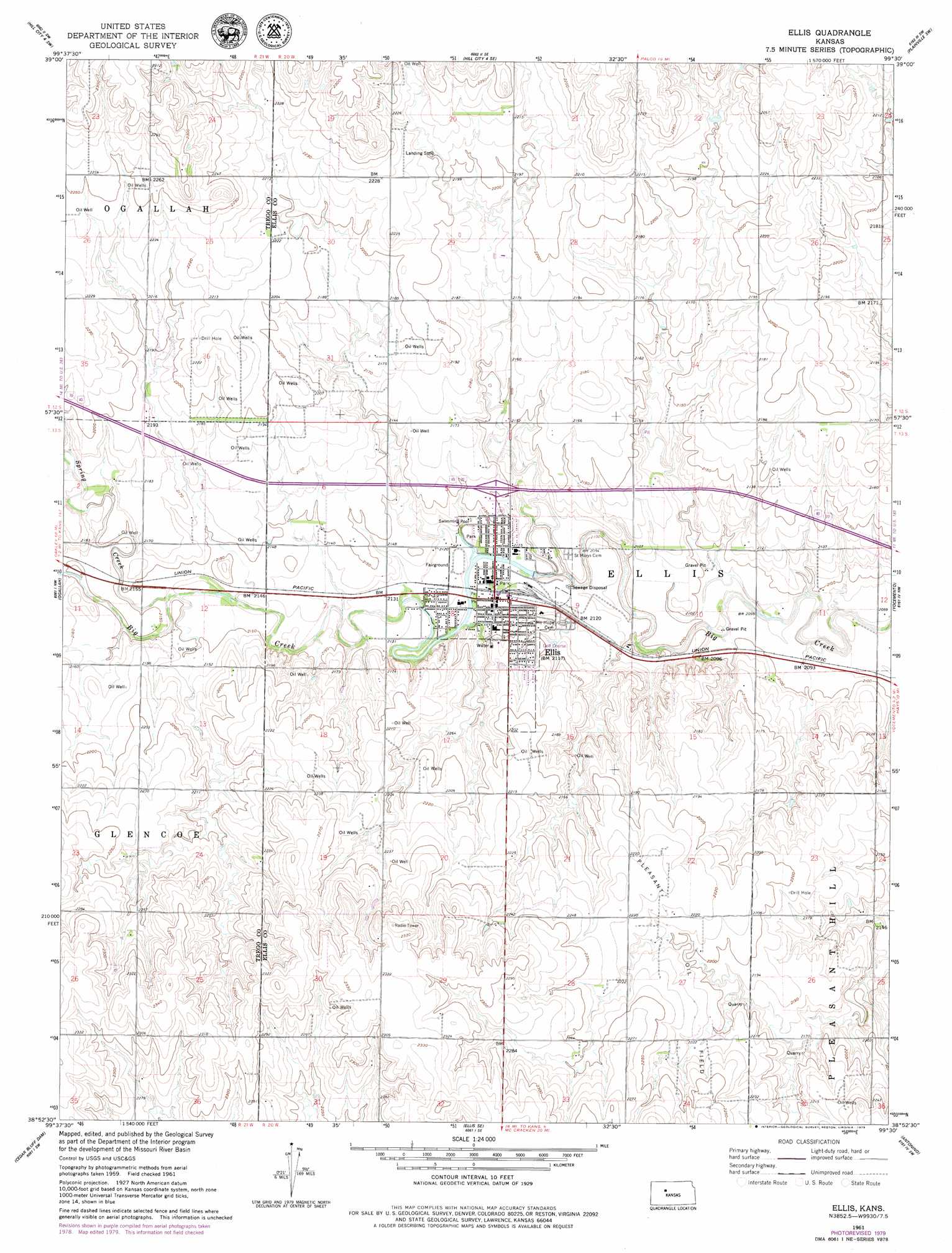
USGS Topo Quad 38099h5 - 1:24,000 scale
| Topo Map Name: | Ellis |
| USGS Topo Quad ID: | 38099h5 |
| Print Size: | ca. 21 1/4" wide x 27" high |
| Southeast Coordinates: | 38.875° N latitude / 99.5° W longitude |
| Map Center Coordinates: | 38.9375° N latitude / 99.5625° W longitude |
| U.S. State: | KS |
| Filename: | o38099h5.jpg |
| Download Map JPG Image: | Ellis topo map 1:24,000 scale |
| Map Type: | Topographic |
| Topo Series: | 7.5´ |
| Map Scale: | 1:24,000 |
| Source of Map Images: | United States Geological Survey (USGS) |
| Alternate Map Versions: |
Ellis KS 1961, updated 1962 Download PDF Buy paper map Ellis KS 1961, updated 1979 Download PDF Buy paper map Ellis KS 2009 Download PDF Buy paper map Ellis KS 2012 Download PDF Buy paper map Ellis KS 2015 Download PDF Buy paper map |
1:24,000 Topo Quads surrounding Ellis
Togo |
Hill City 4 Nw |
Wild Horse Creek |
Zurich |
Plainville |
Wa Keeney East |
Hill City 4 Sw |
Hill City 4 Se |
Plainville Sw |
Plainville Se |
Trego Center Ne |
Ogallah |
Ellis |
Yocemento |
Hays North |
Cedar Bluff |
Cedar Bluff Dam |
Ellis Se |
Antonino |
Hays South |
Osgood |
Brownell |
Mccracken Ne |
La Crosse Nw |
Liebenthal |
> Back to 38099e1 at 1:100,000 scale
> Back to 38098a1 at 1:250,000 scale
> Back to U.S. Topo Maps home
Ellis topo map: Gazetteer
Ellis: Airports
Ellis Landing Field elevation 667m 2188′Ellis: Oilfields
Pleasant Oil Field elevation 671m 2201′Ellis: Populated Places
Ellis elevation 646m 2119′Ellis: Streams
Spring Creek elevation 653m 2142′Ellis digital topo map on disk
Buy this Ellis topo map showing relief, roads, GPS coordinates and other geographical features, as a high-resolution digital map file on DVD: