Scott City Topo Map Kansas
To zoom in, hover over the map of Scott City
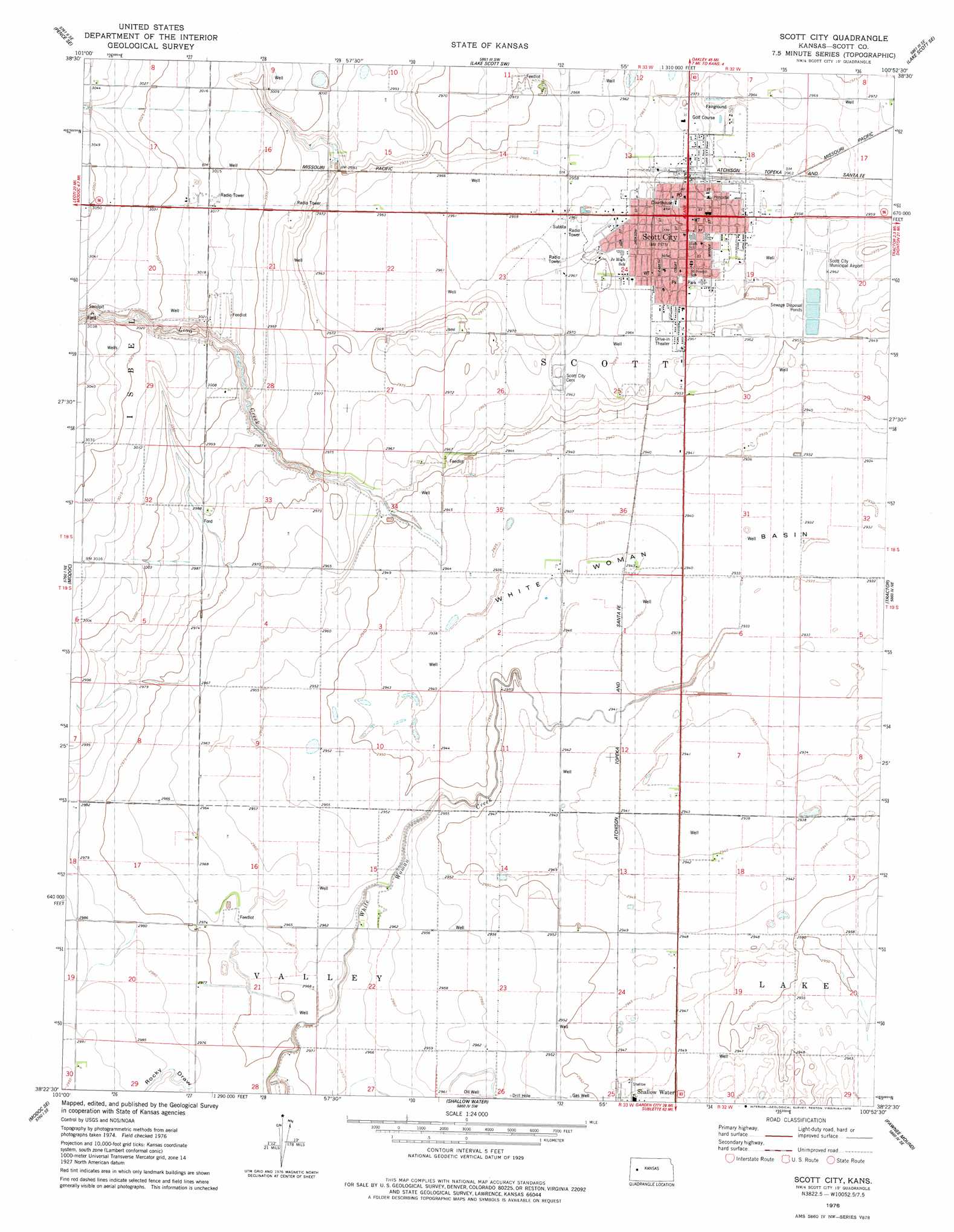
USGS Topo Quad 38100d8 - 1:24,000 scale
| Topo Map Name: | Scott City |
| USGS Topo Quad ID: | 38100d8 |
| Print Size: | ca. 21 1/4" wide x 27" high |
| Southeast Coordinates: | 38.375° N latitude / 100.875° W longitude |
| Map Center Coordinates: | 38.4375° N latitude / 100.9375° W longitude |
| U.S. State: | KS |
| Filename: | o38100d8.jpg |
| Download Map JPG Image: | Scott City topo map 1:24,000 scale |
| Map Type: | Topographic |
| Topo Series: | 7.5´ |
| Map Scale: | 1:24,000 |
| Source of Map Images: | United States Geological Survey (USGS) |
| Alternate Map Versions: |
Scott City KS 1976, updated 1978 Download PDF Buy paper map Scott City KS 2009 Download PDF Buy paper map Scott City KS 2012 Download PDF Buy paper map Scott City KS 2015 Download PDF Buy paper map |
1:24,000 Topo Quads surrounding Scott City
Pence Nw |
Pence |
Lake Scott |
Lake Scott Ne |
Healy Nw |
Pence Sw |
Pence Se |
Lake Scott Sw |
Lake Scott Se |
Manning |
Marienthal |
Modoc |
Scott City |
Tractor |
Grigston |
Modoc Sw |
Modoc Se |
Shallow Water |
Pawnee Mound |
Amy Sw |
Wolf Nw |
Wolf Ne |
Tennis |
Tennis Ne |
Scott City 4 Nw |
> Back to 38100a1 at 1:100,000 scale
> Back to 38100a1 at 1:250,000 scale
> Back to U.S. Topo Maps home
Scott City topo map: Gazetteer
Scott City: Airports
Scott City Municipal Airport elevation 902m 2959′Scott City: Basins
White Woman Basin elevation 893m 2929′Scott City: Populated Places
Hutchins elevation 896m 2939′Scott City elevation 908m 2979′
Scott City: Streams
Lion Creek elevation 898m 2946′White Woman Creek elevation 894m 2933′
Scott City: Valleys
Rocky Draw elevation 903m 2962′Scott City digital topo map on disk
Buy this Scott City topo map showing relief, roads, GPS coordinates and other geographical features, as a high-resolution digital map file on DVD: