Wallace Topo Map Kansas
To zoom in, hover over the map of Wallace
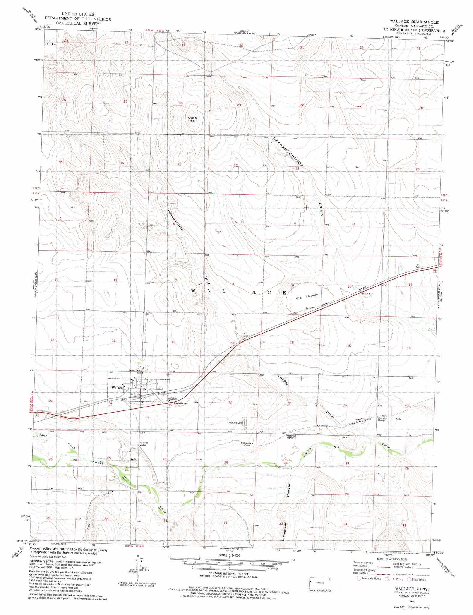
USGS Topo Quad 38101h5 - 1:24,000 scale
| Topo Map Name: | Wallace |
| USGS Topo Quad ID: | 38101h5 |
| Print Size: | ca. 21 1/4" wide x 27" high |
| Southeast Coordinates: | 38.875° N latitude / 101.5° W longitude |
| Map Center Coordinates: | 38.9375° N latitude / 101.5625° W longitude |
| U.S. State: | KS |
| Filename: | o38101h5.jpg |
| Download Map JPG Image: | Wallace topo map 1:24,000 scale |
| Map Type: | Topographic |
| Topo Series: | 7.5´ |
| Map Scale: | 1:24,000 |
| Source of Map Images: | United States Geological Survey (USGS) |
| Alternate Map Versions: |
Wallace KS 1979, updated 1980 Download PDF Buy paper map Wallace KS 2009 Download PDF Buy paper map Wallace KS 2012 Download PDF Buy paper map Wallace KS 2015 Download PDF Buy paper map |
1:24,000 Topo Quads surrounding Wallace
Horsethief Draw Ne |
Wild Horse Draw |
Harris Draw Ne |
Mcallaster Nw |
Mcallaster Ne |
Horsethief Draw Se |
Harris Draw West |
Harris Draw East |
Mcallaster |
Mcallaster Se |
Sharon Springs West |
Sharon Springs East |
Wallace |
Russell Springs 2 Nw |
Russell Springs 2 Ne |
Spring Valley Ranch |
South Flats |
Harrison Flats |
Russell Springs 2 Sw |
Russell Springs 2 Se |
Sharon Springs 3 Ne |
Sharon Springs 4 Nw |
Sharon Springs 4 Ne |
Russell Springs 3 Nw |
Russell Springs 3 Ne |
> Back to 38101e1 at 1:100,000 scale
> Back to 38100a1 at 1:250,000 scale
> Back to U.S. Topo Maps home
Wallace topo map: Gazetteer
Wallace: Flats
Big Lagoon elevation 989m 3244′Wallace: Populated Places
Wallace elevation 1010m 3313′Wallace: Streams
Coon Creek elevation 989m 3244′Pond Creek elevation 994m 3261′
Shirley Creek elevation 993m 3257′
Wallace: Summits
Motti Hill elevation 1062m 3484′Wallace: Valleys
Capper Draw elevation 970m 3182′Headquarters Draw elevation 986m 3234′
Homestead Canyon elevation 977m 3205′
Wallace digital topo map on disk
Buy this Wallace topo map showing relief, roads, GPS coordinates and other geographical features, as a high-resolution digital map file on DVD: