Holly West Topo Map Colorado
To zoom in, hover over the map of Holly West
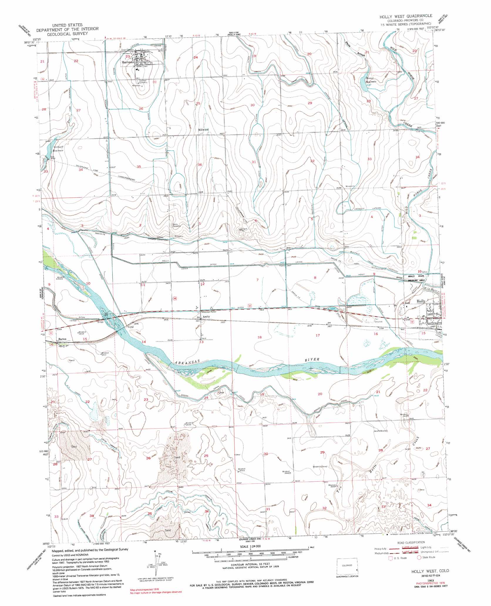
USGS Topo Quad 38102a2 - 1:24,000 scale
| Topo Map Name: | Holly West |
| USGS Topo Quad ID: | 38102a2 |
| Print Size: | ca. 21 1/4" wide x 27" high |
| Southeast Coordinates: | 38° N latitude / 102.125° W longitude |
| Map Center Coordinates: | 38.0625° N latitude / 102.1875° W longitude |
| U.S. State: | CO |
| Filename: | o38102a2.jpg |
| Download Map JPG Image: | Holly West topo map 1:24,000 scale |
| Map Type: | Topographic |
| Topo Series: | 7.5´ |
| Map Scale: | 1:24,000 |
| Source of Map Images: | United States Geological Survey (USGS) |
| Alternate Map Versions: |
Holly West CO 1953, updated 1954 Download PDF Buy paper map Holly West CO 1953, updated 1954 Download PDF Buy paper map Holly West CO 1953, updated 1977 Download PDF Buy paper map Holly West CO 1953, updated 1991 Download PDF Buy paper map Holly West CO 2010 Download PDF Buy paper map Holly West CO 2013 Download PDF Buy paper map Holly West CO 2016 Download PDF Buy paper map |
1:24,000 Topo Quads surrounding Holly West
Sheridan Lake Sw |
Sheridan Lake Se |
Lake Devore |
Towner Se |
Tribune Sw |
Granada Nw |
Granada Ne |
Holly Nw |
Holly Ne |
Tribune 3 Nw |
Carlton |
Granada |
Holly West |
Holly East |
Tribune 3 Sw |
North Plum Creek Nw |
North Plum Creek Ne |
Durkee Creek Nw |
Durkee Creek Ne |
Syracuse West Nw |
Barrel Spring |
North Plum Creek Se |
Two Butte Springs |
Durkee Creek Se |
Syracuse West Sw |
> Back to 38102a1 at 1:100,000 scale
> Back to 38102a1 at 1:250,000 scale
> Back to U.S. Topo Maps home
Holly West topo map: Gazetteer
Holly West: Airports
Air-Sprayers Number 2 Airport elevation 1089m 3572′Holly West: Canals
Buffalo Canal elevation 1049m 3441′Chenoweth Lateral elevation 1087m 3566′
Crowley Lateral elevation 1074m 3523′
East Fork Dead Ditch elevation 1075m 3526′
Holly Ditch elevation 1038m 3405′
Jones Lateral elevation 1083m 3553′
Sisson Canal elevation 1043m 3421′
Swede Lateral elevation 1090m 3576′
Trotter Lateral elevation 1071m 3513′
Holly West: Populated Places
Hartman elevation 1097m 3599′Holly West: Reservoirs
Romer Reservoir elevation 1063m 3487′Verhoeff Reservoir elevation 1065m 3494′
Holly West: Streams
Pauls Arroyo elevation 1055m 3461′Two Butte Creek elevation 1033m 3389′
Holly West digital topo map on disk
Buy this Holly West topo map showing relief, roads, GPS coordinates and other geographical features, as a high-resolution digital map file on DVD: