Cheyenne Wells 3 Sw Topo Map Colorado
To zoom in, hover over the map of Cheyenne Wells 3 Sw
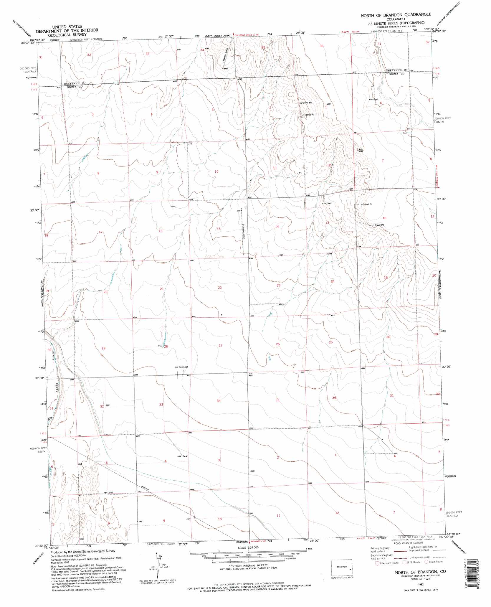
USGS Topo Quad 38102e4 - 1:24,000 scale
| Topo Map Name: | Cheyenne Wells 3 Sw |
| USGS Topo Quad ID: | 38102e4 |
| Print Size: | ca. 21 1/4" wide x 27" high |
| Southeast Coordinates: | 38.5° N latitude / 102.375° W longitude |
| Map Center Coordinates: | 38.5625° N latitude / 102.4375° W longitude |
| U.S. State: | CO |
| Filename: | o38102e4.jpg |
| Download Map JPG Image: | Cheyenne Wells 3 Sw topo map 1:24,000 scale |
| Map Type: | Topographic |
| Topo Series: | 7.5´ |
| Map Scale: | 1:24,000 |
| Source of Map Images: | United States Geological Survey (USGS) |
| Alternate Map Versions: |
Cheyenne Wells 3 SW CO 1982, updated 1982 Download PDF Buy paper map North Of Brandon CO 1982, updated 1995 Download PDF Buy paper map North of Brandon CO 2010 Download PDF Buy paper map North of Brandon CO 2013 Download PDF Buy paper map North of Brandon CO 2016 Download PDF Buy paper map |
1:24,000 Topo Quads surrounding Cheyenne Wells 3 Sw
Eureka Creek South |
Firstview |
Cheyenne Wells Sw |
Cheyenne Wells |
Arapahoe |
Kit Carson 4 Nw |
Kit Carson 4 Ne |
Cheyenne Wells 3 Nw |
Cheyenne Wells 3 Ne |
Lake Albert Nw |
Oswald Ranch |
Kit Carson 4 Se |
Cheyenne Wells 3 Sw |
Cheyenne Wells 3 Se |
Lake Albert |
Alkali Lake |
Chivington |
Brandon |
Sheridan Lake |
Stuart |
Neenoshe Reservoir |
Chivington Se |
Sheridan Lake Sw |
Sheridan Lake Se |
Lake Devore |
> Back to 38102e1 at 1:100,000 scale
> Back to 38102a1 at 1:250,000 scale
> Back to U.S. Topo Maps home
Cheyenne Wells 3 Sw topo map: Gazetteer
Cheyenne Wells 3 Sw: Airports
Scherler Airstrip elevation 1253m 4110′Cheyenne Wells 3 Sw digital topo map on disk
Buy this Cheyenne Wells 3 Sw topo map showing relief, roads, GPS coordinates and other geographical features, as a high-resolution digital map file on DVD: