Arlington Topo Map Colorado
To zoom in, hover over the map of Arlington
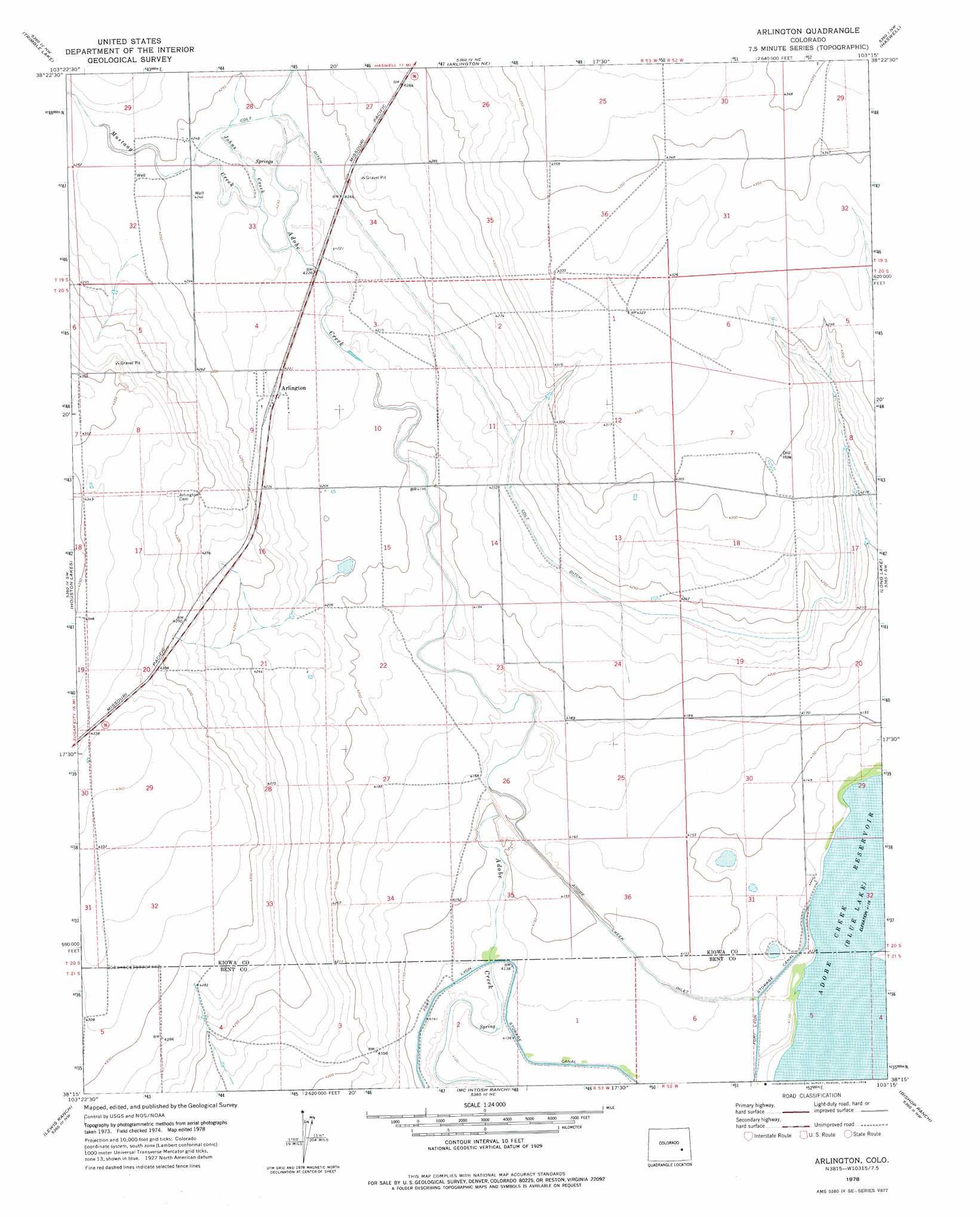
USGS Topo Quad 38103c3 - 1:24,000 scale
| Topo Map Name: | Arlington |
| USGS Topo Quad ID: | 38103c3 |
| Print Size: | ca. 21 1/4" wide x 27" high |
| Southeast Coordinates: | 38.25° N latitude / 103.25° W longitude |
| Map Center Coordinates: | 38.3125° N latitude / 103.3125° W longitude |
| U.S. State: | CO |
| Filename: | o38103c3.jpg |
| Download Map JPG Image: | Arlington topo map 1:24,000 scale |
| Map Type: | Topographic |
| Topo Series: | 7.5´ |
| Map Scale: | 1:24,000 |
| Source of Map Images: | United States Geological Survey (USGS) |
| Alternate Map Versions: |
Arlington CO 1978, updated 1978 Download PDF Buy paper map Arlington CO 2010 Download PDF Buy paper map Arlington CO 2013 Download PDF Buy paper map Arlington CO 2016 Download PDF Buy paper map |
1:24,000 Topo Quads surrounding Arlington
Metz Springs |
Scott Draw |
Bluff Spring |
Galatea Sw |
Galatea |
The Pinnacles |
Trimble Lake |
Arlington Ne |
Haswell |
Haswell Ne |
Todd Point |
Houston Lakes |
Arlington |
Long Lake |
Haswell Se |
Meredith Hill |
Lewis Ranch |
Mcintosh Ranch |
Bishop Ranch |
Tree Top Ranch |
Cheraw |
Hadley |
Cornelia |
Las Animas |
Kreybill |
> Back to 38103a1 at 1:100,000 scale
> Back to 38102a1 at 1:250,000 scale
> Back to U.S. Topo Maps home
Arlington topo map: Gazetteer
Arlington: Canals
Adobe Creek Inlet elevation 1262m 4140′Colt Ditch elevation 1292m 4238′
Arlington: Populated Places
Arlington elevation 1287m 4222′Arlington: Streams
Johns Creek elevation 1287m 4222′Mustang Creek elevation 1289m 4229′
Arlington digital topo map on disk
Buy this Arlington topo map showing relief, roads, GPS coordinates and other geographical features, as a high-resolution digital map file on DVD: