The Pinnacles Topo Map Colorado
To zoom in, hover over the map of The Pinnacles
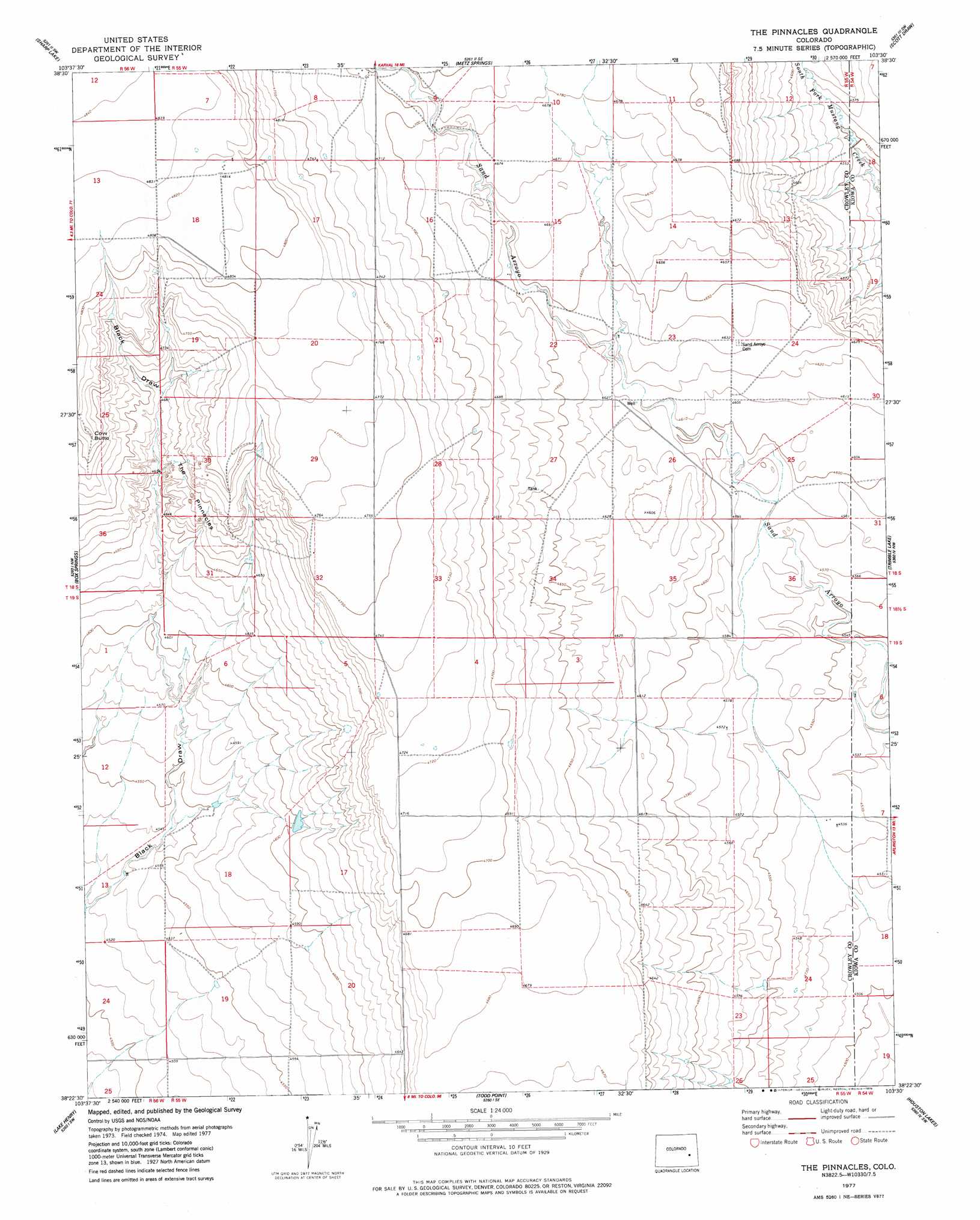
USGS Topo Quad 38103d5 - 1:24,000 scale
| Topo Map Name: | The Pinnacles |
| USGS Topo Quad ID: | 38103d5 |
| Print Size: | ca. 21 1/4" wide x 27" high |
| Southeast Coordinates: | 38.375° N latitude / 103.5° W longitude |
| Map Center Coordinates: | 38.4375° N latitude / 103.5625° W longitude |
| U.S. State: | CO |
| Filename: | o38103d5.jpg |
| Download Map JPG Image: | The Pinnacles topo map 1:24,000 scale |
| Map Type: | Topographic |
| Topo Series: | 7.5´ |
| Map Scale: | 1:24,000 |
| Source of Map Images: | United States Geological Survey (USGS) |
| Alternate Map Versions: |
The Pinnacles CO 1977, updated 1978 Download PDF Buy paper map The Pinnacles CO 2011 Download PDF Buy paper map The Pinnacles CO 2013 Download PDF Buy paper map The Pinnacles CO 2016 Download PDF Buy paper map |
1:24,000 Topo Quads surrounding The Pinnacles
Peace Valley |
Forder |
Karval |
Hubbard Lake |
Barrel Springs Draw |
Walker Point |
Sharp Lake |
Metz Springs |
Scott Draw |
Bluff Spring |
Windmill Lake |
Box Springs |
The Pinnacles |
Trimble Lake |
Arlington Ne |
Nero Hill |
Lake Henry |
Todd Point |
Houston Lakes |
Arlington |
Ordway |
Sugar City |
Meredith Hill |
Lewis Ranch |
Mcintosh Ranch |
> Back to 38103a1 at 1:100,000 scale
> Back to 38102a1 at 1:250,000 scale
> Back to U.S. Topo Maps home
The Pinnacles topo map: Gazetteer
The Pinnacles: Airports
Sand Arroya Airport elevation 1405m 4609′The Pinnacles: Pillars
The Pinnacles elevation 1430m 4691′The Pinnacles: Summits
Cow Butte elevation 1457m 4780′The Pinnacles digital topo map on disk
Buy this The Pinnacles topo map showing relief, roads, GPS coordinates and other geographical features, as a high-resolution digital map file on DVD: