Ninemile Spring Topo Map Colorado
To zoom in, hover over the map of Ninemile Spring
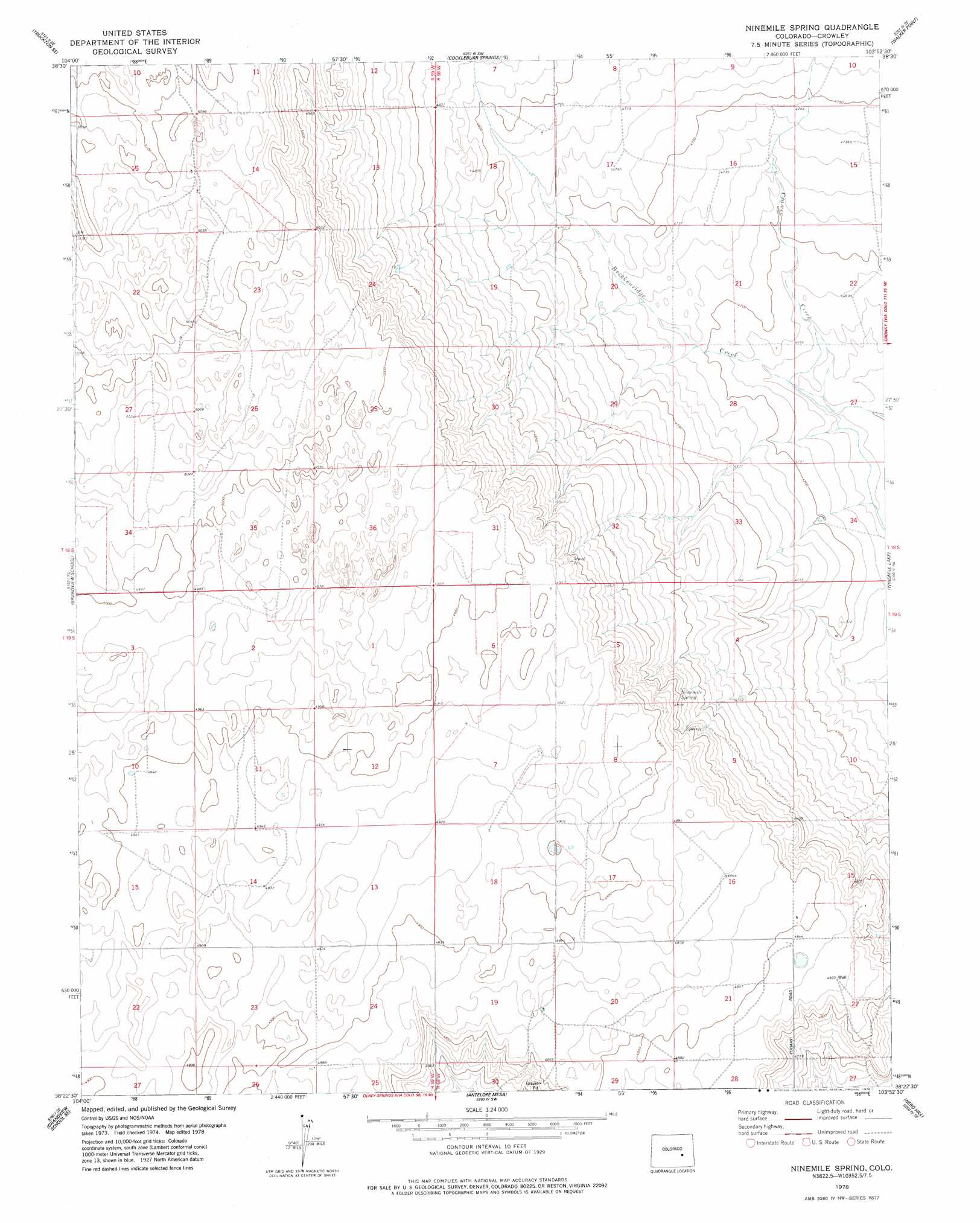
USGS Topo Quad 38103d8 - 1:24,000 scale
| Topo Map Name: | Ninemile Spring |
| USGS Topo Quad ID: | 38103d8 |
| Print Size: | ca. 21 1/4" wide x 27" high |
| Southeast Coordinates: | 38.375° N latitude / 103.875° W longitude |
| Map Center Coordinates: | 38.4375° N latitude / 103.9375° W longitude |
| U.S. State: | CO |
| Filename: | o38103d8.jpg |
| Download Map JPG Image: | Ninemile Spring topo map 1:24,000 scale |
| Map Type: | Topographic |
| Topo Series: | 7.5´ |
| Map Scale: | 1:24,000 |
| Source of Map Images: | United States Geological Survey (USGS) |
| Alternate Map Versions: |
Ninemile Spring CO 1978, updated 1978 Download PDF Buy paper map Ninemile Spring CO 2010 Download PDF Buy paper map Ninemile Spring CO 2013 Download PDF Buy paper map Ninemile Spring CO 2016 Download PDF Buy paper map |
1:24,000 Topo Quads surrounding Ninemile Spring
Truckton |
Truckton Ne |
Sanborn Reservoir |
Peace Valley |
Forder |
Edison School |
Truckton Se |
Cockleburr Springs |
Walker Point |
Sharp Lake |
Highlands Church |
Grandview School |
Ninemile Spring |
Windmill Lake |
Box Springs |
Boone Hill |
Grandview School Se |
Antelope Mesa |
Nero Hill |
Lake Henry |
Nepesta |
Fowler |
Olney Springs |
Ordway |
Sugar City |
> Back to 38103a1 at 1:100,000 scale
> Back to 38102a1 at 1:250,000 scale
> Back to U.S. Topo Maps home
Ninemile Spring topo map: Gazetteer
Ninemile Spring: Springs
Ninemile Spring elevation 1475m 4839′Ninemile Spring: Streams
Cramer Creek elevation 1422m 4665′Ninemile Spring: Summits
Antelope Mesa elevation 1479m 4852′Ninemile Spring digital topo map on disk
Buy this Ninemile Spring topo map showing relief, roads, GPS coordinates and other geographical features, as a high-resolution digital map file on DVD: