Bluff Spring Topo Map Colorado
To zoom in, hover over the map of Bluff Spring
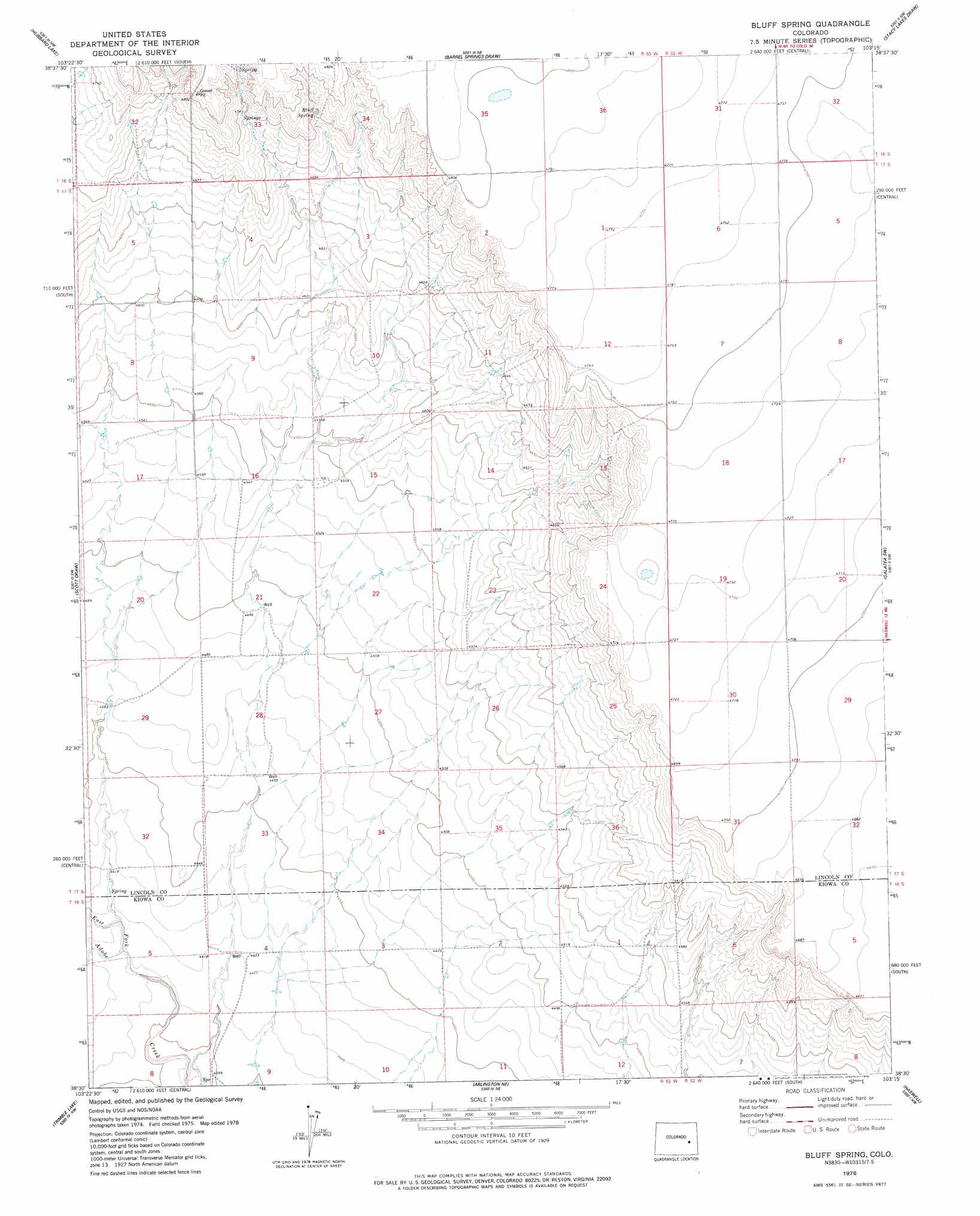
USGS Topo Quad 38103e3 - 1:24,000 scale
| Topo Map Name: | Bluff Spring |
| USGS Topo Quad ID: | 38103e3 |
| Print Size: | ca. 21 1/4" wide x 27" high |
| Southeast Coordinates: | 38.5° N latitude / 103.25° W longitude |
| Map Center Coordinates: | 38.5625° N latitude / 103.3125° W longitude |
| U.S. State: | CO |
| Filename: | o38103e3.jpg |
| Download Map JPG Image: | Bluff Spring topo map 1:24,000 scale |
| Map Type: | Topographic |
| Topo Series: | 7.5´ |
| Map Scale: | 1:24,000 |
| Source of Map Images: | United States Geological Survey (USGS) |
| Alternate Map Versions: |
Bluff Spring CO 1978, updated 1978 Download PDF Buy paper map Bluff Spring CO 2010 Download PDF Buy paper map Bluff Spring CO 2013 Download PDF Buy paper map Bluff Spring CO 2016 Download PDF Buy paper map |
1:24,000 Topo Quads surrounding Bluff Spring
Stanley Gulch |
Mckenzie Draw |
Rock Basin |
Aroya |
Wild Horse |
Karval |
Hubbard Lake |
Barrel Springs Draw |
Stacy Lakes Draw |
Galatea Ne |
Metz Springs |
Scott Draw |
Bluff Spring |
Galatea Sw |
Galatea |
The Pinnacles |
Trimble Lake |
Arlington Ne |
Haswell |
Haswell Ne |
Todd Point |
Houston Lakes |
Arlington |
Long Lake |
Haswell Se |
> Back to 38103e1 at 1:100,000 scale
> Back to 38102a1 at 1:250,000 scale
> Back to U.S. Topo Maps home
Bluff Spring topo map: Gazetteer
Bluff Spring: Springs
Bluff Spring elevation 1446m 4744′Bluff Spring: Streams
East Fork Adobe Creek elevation 1344m 4409′Bluff Spring: Summits
Kim Hill elevation 1382m 4534′Bluff Spring: Valleys
Maverick Gulch elevation 1431m 4694′Bluff Spring digital topo map on disk
Buy this Bluff Spring topo map showing relief, roads, GPS coordinates and other geographical features, as a high-resolution digital map file on DVD: