Swallows Topo Map Colorado
To zoom in, hover over the map of Swallows
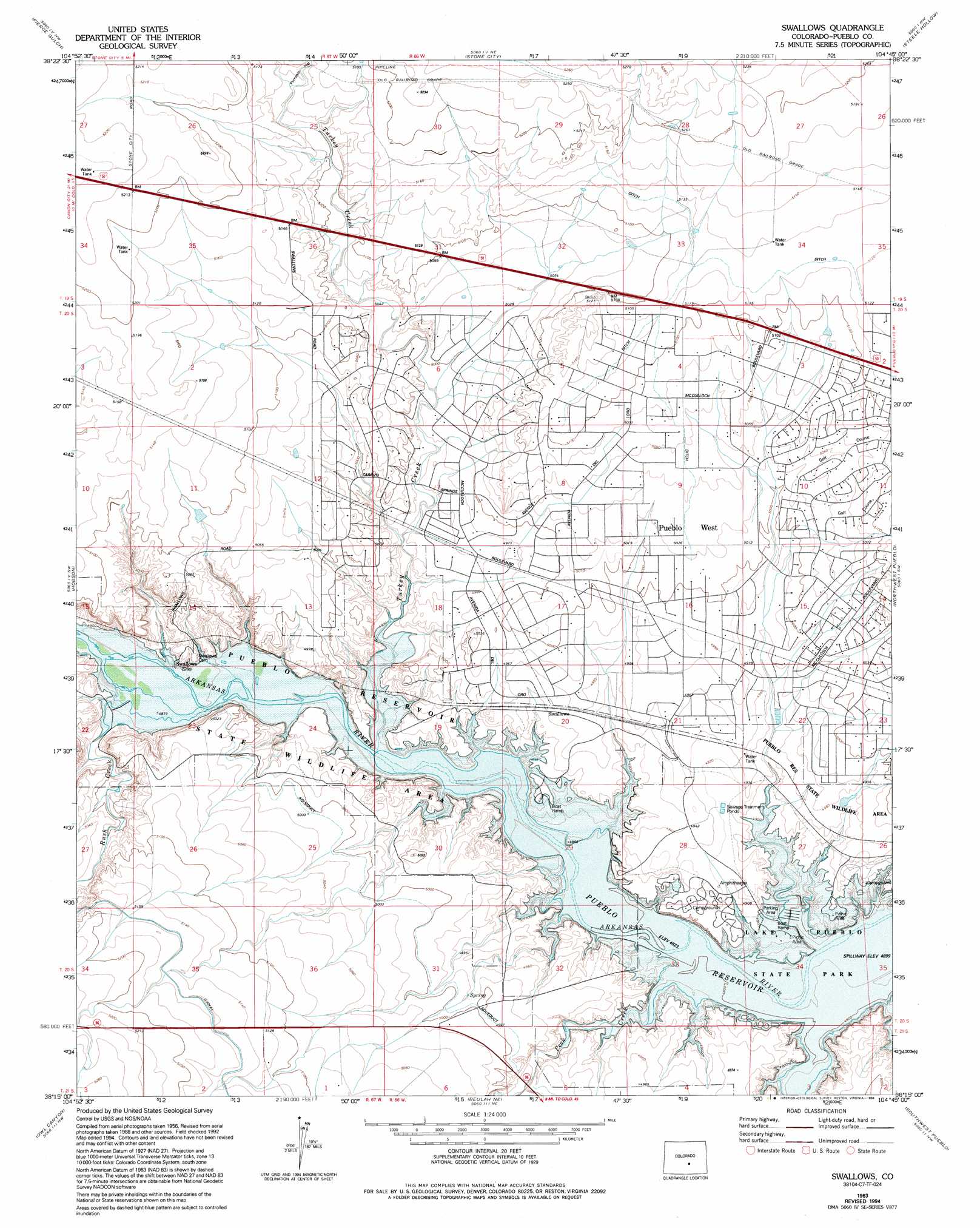
USGS Topo Quad 38104c7 - 1:24,000 scale
| Topo Map Name: | Swallows |
| USGS Topo Quad ID: | 38104c7 |
| Print Size: | ca. 21 1/4" wide x 27" high |
| Southeast Coordinates: | 38.25° N latitude / 104.75° W longitude |
| Map Center Coordinates: | 38.3125° N latitude / 104.8125° W longitude |
| U.S. State: | CO |
| Filename: | o38104c7.jpg |
| Download Map JPG Image: | Swallows topo map 1:24,000 scale |
| Map Type: | Topographic |
| Topo Series: | 7.5´ |
| Map Scale: | 1:24,000 |
| Source of Map Images: | United States Geological Survey (USGS) |
| Alternate Map Versions: |
Swallows CO 1963, updated 1965 Download PDF Buy paper map Swallows CO 1963, updated 1965 Download PDF Buy paper map Swallows CO 1963, updated 1972 Download PDF Buy paper map Swallows CO 1963, updated 1976 Download PDF Buy paper map Swallows CO 1963, updated 1994 Download PDF Buy paper map Swallows CO 1963, updated 1994 Download PDF Buy paper map Swallows CO 2010 Download PDF Buy paper map Swallows CO 2013 Download PDF Buy paper map Swallows CO 2016 Download PDF Buy paper map |
1:24,000 Topo Quads surrounding Swallows
Phantom Canyon |
Mount Pittsburg |
Timber Mountain |
Buttes |
Fountain Se |
Florence |
Pierce Gulch |
Stone City |
Steele Hollow |
Pinon |
Florence Se |
Hobson |
Swallows |
Northwest Pueblo |
Northeast Pueblo |
Wetmore |
Owl Canyon |
Beulah Ne |
Southwest Pueblo |
Southeast Pueblo |
Saint Charles Peak |
Beulah |
Muldoon Hill |
Verde School |
Goat Butte |
> Back to 38104a1 at 1:100,000 scale
> Back to 38104a1 at 1:250,000 scale
> Back to U.S. Topo Maps home
Swallows topo map: Gazetteer
Swallows: Canals
Teller Ditch elevation 1564m 5131′Swallows: Populated Places
Swallows elevation 1489m 4885′Swallows: Streams
Peck Creek elevation 1471m 4826′Rock Creek elevation 1471m 4826′
Rush Creek elevation 1486m 4875′
Turkey Creek elevation 1475m 4839′
Swallows: Valleys
Pumpkin Hollow elevation 1566m 5137′Swallows digital topo map on disk
Buy this Swallows topo map showing relief, roads, GPS coordinates and other geographical features, as a high-resolution digital map file on DVD: