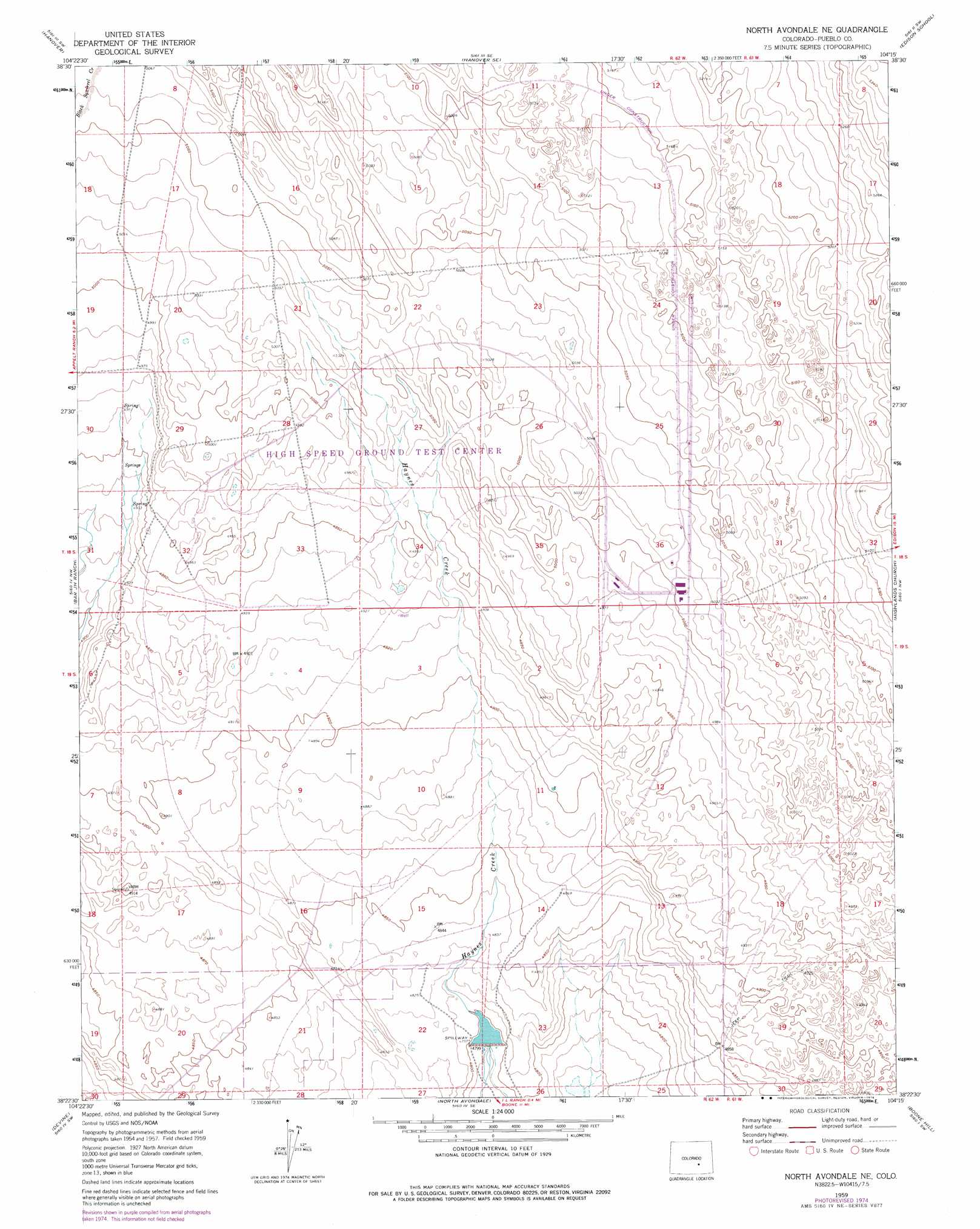
North Avondale Ne Topo Map Colorado
To zoom in, hover over the map of North Avondale Ne
USGS Topo Quad 38104d3 - 1:24,000 scale
| Topo Map Name: | North Avondale Ne |
| USGS Topo Quad ID: | 38104d3 |
| Print Size: | ca. 21 1/4" wide x 27" high |
| Southeast Coordinates: | 38.375° N latitude / 104.25° W longitude |
| Map Center Coordinates: | 38.4375° N latitude / 104.3125° W longitude |
| U.S. State: | CO |
| Filename: | o38104d3.jpg |
| Download Map JPG Image: | North Avondale Ne topo map 1:24,000 scale |
| Map Type: | Topographic |
| Topo Series: | 7.5´ |
| Map Scale: | 1:24,000 |
| Source of Map Images: | United States Geological Survey (USGS) |
| Alternate Map Versions: |
North Avondale NE CO 1959, updated 1962 Download PDF Buy paper map North Avondale NE CO 1960, updated 1972 Download PDF Buy paper map North Avondale NE CO 2010 Download PDF Buy paper map North Avondale NE CO 2013 Download PDF Buy paper map North Avondale NE CO 2016 Download PDF Buy paper map |
1:24,000 Topo Quads surrounding North Avondale Ne
Fountain Ne |
Hanover Nw |
Hanover Ne |
Truckton |
Truckton Ne |
Fountain Se |
Hanover |
Hanover Se |
Edison School |
Truckton Se |
Pinon |
Bar J H Ranch |
North Avondale Ne |
Highlands Church |
Grandview School |
Northeast Pueblo |
Devine |
North Avondale |
Boone Hill |
Grandview School Se |
Southeast Pueblo |
Vineland |
Avondale |
Nepesta |
Fowler |
> Back to 38104a1 at 1:100,000 scale
> Back to 38104a1 at 1:250,000 scale
> Back to U.S. Topo Maps home
North Avondale Ne topo map: Gazetteer
North Avondale Ne: Dams
Thatcher Dam elevation 1463m 4799′North Avondale Ne: Mines
Empire Zinc Mine elevation 1543m 5062′North Avondale Ne: Reservoirs
Thatcher Reservoir elevation 1463m 4799′North Avondale Ne digital topo map on disk
Buy this North Avondale Ne topo map showing relief, roads, GPS coordinates and other geographical features, as a high-resolution digital map file on DVD: