Bar J H Ranch Topo Map Colorado
To zoom in, hover over the map of Bar J H Ranch
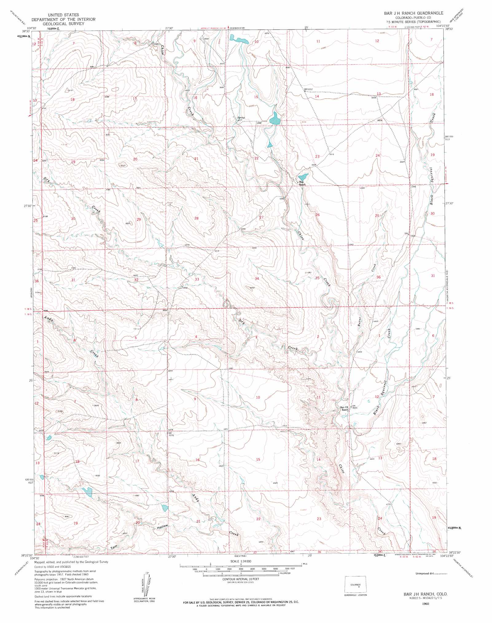
USGS Topo Quad 38104d4 - 1:24,000 scale
| Topo Map Name: | Bar J H Ranch |
| USGS Topo Quad ID: | 38104d4 |
| Print Size: | ca. 21 1/4" wide x 27" high |
| Southeast Coordinates: | 38.375° N latitude / 104.375° W longitude |
| Map Center Coordinates: | 38.4375° N latitude / 104.4375° W longitude |
| U.S. State: | CO |
| Filename: | o38104d4.jpg |
| Download Map JPG Image: | Bar J H Ranch topo map 1:24,000 scale |
| Map Type: | Topographic |
| Topo Series: | 7.5´ |
| Map Scale: | 1:24,000 |
| Source of Map Images: | United States Geological Survey (USGS) |
| Alternate Map Versions: |
Bar J H Ranch CO 1960, updated 1962 Download PDF Buy paper map Bar J H Ranch CO 2010 Download PDF Buy paper map Bar J H Ranch CO 2013 Download PDF Buy paper map Bar J H Ranch CO 2016 Download PDF Buy paper map |
1:24,000 Topo Quads surrounding Bar J H Ranch
Fountain |
Fountain Ne |
Hanover Nw |
Hanover Ne |
Truckton |
Buttes |
Fountain Se |
Hanover |
Hanover Se |
Edison School |
Steele Hollow |
Pinon |
Bar J H Ranch |
North Avondale Ne |
Highlands Church |
Northwest Pueblo |
Northeast Pueblo |
Devine |
North Avondale |
Boone Hill |
Southwest Pueblo |
Southeast Pueblo |
Vineland |
Avondale |
Nepesta |
> Back to 38104a1 at 1:100,000 scale
> Back to 38104a1 at 1:250,000 scale
> Back to U.S. Topo Maps home
Bar J H Ranch topo map: Gazetteer
Bar J H Ranch: Dams
Tolle and Ditch Number 1 Dam elevation 1524m 5000′Bar J H Ranch: Reservoirs
Tolle and Ditch Reservoir Number 1 elevation 1524m 5000′Bar J H Ranch: Streams
Black Squirrel Creek elevation 1457m 4780′Burnt Creek elevation 1470m 4822′
Dry Creek elevation 1470m 4822′
Bar J H Ranch: Valleys
Tom Hollow elevation 1477m 4845′Bar J H Ranch digital topo map on disk
Buy this Bar J H Ranch topo map showing relief, roads, GPS coordinates and other geographical features, as a high-resolution digital map file on DVD: