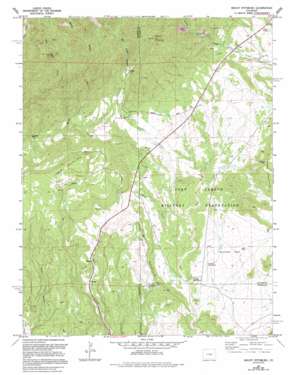
Mount Pittsburg Topo Map Colorado
To zoom in, hover over the map of Mount Pittsburg
USGS Topo Quad 38104e8 - 1:24,000 scale
| Topo Map Name: | Mount Pittsburg |
| USGS Topo Quad ID: | 38104e8 |
| Print Size: | ca. 21 1/4" wide x 27" high |
| Southeast Coordinates: | 38.5° N latitude / 104.875° W longitude |
| Map Center Coordinates: | 38.5625° N latitude / 104.9375° W longitude |
| U.S. State: | CO |
| Filename: | o38104e8.jpg |
| Download Map JPG Image: | Mount Pittsburg topo map 1:24,000 scale |
| Map Type: | Topographic |
| Topo Series: | 7.5´ |
| Map Scale: | 1:24,000 |
| Source of Map Images: | United States Geological Survey (USGS) |
| Alternate Map Versions: |
Mount Pittsburg CO 1948, updated 1956 Download PDF Buy paper map Mount Pittsburg CO 1949 Download PDF Buy paper map Mount Pittsburg CO 1961, updated 1963 Download PDF Buy paper map Mount Pittsburg CO 1961, updated 1963 Download PDF Buy paper map Mount Pittsburg CO 1961, updated 1967 Download PDF Buy paper map Mount Pittsburg CO 1961, updated 1970 Download PDF Buy paper map Mount Pittsburg CO 1961, updated 1970 Download PDF Buy paper map Mount Pittsburg CO 1961, updated 1978 Download PDF Buy paper map Mount Pittsburg CO 1961, updated 1978 Download PDF Buy paper map Mount Pittsburg CO 1961, updated 1994 Download PDF Buy paper map Mount Pittsburg CO 2010 Download PDF Buy paper map Mount Pittsburg CO 2013 Download PDF Buy paper map Mount Pittsburg CO 2016 Download PDF Buy paper map |
1:24,000 Topo Quads surrounding Mount Pittsburg
> Back to 38104e1 at 1:100,000 scale
> Back to 38104a1 at 1:250,000 scale
> Back to U.S. Topo Maps home
Mount Pittsburg topo map: Gazetteer
Mount Pittsburg: Flats
Sullivan Park elevation 1842m 6043′Mount Pittsburg: Mines
Booth Gulch Pit elevation 1879m 6164′Ford Ranch Quarry elevation 2294m 7526′
Salt Creek Mine elevation 1910m 6266′
Mount Pittsburg: Streams
East Fork Red Creek elevation 1840m 6036′West Fork Red Creek elevation 1806m 5925′
Mount Pittsburg: Summits
Mount Pittsburg elevation 2495m 8185′Table Mountain elevation 2260m 7414′
Timber Mountain elevation 2103m 6899′
Wild Mountain elevation 2037m 6683′
Mount Pittsburg: Valleys
East Mill Gulch elevation 1977m 6486′Patton Canyon elevation 1720m 5643′
Red Creek Canyon elevation 2020m 6627′
Turkey Canyon elevation 1986m 6515′
Mount Pittsburg digital topo map on disk
Buy this Mount Pittsburg topo map showing relief, roads, GPS coordinates and other geographical features, as a high-resolution digital map file on DVD:


