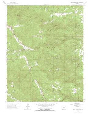
Saint Charles Peak Topo Map Colorado
To zoom in, hover over the map of Saint Charles Peak
USGS Topo Quad 38105a1 - 1:24,000 scale
| Topo Map Name: | Saint Charles Peak |
| USGS Topo Quad ID: | 38105a1 |
| Print Size: | ca. 21 1/4" wide x 27" high |
| Southeast Coordinates: | 38° N latitude / 105° W longitude |
| Map Center Coordinates: | 38.0625° N latitude / 105.0625° W longitude |
| U.S. State: | CO |
| Filename: | o38105a1.jpg |
| Download Map JPG Image: | Saint Charles Peak topo map 1:24,000 scale |
| Map Type: | Topographic |
| Topo Series: | 7.5´ |
| Map Scale: | 1:24,000 |
| Source of Map Images: | United States Geological Survey (USGS) |
| Alternate Map Versions: |
Saint Charles Peak CO 1963, updated 1966 Download PDF Buy paper map Saint Charles Peak CO 1963, updated 1966 Download PDF Buy paper map Saint Charles Peak CO 1963, updated 1971 Download PDF Buy paper map Saint Charles Peak CO 1994, updated 1998 Download PDF Buy paper map Saint Charles Peak CO 2011 Download PDF Buy paper map Saint Charles Peak CO 2013 Download PDF Buy paper map Saint Charles Peak CO 2016 Download PDF Buy paper map |
| FStopo: | US Forest Service topo Saint Charles Peak is available: Download FStopo PDF Download FStopo TIF |
1:24,000 Topo Quads surrounding Saint Charles Peak
> Back to 38105a1 at 1:100,000 scale
> Back to 38104a1 at 1:250,000 scale
> Back to U.S. Topo Maps home
Saint Charles Peak topo map: Gazetteer
Saint Charles Peak: Dams
Eagle Scout Lake Dam elevation 2710m 8891′Saint Charles Dam elevation 2710m 8891′
Saint Charles Peak: Flats
Klipfel Meadow elevation 2525m 8284′Lion Park elevation 2752m 9028′
Potato Park elevation 2488m 8162′
Silver Circle elevation 2590m 8497′
Simonson Meadow elevation 2771m 9091′
Soldier Park elevation 2472m 8110′
Saint Charles Peak: Gaps
Greenhill Divide elevation 2849m 9347′Saint Charles Peak: Parks
Pueblo Mountain Park elevation 2086m 6843′Saint Charles Peak: Pillars
Dome Rock elevation 2638m 8654′Saint Charles Peak: Populated Places
Fairview elevation 2647m 8684′Saint Charles Peak: Reservoirs
Eagle Scout Lake Reservoir elevation 2710m 8891′Saint Charles Reservoir elevation 2710m 8891′
Saint Charles Peak: Ridges
Oak Ridge elevation 2370m 7775′Saint Charles Peak: Streams
Asher Creek elevation 2214m 7263′Bigelow Creek elevation 2631m 8631′
Davenport Creek elevation 2582m 8471′
Ditch Creek elevation 2259m 7411′
Lefthand Fork North Creek elevation 2287m 7503′
Ophir Creek elevation 2669m 8756′
Righthand Fork North Creek elevation 2268m 7440′
White Creek elevation 2154m 7066′
Yellow Creek elevation 2097m 6879′
Saint Charles Peak: Summits
Potato Mountain elevation 2701m 8861′Round Top Mountain elevation 3104m 10183′
Saint Charles Peak elevation 3593m 11788′
Scraggy Peaks elevation 2783m 9130′
Saint Charles Peak: Trails
North Creek Trail elevation 2566m 8418′Saint Charles Trail elevation 3269m 10725′
Second Mace Trail elevation 2648m 8687′
Silver Circle Trail elevation 2652m 8700′
Saint Charles Peak: Valleys
Bear Canyon elevation 2438m 7998′Cooper Gulch elevation 2020m 6627′
Dome Rock Canyon elevation 2174m 7132′
Porter Canyon elevation 2075m 6807′
Snyder Draw elevation 2728m 8950′
Saint Charles Peak digital topo map on disk
Buy this Saint Charles Peak topo map showing relief, roads, GPS coordinates and other geographical features, as a high-resolution digital map file on DVD:


