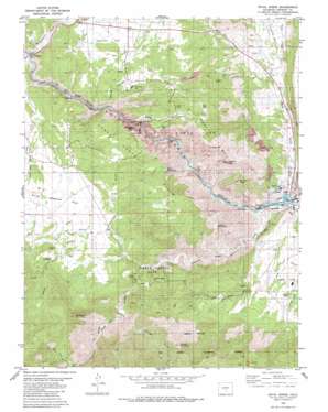
Royal Gorge Topo Map Colorado
To zoom in, hover over the map of Royal Gorge
USGS Topo Quad 38105d3 - 1:24,000 scale
| Topo Map Name: | Royal Gorge |
| USGS Topo Quad ID: | 38105d3 |
| Print Size: | ca. 21 1/4" wide x 27" high |
| Southeast Coordinates: | 38.375° N latitude / 105.25° W longitude |
| Map Center Coordinates: | 38.4375° N latitude / 105.3125° W longitude |
| U.S. State: | CO |
| Filename: | o38105d3.jpg |
| Download Map JPG Image: | Royal Gorge topo map 1:24,000 scale |
| Map Type: | Topographic |
| Topo Series: | 7.5´ |
| Map Scale: | 1:24,000 |
| Source of Map Images: | United States Geological Survey (USGS) |
| Alternate Map Versions: |
Royal Gorge CO 1980, updated 1981 Download PDF Buy paper map Royal Gorge CO 1980, updated 1981 Download PDF Buy paper map Royal Gorge CO 1980, updated 1984 Download PDF Buy paper map Royal Gorge CO 1994, updated 1998 Download PDF Buy paper map Royal Gorge CO 2011 Download PDF Buy paper map Royal Gorge CO 2013 Download PDF Buy paper map Royal Gorge CO 2016 Download PDF Buy paper map |
| FStopo: | US Forest Service topo Royal Gorge is available: Download FStopo PDF Download FStopo TIF |
1:24,000 Topo Quads surrounding Royal Gorge
> Back to 38105a1 at 1:100,000 scale
> Back to 38104a1 at 1:250,000 scale
> Back to U.S. Topo Maps home
Royal Gorge topo map: Gazetteer
Royal Gorge: Airports
Browns Fort Heliport elevation 1956m 6417′Royal Gorge: Flats
Eightmile Park elevation 1915m 6282′South Webster Park elevation 1887m 6190′
Threemile Park elevation 1811m 5941′
Royal Gorge: Gaps
Devils Gap elevation 1845m 6053′The Tights elevation 1894m 6213′
Royal Gorge: Mines
Border Feldspar Mine elevation 1959m 6427′Climax Mine elevation 1801m 5908′
Devils Hole Quarry elevation 1819m 5967′
Goat Hill Quarry elevation 1890m 6200′
Hoover Quarry elevation 1890m 6200′
Meyers Mine elevation 1989m 6525′
Parkdale Quarry elevation 1760m 5774′
R. H. Magnuson Mine elevation 1958m 6423′
Royal Gorge Quarry elevation 1801m 5908′
School Section Mine elevation 1830m 6003′
Suzanna Mine elevation 2048m 6719′
Volcano Gulch Mine elevation 1846m 6056′
Royal Gorge: Parks
Grape Creek Picnic Ground elevation 1878m 6161′Royal Gorge Park elevation 2053m 6735′
Temple Canyon Park elevation 1855m 6085′
Royal Gorge: Populated Places
Buckskin Joe elevation 1920m 6299′Sample elevation 1748m 5734′
Royal Gorge: Post Offices
Buckskin Joe Post Office (historical) elevation 1920m 6299′Royal Gorge: Ranges
Gorge Hills elevation 2077m 6814′Grand Canyon Hills elevation 2087m 6847′
Royal Gorge: Springs
Canon City Hot Springs elevation 1636m 5367′Royal Gorge: Streams
Grape Creek elevation 1638m 5374′Sand Creek elevation 1634m 5360′
Royal Gorge: Summits
Baldy Mountain elevation 2078m 6817′Dawson Mountain elevation 2428m 7965′
Fremont Peak elevation 2163m 7096′
Horseshoe Mountain elevation 2350m 7709′
Nonans Peak elevation 2088m 6850′
Y M C A Mountain elevation 2114m 6935′
Royal Gorge: Valleys
Bumback Gulch elevation 1747m 5731′Hellgate Gulch elevation 2451m 8041′
Jennings Gulch elevation 1805m 5921′
McIntyre Gulch elevation 1776m 5826′
Ohio Canyon elevation 1773m 5816′
Royal Gorge elevation 1638m 5374′
Sand Draw elevation 1752m 5748′
Sawmill Gulch elevation 1924m 6312′
South Marsh Gulch elevation 1970m 6463′
Tanner Gulch elevation 2201m 7221′
Temple Canyon elevation 1640m 5380′
Volcano Gulch elevation 1784m 5853′
Royal Gorge digital topo map on disk
Buy this Royal Gorge topo map showing relief, roads, GPS coordinates and other geographical features, as a high-resolution digital map file on DVD:


