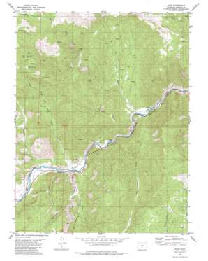
Echo Topo Map Colorado
To zoom in, hover over the map of Echo
USGS Topo Quad 38105d5 - 1:24,000 scale
| Topo Map Name: | Echo |
| USGS Topo Quad ID: | 38105d5 |
| Print Size: | ca. 21 1/4" wide x 27" high |
| Southeast Coordinates: | 38.375° N latitude / 105.5° W longitude |
| Map Center Coordinates: | 38.4375° N latitude / 105.5625° W longitude |
| U.S. State: | CO |
| Filename: | o38105d5.jpg |
| Download Map JPG Image: | Echo topo map 1:24,000 scale |
| Map Type: | Topographic |
| Topo Series: | 7.5´ |
| Map Scale: | 1:24,000 |
| Source of Map Images: | United States Geological Survey (USGS) |
| Alternate Map Versions: |
Echo CO 1980, updated 1980 Download PDF Buy paper map Echo CO 2010 Download PDF Buy paper map Echo CO 2013 Download PDF Buy paper map Echo CO 2016 Download PDF Buy paper map |
1:24,000 Topo Quads surrounding Echo
> Back to 38105a1 at 1:100,000 scale
> Back to 38104a1 at 1:250,000 scale
> Back to U.S. Topo Maps home
Echo topo map: Gazetteer
Echo: Airports
Tezak Airport elevation 1898m 6227′Echo: Basins
Devils Hole elevation 2116m 6942′Echo: Mines
Big Emma Claim elevation 2243m 7358′Bull Gulch Mine elevation 2594m 8510′
Bull Ridge Mine elevation 2594m 8510′
Dreamer Mine elevation 2514m 8248′
Misery Mine Group elevation 2173m 7129′
Navajo Claim elevation 2243m 7358′
Texas Creek Mine elevation 1981m 6499′
Zingheim Quarry elevation 2135m 7004′
Echo: Populated Places
Echo elevation 1855m 6085′Texas Creek elevation 1888m 6194′
Echo: Ridges
Bull Ridge elevation 2743m 8999′Echo: Streams
Texas Creek elevation 1879m 6164′Echo: Valleys
Antelope Gulch elevation 2528m 8293′Back Door Gulch elevation 1940m 6364′
Bull Gulch elevation 2212m 7257′
East Gulch elevation 1963m 6440′
Echo Canyon elevation 1865m 6118′
Five Point Gulch elevation 1853m 6079′
Hindman Gulch elevation 1878m 6161′
Race Path Gulch elevation 1930m 6332′
Reese Gulch elevation 1895m 6217′
Texas Creek Gulch elevation 1899m 6230′
Echo digital topo map on disk
Buy this Echo topo map showing relief, roads, GPS coordinates and other geographical features, as a high-resolution digital map file on DVD:


