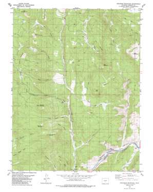
Arkansas Mountain Topo Map Colorado
To zoom in, hover over the map of Arkansas Mountain
USGS Topo Quad 38105d6 - 1:24,000 scale
| Topo Map Name: | Arkansas Mountain |
| USGS Topo Quad ID: | 38105d6 |
| Print Size: | ca. 21 1/4" wide x 27" high |
| Southeast Coordinates: | 38.375° N latitude / 105.625° W longitude |
| Map Center Coordinates: | 38.4375° N latitude / 105.6875° W longitude |
| U.S. State: | CO |
| Filename: | o38105d6.jpg |
| Download Map JPG Image: | Arkansas Mountain topo map 1:24,000 scale |
| Map Type: | Topographic |
| Topo Series: | 7.5´ |
| Map Scale: | 1:24,000 |
| Source of Map Images: | United States Geological Survey (USGS) |
| Alternate Map Versions: |
Arkansas Mountain CO 1980, updated 1981 Download PDF Buy paper map Arkansas Mountain CO 1980, updated 1985 Download PDF Buy paper map Arkansas Mountain CO 1980, updated 1985 Download PDF Buy paper map Arkansas Mountain CO 2010 Download PDF Buy paper map Arkansas Mountain CO 2013 Download PDF Buy paper map Arkansas Mountain CO 2016 Download PDF Buy paper map |
1:24,000 Topo Quads surrounding Arkansas Mountain
> Back to 38105a1 at 1:100,000 scale
> Back to 38104a1 at 1:250,000 scale
> Back to U.S. Topo Maps home
Arkansas Mountain topo map: Gazetteer
Arkansas Mountain: Mines
Cotopaxi Mine elevation 2322m 7618′Indian Gulch Mine elevation 2521m 8270′
Arkansas Mountain: Springs
Mud Spring elevation 2339m 7673′Arkansas Mountain: Streams
Carrol Creek elevation 1914m 6279′Gross Creek elevation 2096m 6876′
Monument Creek elevation 1983m 6505′
Arkansas Mountain: Summits
Arkansas Mountain elevation 2827m 9274′Bear Mountain elevation 2678m 8786′
Cedar Springs Mountain elevation 2653m 8704′
Falls Gulch Mountain elevation 2745m 9005′
Garell Peak elevation 2495m 8185′
Indian Mountain elevation 2623m 8605′
Park Mountain elevation 3044m 9986′
South Burno Mountain elevation 2937m 9635′
Spruce Mountain elevation 2978m 9770′
Table Mountain elevation 2783m 9130′
Arkansas Mountain: Valleys
Arkansas Gulch elevation 2320m 7611′Basin Gulch elevation 2356m 7729′
Dirty Gulch elevation 2429m 7969′
Falls Gulch elevation 2584m 8477′
Fernleaf Gulch elevation 1916m 6286′
Indian Gulch elevation 2306m 7565′
Long Gulch elevation 2301m 7549′
Maverick Gulch elevation 2251m 7385′
Mud Gulch elevation 2292m 7519′
Park Gulch elevation 2469m 8100′
Pasture Gulch elevation 1923m 6309′
Red Gulch elevation 2009m 6591′
Sand Gulch elevation 2041m 6696′
Sand Gulch elevation 1909m 6263′
Arkansas Mountain digital topo map on disk
Buy this Arkansas Mountain topo map showing relief, roads, GPS coordinates and other geographical features, as a high-resolution digital map file on DVD:


