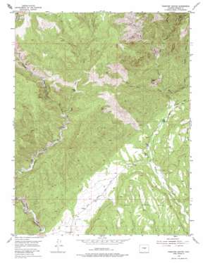
Phantom Canyon Topo Map Colorado
To zoom in, hover over the map of Phantom Canyon
USGS Topo Quad 38105e1 - 1:24,000 scale
| Topo Map Name: | Phantom Canyon |
| USGS Topo Quad ID: | 38105e1 |
| Print Size: | ca. 21 1/4" wide x 27" high |
| Southeast Coordinates: | 38.5° N latitude / 105° W longitude |
| Map Center Coordinates: | 38.5625° N latitude / 105.0625° W longitude |
| U.S. State: | CO |
| Filename: | o38105e1.jpg |
| Download Map JPG Image: | Phantom Canyon topo map 1:24,000 scale |
| Map Type: | Topographic |
| Topo Series: | 7.5´ |
| Map Scale: | 1:24,000 |
| Source of Map Images: | United States Geological Survey (USGS) |
| Alternate Map Versions: |
Phantom Canyon CO 1954, updated 1955 Download PDF Buy paper map Phantom Canyon CO 1954, updated 1955 Download PDF Buy paper map Phantom Canyon CO 1954, updated 1975 Download PDF Buy paper map Phantom Canyon CO 1954, updated 1975 Download PDF Buy paper map Phantom Canyon CO 2011 Download PDF Buy paper map Phantom Canyon CO 2013 Download PDF Buy paper map Phantom Canyon CO 2016 Download PDF Buy paper map |
1:24,000 Topo Quads surrounding Phantom Canyon
> Back to 38105e1 at 1:100,000 scale
> Back to 38104a1 at 1:250,000 scale
> Back to U.S. Topo Maps home
Phantom Canyon topo map: Gazetteer
Phantom Canyon: Flats
Soda Springs Park elevation 1894m 6213′Phantom Canyon: Mines
Brandt Claims elevation 1899m 6230′Dell Mine elevation 2140m 7020′
Eight Mile Park Quarry elevation 1888m 6194′
Phantom Lode Mine elevation 2357m 7732′
Phantom Canyon: Populated Places
Adelaide elevation 2118m 6948′Phantom Canyon: Streams
East Beaver Creek elevation 1969m 6459′East Fork Eightmile Creek elevation 2136m 7007′
West Beaver Creek elevation 1969m 6459′
West Mill Creek elevation 1872m 6141′
Phantom Canyon: Summits
Sugar Loaf elevation 2269m 7444′Phantom Canyon: Valleys
Banta Gulch elevation 1857m 6092′Trail Gulch elevation 1871m 6138′
Phantom Canyon digital topo map on disk
Buy this Phantom Canyon topo map showing relief, roads, GPS coordinates and other geographical features, as a high-resolution digital map file on DVD:


