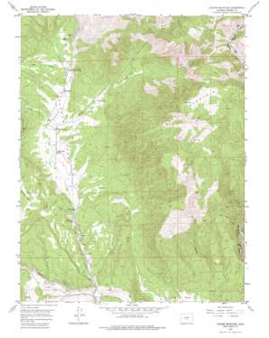
Cooper Mountain Topo Map Colorado
To zoom in, hover over the map of Cooper Mountain
USGS Topo Quad 38105e2 - 1:24,000 scale
| Topo Map Name: | Cooper Mountain |
| USGS Topo Quad ID: | 38105e2 |
| Print Size: | ca. 21 1/4" wide x 27" high |
| Southeast Coordinates: | 38.5° N latitude / 105.125° W longitude |
| Map Center Coordinates: | 38.5625° N latitude / 105.1875° W longitude |
| U.S. State: | CO |
| Filename: | o38105e2.jpg |
| Download Map JPG Image: | Cooper Mountain topo map 1:24,000 scale |
| Map Type: | Topographic |
| Topo Series: | 7.5´ |
| Map Scale: | 1:24,000 |
| Source of Map Images: | United States Geological Survey (USGS) |
| Alternate Map Versions: |
Cooper Mountain CO 1954, updated 1955 Download PDF Buy paper map Cooper Mountain CO 1954, updated 1955 Download PDF Buy paper map Cooper Mountain CO 1954, updated 1976 Download PDF Buy paper map Cooper Mountain CO 2010 Download PDF Buy paper map Cooper Mountain CO 2013 Download PDF Buy paper map Cooper Mountain CO 2016 Download PDF Buy paper map |
1:24,000 Topo Quads surrounding Cooper Mountain
> Back to 38105e1 at 1:100,000 scale
> Back to 38104a1 at 1:250,000 scale
> Back to U.S. Topo Maps home
Cooper Mountain topo map: Gazetteer
Cooper Mountain: Flats
Garden Park elevation 1874m 6148′Cooper Mountain: Mines
Colexco Mine elevation 1870m 6135′Deer Hill Mine elevation 1913m 6276′
Diamond Flint Mine elevation 1916m 6286′
Cooper Mountain: Pillars
Garden Park Dinosaur Monument elevation 1784m 5853′Cooper Mountain: Streams
East Fork Milsap Creek elevation 2036m 6679′Felch Creek elevation 1794m 5885′
Milsap Creek elevation 1840m 6036′
North Fork Millsap Creek elevation 2036m 6679′
Wilson Creek elevation 1681m 5515′
Cooper Mountain: Summits
Cooper Mountain elevation 2785m 9137′Cooper Mountain: Valleys
Espinosa Gulch elevation 1891m 6204′Helena Canyon elevation 1901m 6236′
Long Gulch elevation 1890m 6200′
South Cedar Gulch elevation 1875m 6151′
Cooper Mountain digital topo map on disk
Buy this Cooper Mountain topo map showing relief, roads, GPS coordinates and other geographical features, as a high-resolution digital map file on DVD:


