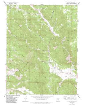
Gribble Mountain Topo Map Colorado
To zoom in, hover over the map of Gribble Mountain
USGS Topo Quad 38105e4 - 1:24,000 scale
| Topo Map Name: | Gribble Mountain |
| USGS Topo Quad ID: | 38105e4 |
| Print Size: | ca. 21 1/4" wide x 27" high |
| Southeast Coordinates: | 38.5° N latitude / 105.375° W longitude |
| Map Center Coordinates: | 38.5625° N latitude / 105.4375° W longitude |
| U.S. State: | CO |
| Filename: | o38105e4.jpg |
| Download Map JPG Image: | Gribble Mountain topo map 1:24,000 scale |
| Map Type: | Topographic |
| Topo Series: | 7.5´ |
| Map Scale: | 1:24,000 |
| Source of Map Images: | United States Geological Survey (USGS) |
| Alternate Map Versions: |
Gribble Mountain CO 1983, updated 1983 Download PDF Buy paper map Gribble Mountain CO 2010 Download PDF Buy paper map Gribble Mountain CO 2013 Download PDF Buy paper map Gribble Mountain CO 2016 Download PDF Buy paper map |
1:24,000 Topo Quads surrounding Gribble Mountain
> Back to 38105e1 at 1:100,000 scale
> Back to 38104a1 at 1:250,000 scale
> Back to U.S. Topo Maps home
Gribble Mountain topo map: Gazetteer
Gribble Mountain: Basins
Twelvemile Hole elevation 2296m 7532′Gribble Mountain: Cliffs
Thompson Point elevation 2527m 8290′Gribble Mountain: Dams
Harvey Brothers Dam elevation 1894m 6213′Gribble Mountain: Flats
Twelvemile Park elevation 1903m 6243′Gribble Mountain: Mines
Cap Rock Forty Mine elevation 2291m 7516′Currant Creek Mine elevation 2219m 7280′
First Chance Mine elevation 2335m 7660′
Isabel Mine elevation 2399m 7870′
Last Chance Mine elevation 2397m 7864′
Lucky Strike Mine elevation 1938m 6358′
Red Devil Mine elevation 1960m 6430′
Venture Number One Mine elevation 2459m 8067′
Gribble Mountain: Reservoirs
Harvey Brothers Reservoir elevation 1894m 6213′Gribble Mountain: Ridges
Cottonwood Ridge elevation 2486m 8156′Gribble Mountain: Springs
Smith Springs elevation 2311m 7582′Gribble Mountain: Streams
Cottonwood Creek elevation 1854m 6082′South Tallahassee Creek elevation 2338m 7670′
Gribble Mountain: Summits
Cactus Mountain elevation 2156m 7073′Crampton Mountain elevation 2664m 8740′
Gardner Peak elevation 2708m 8884′
Gribble Mountain elevation 2399m 7870′
Little Crampton Mountain elevation 2344m 7690′
Thompson Mountain elevation 2659m 8723′
Gribble Mountain: Valleys
Binckley Gulch elevation 2269m 7444′Long Gulch elevation 2348m 7703′
Lucero Canyon elevation 1895m 6217′
Meadow Gulch elevation 1976m 6482′
Miner Gulch elevation 2202m 7224′
Sand Gulch elevation 1919m 6295′
Seymour Gulch elevation 2281m 7483′
Smith Gulch elevation 2247m 7372′
Trail Gulch elevation 2151m 7057′
Webster Gulch elevation 2064m 6771′
Gribble Mountain digital topo map on disk
Buy this Gribble Mountain topo map showing relief, roads, GPS coordinates and other geographical features, as a high-resolution digital map file on DVD:


