Dicks Peak Topo Map Colorado
To zoom in, hover over the map of Dicks Peak
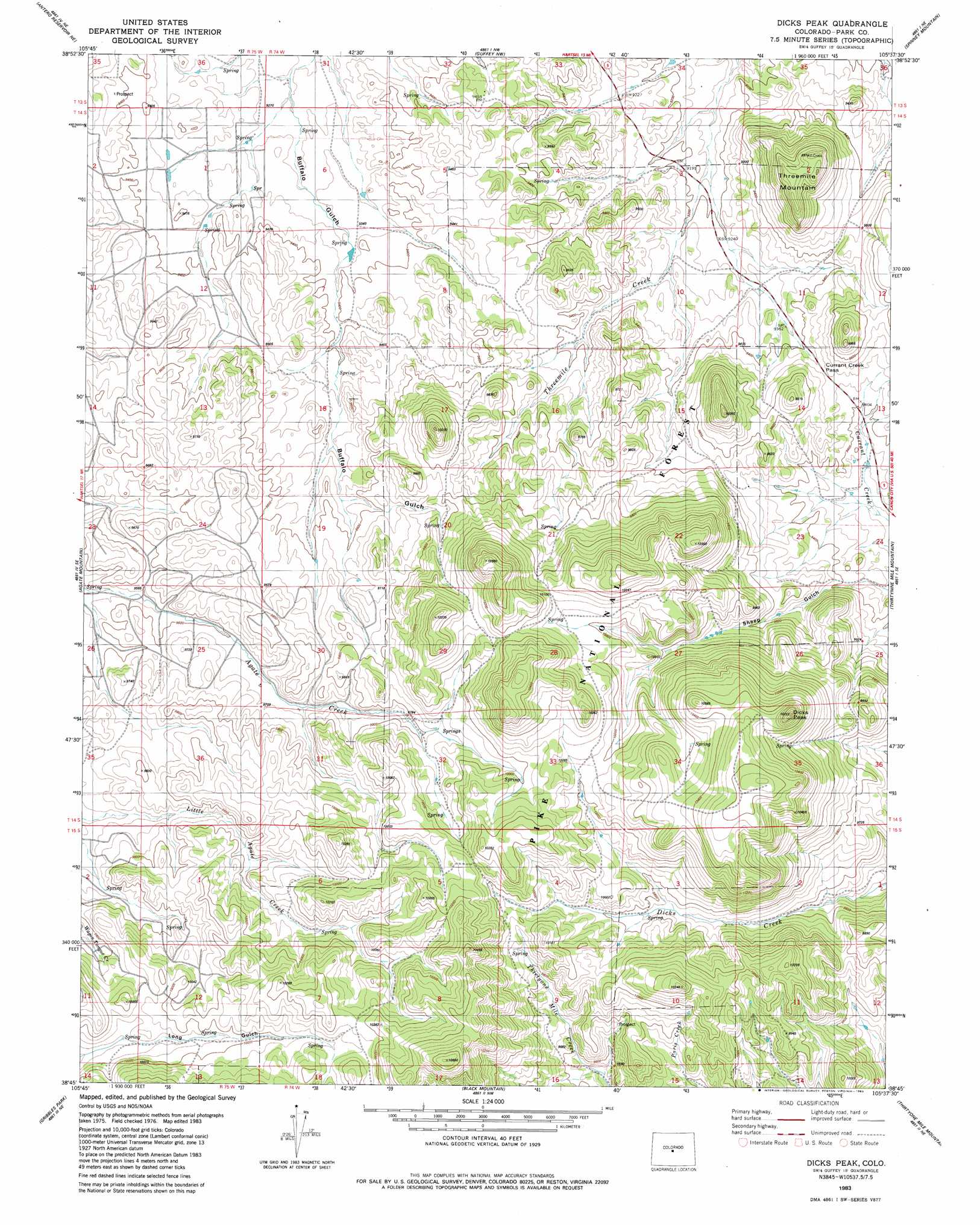
USGS Topo Quad 38105g6 - 1:24,000 scale
| Topo Map Name: | Dicks Peak |
| USGS Topo Quad ID: | 38105g6 |
| Print Size: | ca. 21 1/4" wide x 27" high |
| Southeast Coordinates: | 38.75° N latitude / 105.625° W longitude |
| Map Center Coordinates: | 38.8125° N latitude / 105.6875° W longitude |
| U.S. State: | CO |
| Filename: | o38105g6.jpg |
| Download Map JPG Image: | Dicks Peak topo map 1:24,000 scale |
| Map Type: | Topographic |
| Topo Series: | 7.5´ |
| Map Scale: | 1:24,000 |
| Source of Map Images: | United States Geological Survey (USGS) |
| Alternate Map Versions: |
Dicks Peak CO 1983, updated 1983 Download PDF Buy paper map Dicks Peak CO 1994, updated 1998 Download PDF Buy paper map Dicks Peak CO 1994, updated 1998 Download PDF Buy paper map Dicks Peak CO 2011 Download PDF Buy paper map Dicks Peak CO 2013 Download PDF Buy paper map Dicks Peak CO 2016 Download PDF Buy paper map |
| FStopo: | US Forest Service topo Dicks Peak is available: Download FStopo PDF Download FStopo TIF |
1:24,000 Topo Quads surrounding Dicks Peak
Garo |
Hartsel |
Sulphur Mountain |
Glentivar |
Tarryall |
Antero Reservoir |
Antero Reservoir Ne |
Guffey Nw |
Spinney Mountain |
Elevenmile Canyon |
Castle Rock Gulch |
Agate Mountain |
Dicks Peak |
Thirtynine Mile Mountain |
Witcher Mountain |
Cameron Mountain |
Gribbles Park |
Black Mountain |
Thirtyone Mile Mountain |
Cover Mountain |
Salida East |
Jack Hall Mountain |
Waugh Mountain |
Hall Gulch |
Gribble Mountain |
> Back to 38105e1 at 1:100,000 scale
> Back to 38104a1 at 1:250,000 scale
> Back to U.S. Topo Maps home
Dicks Peak topo map: Gazetteer
Dicks Peak: Gaps
Currant Creek Pass elevation 2891m 9484′Dicks Peak: Summits
Dicks Peak elevation 3253m 10672′Threemile Mountain elevation 3038m 9967′
Dicks Peak digital topo map on disk
Buy this Dicks Peak topo map showing relief, roads, GPS coordinates and other geographical features, as a high-resolution digital map file on DVD: