Laughlin Gulch Topo Map Colorado
To zoom in, hover over the map of Laughlin Gulch
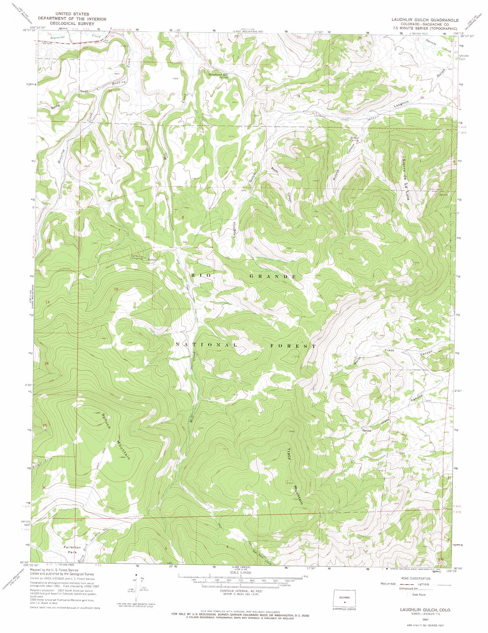
USGS Topo Quad 38106a3 - 1:24,000 scale
| Topo Map Name: | Laughlin Gulch |
| USGS Topo Quad ID: | 38106a3 |
| Print Size: | ca. 21 1/4" wide x 27" high |
| Southeast Coordinates: | 38° N latitude / 106.25° W longitude |
| Map Center Coordinates: | 38.0625° N latitude / 106.3125° W longitude |
| U.S. State: | CO |
| Filename: | o38106a3.jpg |
| Download Map JPG Image: | Laughlin Gulch topo map 1:24,000 scale |
| Map Type: | Topographic |
| Topo Series: | 7.5´ |
| Map Scale: | 1:24,000 |
| Source of Map Images: | United States Geological Survey (USGS) |
| Alternate Map Versions: |
Laughlin Gulch CO 1967, updated 1969 Download PDF Buy paper map Laughlin Gulch CO 1967, updated 1969 Download PDF Buy paper map Laughlin Gulch CO 2001, updated 2005 Download PDF Buy paper map Laughlin Gulch CO 2011 Download PDF Buy paper map Laughlin Gulch CO 2013 Download PDF Buy paper map Laughlin Gulch CO 2016 Download PDF Buy paper map |
| FStopo: | US Forest Service topo Laughlin Gulch is available: Download FStopo PDF Download FStopo TIF |
1:24,000 Topo Quads surrounding Laughlin Gulch
West Baldy |
Sargents Mesa |
Chester |
Bonanza |
Whale Hill |
North Pass |
Trickle Mountain |
Lake Mountain Ne |
Klondike Mine |
Graveyard Gulch |
Grouse Creek |
Lake Mountain |
Laughlin Gulch |
Saguache |
Hickey Bridge |
Bowers Peak |
Lookout Mountain |
Lime Creek |
Swede Corners |
Harrence Lake |
Pine Cone Knob |
Twin Mountains |
Twin Mountains Se |
La Garita |
Center North |
> Back to 38106a1 at 1:100,000 scale
> Back to 38106a1 at 1:250,000 scale
> Back to U.S. Topo Maps home
Laughlin Gulch topo map: Gazetteer
Laughlin Gulch: Airports
Norwood Junction Heliport elevation 2620m 8595′Laughlin Gulch: Springs
Boland Spring elevation 2559m 8395′Houghland Hill Spring elevation 2582m 8471′
Laughlin Gulch: Streams
Houselog Creek elevation 2557m 8389′Laughlin Gulch: Summits
Sierra de La Lola elevation 2893m 9491′Spruce Mountain elevation 3311m 10862′
Tracy Mountain elevation 3353m 11000′
Laughlin Gulch: Valleys
Boland Canyon elevation 2526m 8287′Burro Canyon elevation 2646m 8681′
Laughlin Gulch elevation 2414m 7919′
Spring Gulch elevation 2557m 8389′
Laughlin Gulch digital topo map on disk
Buy this Laughlin Gulch topo map showing relief, roads, GPS coordinates and other geographical features, as a high-resolution digital map file on DVD: