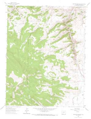
Sawtooth Mountain Topo Map Colorado
To zoom in, hover over the map of Sawtooth Mountain
USGS Topo Quad 38106c7 - 1:24,000 scale
| Topo Map Name: | Sawtooth Mountain |
| USGS Topo Quad ID: | 38106c7 |
| Print Size: | ca. 21 1/4" wide x 27" high |
| Southeast Coordinates: | 38.25° N latitude / 106.75° W longitude |
| Map Center Coordinates: | 38.3125° N latitude / 106.8125° W longitude |
| U.S. State: | CO |
| Filename: | o38106c7.jpg |
| Download Map JPG Image: | Sawtooth Mountain topo map 1:24,000 scale |
| Map Type: | Topographic |
| Topo Series: | 7.5´ |
| Map Scale: | 1:24,000 |
| Source of Map Images: | United States Geological Survey (USGS) |
| Alternate Map Versions: |
Sawtooth Mountain CO 1962, updated 1964 Download PDF Buy paper map Sawtooth Mountain CO 1962, updated 1964 Download PDF Buy paper map Sawtooth Mountain CO 1962, updated 1973 Download PDF Buy paper map Sawtooth Mountain CO 2001, updated 2004 Download PDF Buy paper map Sawtooth Mountain CO 2011 Download PDF Buy paper map Sawtooth Mountain CO 2013 Download PDF Buy paper map Sawtooth Mountain CO 2016 Download PDF Buy paper map |
| FStopo: | US Forest Service topo Sawtooth Mountain is available: Download FStopo PDF Download FStopo TIF |
1:24,000 Topo Quads surrounding Sawtooth Mountain
> Back to 38106a1 at 1:100,000 scale
> Back to 38106a1 at 1:250,000 scale
> Back to U.S. Topo Maps home
Sawtooth Mountain topo map: Gazetteer
Sawtooth Mountain: Flats
Bead Park elevation 3045m 9990′Lick Park elevation 2876m 9435′
Muddy Park elevation 3015m 9891′
Sawtooth Mountain: Mines
Boston Mine elevation 2816m 9238′Cochetopa Creek Mine elevation 2865m 9399′
Elisha Group Mine elevation 2879m 9445′
Fairview Mine elevation 2816m 9238′
La Rue Number Two Mine elevation 2950m 9678′
Los Ocho Mine elevation 2615m 8579′
M and W Group Mine elevation 2781m 9124′
Mercury Alpine Mine elevation 2845m 9333′
Mercury Mine elevation 2841m 9320′
Ridgeway Number Three Claim Mine elevation 2633m 8638′
Shurshot Claims Mine elevation 2787m 9143′
Snowshoe Mine elevation 2680m 8792′
Sawtooth Mountain: Streams
Alkali Creek elevation 2679m 8789′Lick Creek elevation 2778m 9114′
Los Pinos Creek elevation 2704m 8871′
Muddy Creek elevation 2528m 8293′
Rock Creek elevation 2602m 8536′
Sawtooth Mountain: Summits
Agency Peak elevation 3574m 11725′Cooper Mountain elevation 3057m 10029′
Sawtooth Mountain elevation 3700m 12139′
Sawtooth Mountain: Valleys
Homestead Gulch elevation 2690m 8825′Poison Gulch elevation 2572m 8438′
Townsite Gulch elevation 2719m 8920′
Sawtooth Mountain digital topo map on disk
Buy this Sawtooth Mountain topo map showing relief, roads, GPS coordinates and other geographical features, as a high-resolution digital map file on DVD:


