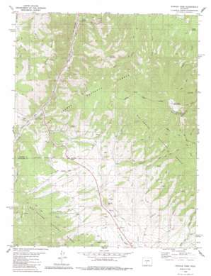
Poncha Pass Topo Map Colorado
To zoom in, hover over the map of Poncha Pass
USGS Topo Quad 38106d1 - 1:24,000 scale
| Topo Map Name: | Poncha Pass |
| USGS Topo Quad ID: | 38106d1 |
| Print Size: | ca. 21 1/4" wide x 27" high |
| Southeast Coordinates: | 38.375° N latitude / 106° W longitude |
| Map Center Coordinates: | 38.4375° N latitude / 106.0625° W longitude |
| U.S. State: | CO |
| Filename: | o38106d1.jpg |
| Download Map JPG Image: | Poncha Pass topo map 1:24,000 scale |
| Map Type: | Topographic |
| Topo Series: | 7.5´ |
| Map Scale: | 1:24,000 |
| Source of Map Images: | United States Geological Survey (USGS) |
| Alternate Map Versions: |
Poncha Pass CO 1980, updated 1981 Download PDF Buy paper map Poncha Pass CO 1980, updated 1985 Download PDF Buy paper map Poncha Pass CO 1980, updated 1991 Download PDF Buy paper map Poncha Pass CO 1980, updated 1991 Download PDF Buy paper map Poncha Pass CO 1994, updated 1998 Download PDF Buy paper map Poncha Pass CO 2011 Download PDF Buy paper map Poncha Pass CO 2013 Download PDF Buy paper map Poncha Pass CO 2016 Download PDF Buy paper map |
| FStopo: | US Forest Service topo Poncha Pass is available: Download FStopo PDF Download FStopo TIF |
1:24,000 Topo Quads surrounding Poncha Pass
> Back to 38106a1 at 1:100,000 scale
> Back to 38106a1 at 1:250,000 scale
> Back to U.S. Topo Maps home
Poncha Pass topo map: Gazetteer
Poncha Pass: Basins
Murphys Hole elevation 2887m 9471′Poncha Pass: Gaps
Poncha Pass elevation 2751m 9025′Poncha Pass: Lakes
Salamander Lake elevation 3345m 10974′Poncha Pass: Springs
Poncha Hot Springs elevation 2442m 8011′Wicker Spring elevation 2418m 7933′
Poncha Pass: Streams
Clover Creek elevation 2595m 8513′Dorsey Creek elevation 2746m 9009′
Droz Creek elevation 2601m 8533′
Lone Tree Creek elevation 2621m 8599′
North Decker Creek elevation 2711m 8894′
South Decker Creek elevation 2711m 8894′
Swidinski Creek elevation 2596m 8517′
Poncha Pass: Summits
Cleveland Mountain elevation 2932m 9619′Methodist Mountain elevation 3563m 11689′
Poncha Mountain elevation 3089m 10134′
Round Hill elevation 2747m 9012′
Poncha Pass: Trails
Round Hill Trail elevation 3114m 10216′Simmons Peak Trail elevation 3271m 10731′
Poncha Pass: Valleys
Camp Rock Gulch elevation 2571m 8435′Round Hill Gulch elevation 2660m 8727′
Sawmill Gulch elevation 2680m 8792′
Poncha Pass digital topo map on disk
Buy this Poncha Pass topo map showing relief, roads, GPS coordinates and other geographical features, as a high-resolution digital map file on DVD:


