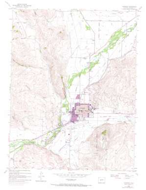
Gunnison Topo Map Colorado
To zoom in, hover over the map of Gunnison
USGS Topo Quad 38106e8 - 1:24,000 scale
| Topo Map Name: | Gunnison |
| USGS Topo Quad ID: | 38106e8 |
| Print Size: | ca. 21 1/4" wide x 27" high |
| Southeast Coordinates: | 38.5° N latitude / 106.875° W longitude |
| Map Center Coordinates: | 38.5625° N latitude / 106.9375° W longitude |
| U.S. State: | CO |
| Filename: | o38106e8.jpg |
| Download Map JPG Image: | Gunnison topo map 1:24,000 scale |
| Map Type: | Topographic |
| Topo Series: | 7.5´ |
| Map Scale: | 1:24,000 |
| Source of Map Images: | United States Geological Survey (USGS) |
| Alternate Map Versions: |
Gunnison CO 1954, updated 1955 Download PDF Buy paper map Gunnison CO 1954, updated 1965 Download PDF Buy paper map Gunnison CO 1954, updated 1973 Download PDF Buy paper map Gunnison CO 2010 Download PDF Buy paper map Gunnison CO 2013 Download PDF Buy paper map Gunnison CO 2016 Download PDF Buy paper map |
1:24,000 Topo Quads surrounding Gunnison
> Back to 38106e1 at 1:100,000 scale
> Back to 38106a1 at 1:250,000 scale
> Back to U.S. Topo Maps home
Gunnison topo map: Gazetteer
Gunnison: Airports
Gunnison County Airport elevation 2336m 7664′Gunnison Valley Hospital Heliport elevation 2352m 7716′
Gunnison: Parks
American Legion Memorial Park elevation 2346m 7696′Court House Square elevation 2349m 7706′
Mountaineer Stadium elevation 2367m 7765′
Gunnison: Populated Places
Gunnison elevation 2348m 7703′Gunnison: Post Offices
Gunnison Post Office elevation 2348m 7703′Gunnison: Streams
Antelope Creek elevation 2342m 7683′Gold Basin Creek elevation 2324m 7624′
Ohio Creek elevation 2358m 7736′
Tomichi Creek elevation 2322m 7618′
West Antelope Creek elevation 2404m 7887′
Gunnison: Summits
Tenderfoot Mountain elevation 2629m 8625′Gunnison: Valleys
Blinberry Gulch elevation 2386m 7828′Deep Gulch elevation 2490m 8169′
Doyle Gulch elevation 2492m 8175′
Hartman Gulch elevation 2454m 8051′
Maggie Gulch elevation 2460m 8070′
Sheep Gulch elevation 2409m 7903′
Steers Gulch elevation 2319m 7608′
Stubbs Gulch elevation 2330m 7644′
Gunnison digital topo map on disk
Buy this Gunnison topo map showing relief, roads, GPS coordinates and other geographical features, as a high-resolution digital map file on DVD:


