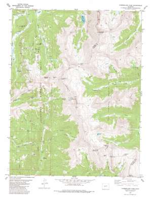
Cumberland Pass Topo Map Colorado
To zoom in, hover over the map of Cumberland Pass
USGS Topo Quad 38106f4 - 1:24,000 scale
| Topo Map Name: | Cumberland Pass |
| USGS Topo Quad ID: | 38106f4 |
| Print Size: | ca. 21 1/4" wide x 27" high |
| Southeast Coordinates: | 38.625° N latitude / 106.375° W longitude |
| Map Center Coordinates: | 38.6875° N latitude / 106.4375° W longitude |
| U.S. State: | CO |
| Filename: | o38106f4.jpg |
| Download Map JPG Image: | Cumberland Pass topo map 1:24,000 scale |
| Map Type: | Topographic |
| Topo Series: | 7.5´ |
| Map Scale: | 1:24,000 |
| Source of Map Images: | United States Geological Survey (USGS) |
| Alternate Map Versions: |
Cumberland Pass CO 1982, updated 1983 Download PDF Buy paper map Cumberland Pass CO 1982, updated 1987 Download PDF Buy paper map Cumberland Pass CO 1994, updated 1998 Download PDF Buy paper map Cumberland Pass CO 2011 Download PDF Buy paper map Cumberland Pass CO 2013 Download PDF Buy paper map Cumberland Pass CO 2016 Download PDF Buy paper map |
| FStopo: | US Forest Service topo Cumberland Pass is available: Download FStopo PDF Download FStopo TIF |
1:24,000 Topo Quads surrounding Cumberland Pass
> Back to 38106e1 at 1:100,000 scale
> Back to 38106a1 at 1:250,000 scale
> Back to U.S. Topo Maps home
Cumberland Pass topo map: Gazetteer
Cumberland Pass: Basins
Bone Basin elevation 3420m 11220′Graphite Basin elevation 3463m 11361′
Cumberland Pass: Cliffs
The Palisades elevation 3482m 11423′Cumberland Pass: Gaps
Cumberland Pass elevation 3668m 12034′Mapoleon Pass elevation 3665m 12024′
Napoleon Pass elevation 3668m 12034′
Tincup Pass elevation 3643m 11952′
Williams Pass elevation 3591m 11781′
Cumberland Pass: Lakes
Graphite Lake elevation 3592m 11784′Maid Lake elevation 3328m 10918′
Mirror Lake elevation 3343m 10967′
Tunnel Lake elevation 3644m 11955′
Cumberland Pass: Mines
Cumberland Mine elevation 3779m 12398′Gold Cup Republic Mine elevation 3278m 10754′
Jimmie Mack Mine elevation 3625m 11893′
Kerntucky Belle-Baby Gerald Mine elevation 3724m 12217′
Morning Glory Mine elevation 3504m 11496′
New Gold Cup Mine elevation 3325m 10908′
Old Gold Cup Mine elevation 3454m 11332′
Pearson Property Mine elevation 3686m 12093′
Cumberland Pass: Streams
Graphite Creek elevation 3242m 10636′Mosquito Creek elevation 3028m 9934′
Mosquito Creek elevation 3021m 9911′
Spring Branch elevation 3228m 10590′
Woodchopper Creek elevation 3277m 10751′
Cumberland Pass: Summits
Carbonate Hill elevation 3330m 10925′Duncan Hill elevation 3561m 11683′
Emma Burr Mountain elevation 4125m 13533′
Fitzpatrick Peak elevation 3979m 13054′
Gold Hill elevation 3625m 11893′
Mount Arps elevation 3773m 12378′
Mount Helmers elevation 3896m 12782′
Mount Poor elevation 3765m 12352′
Napoleon Mountain elevation 3825m 12549′
Sawmill Hill elevation 3586m 11765′
Cumberland Pass: Tunnels
Old Alpine Tunnel (historical) elevation 3639m 11938′Cumberland Pass: Valleys
Halls Gulch elevation 3052m 10013′Lake Gulch elevation 3200m 10498′
Payne Gulch elevation 3340m 10958′
Sawmill Gulch elevation 3232m 10603′
Slaughterhouse Gulch elevation 3119m 10232′
Tincup Gulch elevation 3227m 10587′
Tunnel Gulch elevation 3238m 10623′
Tunnel Gulch elevation 3197m 10488′
Wildcat Gulch elevation 3198m 10492′
Cumberland Pass digital topo map on disk
Buy this Cumberland Pass topo map showing relief, roads, GPS coordinates and other geographical features, as a high-resolution digital map file on DVD:


