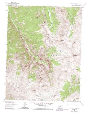
Wetterhorn Peak Topo Map Colorado
To zoom in, hover over the map of Wetterhorn Peak
USGS Topo Quad 38107a5 - 1:24,000 scale
| Topo Map Name: | Wetterhorn Peak |
| USGS Topo Quad ID: | 38107a5 |
| Print Size: | ca. 21 1/4" wide x 27" high |
| Southeast Coordinates: | 38° N latitude / 107.5° W longitude |
| Map Center Coordinates: | 38.0625° N latitude / 107.5625° W longitude |
| U.S. State: | CO |
| Filename: | o38107a5.jpg |
| Download Map JPG Image: | Wetterhorn Peak topo map 1:24,000 scale |
| Map Type: | Topographic |
| Topo Series: | 7.5´ |
| Map Scale: | 1:24,000 |
| Source of Map Images: | United States Geological Survey (USGS) |
| Alternate Map Versions: |
Wetterhorn Peak CO 1963, updated 1966 Download PDF Buy paper map Wetterhorn Peak CO 1963, updated 1966 Download PDF Buy paper map Wetterhorn Peak CO 1963, updated 1970 Download PDF Buy paper map Wetterhorn Peak CO 1963, updated 1970 Download PDF Buy paper map Wetterhorn Peak CO 1963, updated 1984 Download PDF Buy paper map Wetterhorn Peak CO 1963, updated 1987 Download PDF Buy paper map Wetterhorn Peak CO 2011 Download PDF Buy paper map Wetterhorn Peak CO 2013 Download PDF Buy paper map Wetterhorn Peak CO 2016 Download PDF Buy paper map |
| FStopo: | US Forest Service topo Wetterhorn Peak is available: Download FStopo PDF Download FStopo TIF |
1:24,000 Topo Quads surrounding Wetterhorn Peak
> Back to 38107a1 at 1:100,000 scale
> Back to 38106a1 at 1:250,000 scale
> Back to U.S. Topo Maps home
Wetterhorn Peak topo map: Gazetteer
Wetterhorn Peak: Basins
Porphyry Basin elevation 3597m 11801′Wetterhorn Basin elevation 3645m 11958′
Wetterhorn Peak: Lakes
American Lake elevation 3727m 12227′Wetterhorn Peak: Mines
Chord Mine elevation 3252m 10669′Wetterhorn Peak: Ridges
Bighorn Ridge elevation 3773m 12378′Dike Ridge elevation 3630m 11909′
Wetterhorn Peak: Streams
Difficulty Creek elevation 2700m 8858′Mary Alice Creek elevation 3216m 10551′
Oben Creek elevation 2536m 8320′
Wetterhorn Creek elevation 2791m 9156′
Wildhorse Creek elevation 2799m 9183′
Wetterhorn Peak: Summits
Blackwall Mountain elevation 3981m 13061′Coxcomb Peak elevation 4149m 13612′
Precipice Peak elevation 3845m 12614′
Redcliff elevation 4154m 13628′
Wetterhorn Peak elevation 4247m 13933′
Wildhorse Peak elevation 4037m 13244′
Wetterhorn Peak: Trails
Cow Creek Trail elevation 3335m 10941′Green Mountain Trail elevation 2894m 9494′
Ridge Stock Driveway elevation 3683m 12083′
West Fork Trail elevation 3685m 12089′
Wetterhorn Peak: Valleys
Middle Canyon elevation 2928m 9606′Wetterhorn Peak digital topo map on disk
Buy this Wetterhorn Peak topo map showing relief, roads, GPS coordinates and other geographical features, as a high-resolution digital map file on DVD:


