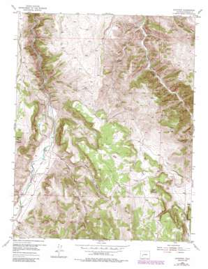
Gateview Topo Map Colorado
To zoom in, hover over the map of Gateview
USGS Topo Quad 38107c2 - 1:24,000 scale
| Topo Map Name: | Gateview |
| USGS Topo Quad ID: | 38107c2 |
| Print Size: | ca. 21 1/4" wide x 27" high |
| Southeast Coordinates: | 38.25° N latitude / 107.125° W longitude |
| Map Center Coordinates: | 38.3125° N latitude / 107.1875° W longitude |
| U.S. State: | CO |
| Filename: | o38107c2.jpg |
| Download Map JPG Image: | Gateview topo map 1:24,000 scale |
| Map Type: | Topographic |
| Topo Series: | 7.5´ |
| Map Scale: | 1:24,000 |
| Source of Map Images: | United States Geological Survey (USGS) |
| Alternate Map Versions: |
Gateview CO 1954, updated 1956 Download PDF Buy paper map Gateview CO 1954, updated 1956 Download PDF Buy paper map Gateview CO 1954, updated 1965 Download PDF Buy paper map Gateview CO 1954, updated 1965 Download PDF Buy paper map Gateview CO 1954, updated 1975 Download PDF Buy paper map Gateview CO 1954, updated 1984 Download PDF Buy paper map Gateview CO 2010 Download PDF Buy paper map Gateview CO 2013 Download PDF Buy paper map Gateview CO 2016 Download PDF Buy paper map |
1:24,000 Topo Quads surrounding Gateview
> Back to 38107a1 at 1:100,000 scale
> Back to 38106a1 at 1:250,000 scale
> Back to U.S. Topo Maps home
Gateview topo map: Gazetteer
Gateview: Mines
American Flag Shaft Mine elevation 2655m 8710′C W Carr Manganese Prospect Number One elevation 2687m 8815′
Dubois Mine elevation 2454m 8051′
Goose Creek Flat District Mine elevation 2449m 8034′
May Queen Mine elevation 2722m 8930′
Gateview: Populated Places
Gateview elevation 2423m 7949′Gateview: Springs
Goose Creek Spring elevation 2670m 8759′Gateview: Streams
Goose Creek elevation 2351m 7713′Indian Creek elevation 2390m 7841′
West Fork Indian Creek elevation 2563m 8408′
Gateview: Summits
Cap Mountain elevation 2753m 9032′Dillon Mesa elevation 2460m 8070′
Tolvar Peak elevation 2892m 9488′
Gateview: Valleys
Dutch Gulch elevation 2448m 8031′Water Gulch elevation 2445m 8021′
Yeager Gulch elevation 2428m 7965′
Gateview digital topo map on disk
Buy this Gateview topo map showing relief, roads, GPS coordinates and other geographical features, as a high-resolution digital map file on DVD:


