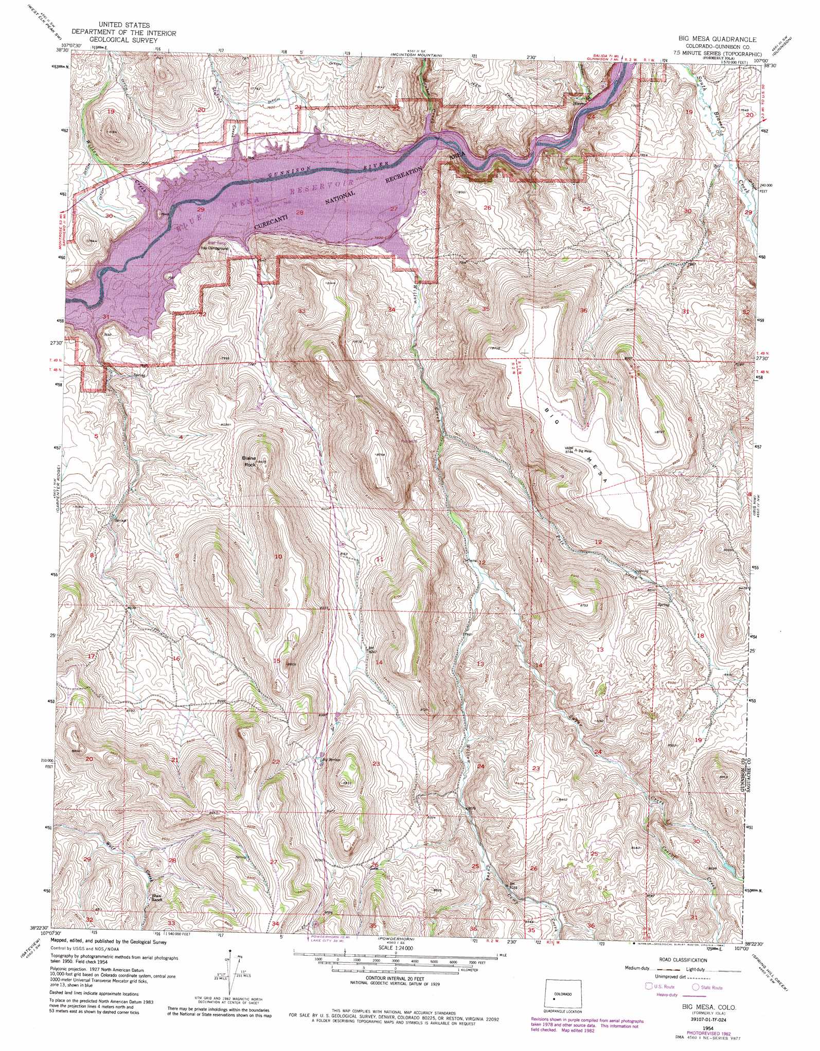
Big Mesa Topo Map Colorado
To zoom in, hover over the map of Big Mesa
USGS Topo Quad 38107d1 - 1:24,000 scale
| Topo Map Name: | Big Mesa |
| USGS Topo Quad ID: | 38107d1 |
| Print Size: | ca. 21 1/4" wide x 27" high |
| Southeast Coordinates: | 38.375° N latitude / 107° W longitude |
| Map Center Coordinates: | 38.4375° N latitude / 107.0625° W longitude |
| U.S. State: | CO |
| Filename: | o38107d1.jpg |
| Download Map JPG Image: | Big Mesa topo map 1:24,000 scale |
| Map Type: | Topographic |
| Topo Series: | 7.5´ |
| Map Scale: | 1:24,000 |
| Source of Map Images: | United States Geological Survey (USGS) |
| Alternate Map Versions: |
Iola CO 1954, updated 1955 Download PDF Buy paper map Iola CO 1954, updated 1955 Download PDF Buy paper map Iola CO 1954, updated 1963 Download PDF Buy paper map Iola CO 1954, updated 1963 Download PDF Buy paper map Big Mesa CO 1954, updated 1972 Download PDF Buy paper map Big Mesa CO 1954, updated 1973 Download PDF Buy paper map Big Mesa CO 1954, updated 1973 Download PDF Buy paper map Big Mesa CO 1954, updated 1984 Download PDF Buy paper map Big Mesa CO 2010 Download PDF Buy paper map Big Mesa CO 2013 Download PDF Buy paper map Big Mesa CO 2016 Download PDF Buy paper map |
1:24,000 Topo Quads surrounding Big Mesa
Big Soap Park |
West Elk Peak |
Squirrel Creek |
Flat Top |
Almont |
Little Soap Park |
West Elk Peak Sw |
Mcintosh Mountain |
Gunnison |
Signal Peak |
Sapinero |
Carpenter Ridge |
Big Mesa |
Iris Nw |
Iris |
Poison Draw |
Gateview |
Powderhorn |
Spring Hill Creek |
Sawtooth Mountain |
Alpine Plateau |
Powderhorn Lakes |
Rudolph Hill |
Rock Creek Park |
Cold Spring Park |
> Back to 38107a1 at 1:100,000 scale
> Back to 38106a1 at 1:250,000 scale
> Back to U.S. Topo Maps home
Big Mesa topo map: Gazetteer
Big Mesa: Pillars
Blaine Rock elevation 2568m 8425′Big Mesa: Populated Places
Iola (historical) elevation 2293m 7522′Big Mesa: Springs
Big Springs elevation 2558m 8392′Big Mesa: Streams
Beaver Creek elevation 2294m 7526′Camp Creek elevation 2480m 8136′
Corral Creek elevation 2494m 8182′
Pole Creek elevation 2345m 7693′
Steuben Creek elevation 2293m 7522′
Stevens Creek elevation 2293m 7522′
Sugar Creek elevation 2401m 7877′
Willow Creek elevation 2293m 7522′
Willow Creek elevation 2293m 7522′
Big Mesa: Summits
Big Mesa elevation 2667m 8750′Big Mesa digital topo map on disk
Buy this Big Mesa topo map showing relief, roads, GPS coordinates and other geographical features, as a high-resolution digital map file on DVD: