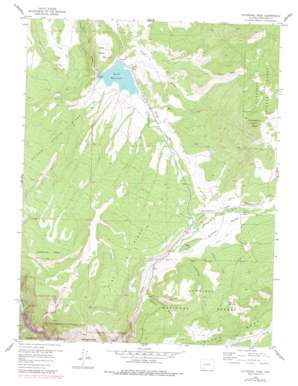
Cathedral Peak Topo Map Colorado
To zoom in, hover over the map of Cathedral Peak
USGS Topo Quad 38107e5 - 1:24,000 scale
| Topo Map Name: | Cathedral Peak |
| USGS Topo Quad ID: | 38107e5 |
| Print Size: | ca. 21 1/4" wide x 27" high |
| Southeast Coordinates: | 38.5° N latitude / 107.5° W longitude |
| Map Center Coordinates: | 38.5625° N latitude / 107.5625° W longitude |
| U.S. State: | CO |
| Filename: | o38107e5.jpg |
| Download Map JPG Image: | Cathedral Peak topo map 1:24,000 scale |
| Map Type: | Topographic |
| Topo Series: | 7.5´ |
| Map Scale: | 1:24,000 |
| Source of Map Images: | United States Geological Survey (USGS) |
| Alternate Map Versions: |
Cathedral Peak CO 1957 Download PDF Buy paper map Cathedral Peak CO 1957, updated 1959 Download PDF Buy paper map Cathedral Peak CO 1957, updated 1959 Download PDF Buy paper map Cathedral Peak CO 1957, updated 1964 Download PDF Buy paper map Cathedral Peak CO 1957, updated 1964 Download PDF Buy paper map Cathedral Peak CO 1957, updated 1979 Download PDF Buy paper map Cathedral Peak CO 2001, updated 2004 Download PDF Buy paper map Cathedral Peak CO 2011 Download PDF Buy paper map Cathedral Peak CO 2013 Download PDF Buy paper map Cathedral Peak CO 2016 Download PDF Buy paper map |
| FStopo: | US Forest Service topo Cathedral Peak is available: Download FStopo PDF Download FStopo TIF |
1:24,000 Topo Quads surrounding Cathedral Peak
> Back to 38107e1 at 1:100,000 scale
> Back to 38106a1 at 1:250,000 scale
> Back to U.S. Topo Maps home
Cathedral Peak topo map: Gazetteer
Cathedral Peak: Canals
Cattlemans Ditch elevation 2243m 7358′Crystal Valley Ditch elevation 2461m 8074′
Dyer Fork Ditch elevation 2493m 8179′
Cathedral Peak: Dams
Bottle Stomp Dam elevation 2568m 8425′Crystal Dam elevation 2060m 6758′
Don Meek Number 1 Dam elevation 2685m 8809′
Hay Park Reservoir Dam elevation 2685m 8809′
Onion Valley Dam elevation 2306m 7565′
Cathedral Peak: Reservoirs
Bottle Stomp Reservoir elevation 2568m 8425′Crystal Reservoir elevation 2060m 6758′
Don Meek Reservoir Number 1 elevation 2685m 8809′
Gould Reservoir elevation 2232m 7322′
Hay Park Reservoir elevation 2685m 8809′
Meek Reservoir elevation 2695m 8841′
Onion Valley Reservoir elevation 2306m 7565′
Cathedral Peak: Ridges
Pine Ridge elevation 2717m 8914′Poison Spring Ridge elevation 2564m 8412′
Cathedral Peak: Streams
Bull Creek elevation 2192m 7191′Cottonwood Creek elevation 2393m 7851′
Quacker Creek elevation 2460m 8070′
Schmit Creek elevation 2466m 8090′
Cathedral Peak: Summits
Big Hill elevation 2494m 8182′Cathedral Peak elevation 2929m 9609′
Cedar Point elevation 2346m 7696′
Dead Horse Mesa elevation 2673m 8769′
Flatiron elevation 2642m 8667′
Cathedral Peak: Valleys
Buckhorn Gulch elevation 2365m 7759′Crystal Valley elevation 2379m 7805′
Onion Valley elevation 2232m 7322′
Pool Gulch elevation 2059m 6755′
Spring Gulch elevation 2059m 6755′
Cathedral Peak digital topo map on disk
Buy this Cathedral Peak topo map showing relief, roads, GPS coordinates and other geographical features, as a high-resolution digital map file on DVD:


