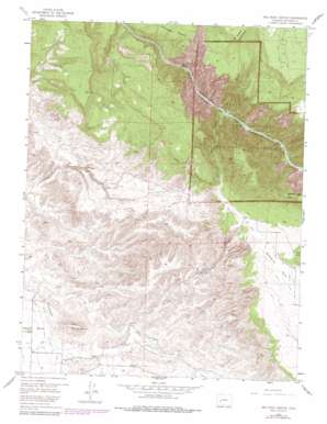
Red Rock Canyon Topo Map Colorado
To zoom in, hover over the map of Red Rock Canyon
USGS Topo Quad 38107e7 - 1:24,000 scale
| Topo Map Name: | Red Rock Canyon |
| USGS Topo Quad ID: | 38107e7 |
| Print Size: | ca. 21 1/4" wide x 27" high |
| Southeast Coordinates: | 38.5° N latitude / 107.75° W longitude |
| Map Center Coordinates: | 38.5625° N latitude / 107.8125° W longitude |
| U.S. State: | CO |
| Filename: | o38107e7.jpg |
| Download Map JPG Image: | Red Rock Canyon topo map 1:24,000 scale |
| Map Type: | Topographic |
| Topo Series: | 7.5´ |
| Map Scale: | 1:24,000 |
| Source of Map Images: | United States Geological Survey (USGS) |
| Alternate Map Versions: |
Red Rock Canyon CO 1955, updated 1957 Download PDF Buy paper map Red Rock Canyon CO 1955, updated 1957 Download PDF Buy paper map Red Rock Canyon CO 1955, updated 1967 Download PDF Buy paper map Red Rock Canyon CO 1955, updated 1979 Download PDF Buy paper map Red Rock Canyon CO 2011 Download PDF Buy paper map Red Rock Canyon CO 2013 Download PDF Buy paper map Red Rock Canyon CO 2016 Download PDF Buy paper map |
1:24,000 Topo Quads surrounding Red Rock Canyon
> Back to 38107e1 at 1:100,000 scale
> Back to 38106a1 at 1:250,000 scale
> Back to U.S. Topo Maps home
Red Rock Canyon topo map: Gazetteer
Red Rock Canyon: Canals
Loutsenhizer Canal elevation 1789m 5869′Red Rock Canyon: Cliffs
Red Rocks elevation 2101m 6893′Warner Point elevation 2486m 8156′
Red Rock Canyon: Dams
State Tunnel Dam elevation 1888m 6194′Red Rock Canyon: Mines
State Tunnel elevation 1889m 6197′Red Rock Canyon: Summits
Flat Top elevation 1920m 6299′Green Mountain elevation 2572m 8438′
Warner Point elevation 2453m 8047′
Red Rock Canyon: Valleys
Jones Draw elevation 2110m 6922′Red Rock Canyon elevation 1683m 5521′
Red Rock Canyon digital topo map on disk
Buy this Red Rock Canyon topo map showing relief, roads, GPS coordinates and other geographical features, as a high-resolution digital map file on DVD:


