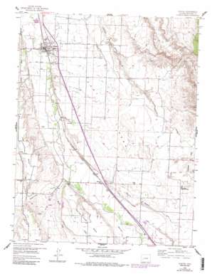
Olathe Topo Map Colorado
To zoom in, hover over the map of Olathe
USGS Topo Quad 38107e8 - 1:24,000 scale
| Topo Map Name: | Olathe |
| USGS Topo Quad ID: | 38107e8 |
| Print Size: | ca. 21 1/4" wide x 27" high |
| Southeast Coordinates: | 38.5° N latitude / 107.875° W longitude |
| Map Center Coordinates: | 38.5625° N latitude / 107.9375° W longitude |
| U.S. State: | CO |
| Filename: | o38107e8.jpg |
| Download Map JPG Image: | Olathe topo map 1:24,000 scale |
| Map Type: | Topographic |
| Topo Series: | 7.5´ |
| Map Scale: | 1:24,000 |
| Source of Map Images: | United States Geological Survey (USGS) |
| Alternate Map Versions: |
Olathe CO 1955, updated 1956 Download PDF Buy paper map Olathe CO 1955, updated 1956 Download PDF Buy paper map Olathe CO 1955, updated 1963 Download PDF Buy paper map Olathe CO 1955, updated 1963 Download PDF Buy paper map Olathe CO 1955, updated 1984 Download PDF Buy paper map Olathe CO 2010 Download PDF Buy paper map Olathe CO 2013 Download PDF Buy paper map Olathe CO 2016 Download PDF Buy paper map |
1:24,000 Topo Quads surrounding Olathe
> Back to 38107e1 at 1:100,000 scale
> Back to 38106a1 at 1:250,000 scale
> Back to U.S. Topo Maps home
Olathe topo map: Gazetteer
Olathe: Airports
Clifford Field elevation 1695m 5561′Montrose Regional Airport elevation 1745m 5725′
Olathe: Canals
Selig Canal elevation 1706m 5597′Olathe: Parks
Lions Park elevation 1630m 5347′Olathe: Populated Places
Frost elevation 1662m 5452′Olathe elevation 1633m 5357′
Roe elevation 1696m 5564′
Olathe: Post Offices
Olathe Post Office elevation 1631m 5351′Olathe: Streams
Cedar Creek elevation 1720m 5643′Spring Creek elevation 1683m 5521′
Olathe: Summits
East Mesa elevation 1715m 5626′High Mesa elevation 1767m 5797′
North Mesa elevation 1752m 5748′
Olathe: Valleys
Deadmans Gulch elevation 1691m 5547′Mexican Gulch elevation 1716m 5629′
Olathe digital topo map on disk
Buy this Olathe topo map showing relief, roads, GPS coordinates and other geographical features, as a high-resolution digital map file on DVD:


