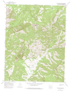
Big Soap Park Topo Map Colorado
To zoom in, hover over the map of Big Soap Park
USGS Topo Quad 38107f3 - 1:24,000 scale
| Topo Map Name: | Big Soap Park |
| USGS Topo Quad ID: | 38107f3 |
| Print Size: | ca. 21 1/4" wide x 27" high |
| Southeast Coordinates: | 38.625° N latitude / 107.25° W longitude |
| Map Center Coordinates: | 38.6875° N latitude / 107.3125° W longitude |
| U.S. State: | CO |
| Filename: | o38107f3.jpg |
| Download Map JPG Image: | Big Soap Park topo map 1:24,000 scale |
| Map Type: | Topographic |
| Topo Series: | 7.5´ |
| Map Scale: | 1:24,000 |
| Source of Map Images: | United States Geological Survey (USGS) |
| Alternate Map Versions: |
Big Soap Park CO 1965, updated 1968 Download PDF Buy paper map Big Soap Park CO 1965, updated 1968 Download PDF Buy paper map Big Soap Park CO 1965, updated 1975 Download PDF Buy paper map Big Soap Park CO 2001, updated 2004 Download PDF Buy paper map Big Soap Park CO 2011 Download PDF Buy paper map Big Soap Park CO 2013 Download PDF Buy paper map Big Soap Park CO 2016 Download PDF Buy paper map |
| FStopo: | US Forest Service topo Big Soap Park is available: Download FStopo PDF Download FStopo TIF |
1:24,000 Topo Quads surrounding Big Soap Park
> Back to 38107e1 at 1:100,000 scale
> Back to 38106a1 at 1:250,000 scale
> Back to U.S. Topo Maps home
Big Soap Park topo map: Gazetteer
Big Soap Park: Basins
Elk Basin elevation 2840m 9317′Big Soap Park: Flats
Big Soap Park elevation 2554m 8379′Big Soap Park: Gaps
Curecanti Pass elevation 3195m 10482′Big Soap Park: Ridges
Kaufman Ridge elevation 3034m 9954′Big Soap Park: Streams
Coffeepot Creek elevation 2748m 9015′Dry Fork Curecanti Creek elevation 2774m 9101′
East Soap Creek elevation 2632m 8635′
West Soap Creek elevation 2534m 8313′
Big Soap Park: Summits
Bonfisk Peak elevation 3523m 11558′Haystack Mountain elevation 3360m 11023′
Porcupine Cone elevation 3486m 11437′
Sheep Mountain elevation 3583m 11755′
Big Soap Park: Trails
Cureranti Pass Trail elevation 2918m 9573′Big Soap Park: Valleys
Buck Hollow elevation 2528m 8293′Jackass Gulch elevation 2562m 8405′
Smooth Canyon elevation 2860m 9383′
Big Soap Park digital topo map on disk
Buy this Big Soap Park topo map showing relief, roads, GPS coordinates and other geographical features, as a high-resolution digital map file on DVD:


