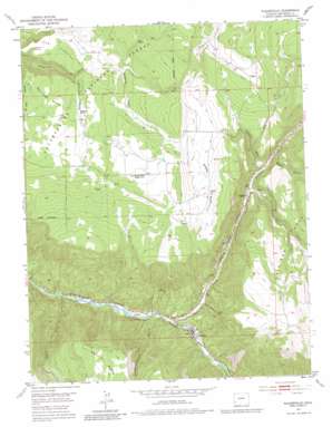
Placerville Topo Map Colorado
To zoom in, hover over the map of Placerville
USGS Topo Quad 38108a1 - 1:24,000 scale
| Topo Map Name: | Placerville |
| USGS Topo Quad ID: | 38108a1 |
| Print Size: | ca. 21 1/4" wide x 27" high |
| Southeast Coordinates: | 38° N latitude / 108° W longitude |
| Map Center Coordinates: | 38.0625° N latitude / 108.0625° W longitude |
| U.S. State: | CO |
| Filename: | o38108a1.jpg |
| Download Map JPG Image: | Placerville topo map 1:24,000 scale |
| Map Type: | Topographic |
| Topo Series: | 7.5´ |
| Map Scale: | 1:24,000 |
| Source of Map Images: | United States Geological Survey (USGS) |
| Alternate Map Versions: |
Placerville CO 1953, updated 1954 Download PDF Buy paper map Placerville CO 1953, updated 1954 Download PDF Buy paper map Placerville CO 1953, updated 1965 Download PDF Buy paper map Placerville CO 1953, updated 1965 Download PDF Buy paper map Placerville CO 1953, updated 1974 Download PDF Buy paper map Placerville CO 1953, updated 1982 Download PDF Buy paper map Placerville CO 2011 Download PDF Buy paper map Placerville CO 2013 Download PDF Buy paper map Placerville CO 2016 Download PDF Buy paper map |
| FStopo: | US Forest Service topo Placerville is available: Download FStopo PDF Download FStopo TIF |
1:24,000 Topo Quads surrounding Placerville
> Back to 38108a1 at 1:100,000 scale
> Back to 38108a1 at 1:250,000 scale
> Back to U.S. Topo Maps home
Placerville topo map: Gazetteer
Placerville: Airports
Placerville Heliport elevation 2243m 7358′Placerville: Cliffs
Haskill Hill elevation 2535m 8316′Placerville: Mines
Alpha and Gamma Mine elevation 2750m 9022′Black King Mine elevation 2259m 7411′
Black King Mine elevation 2391m 7844′
Crescent City Mine elevation 2227m 7306′
Donegan Placer Mine elevation 2316m 7598′
Donovan Placer Mine elevation 2316m 7598′
E Bar Placer Mine elevation 2231m 7319′
Evans Claims Mine elevation 2516m 8254′
Gold Ledge Placer Mine elevation 2237m 7339′
Grumwald Mine elevation 2231m 7319′
Guthrie Pit elevation 2231m 7319′
Idaho Mine elevation 2254m 7395′
Ironside Mine elevation 2231m 7319′
Laen Mine elevation 2392m 7847′
Leopard Mine elevation 2294m 7526′
Omega Mine elevation 2507m 8225′
Pocahontas Mine elevation 2237m 7339′
Pretty Blue Mine elevation 2384m 7821′
Single Jack Mine elevation 2271m 7450′
Wave Bar Mine elevation 2270m 7447′
White Crow Mine elevation 2228m 7309′
White Spar Mine elevation 2391m 7844′
Wilson and Chambers Mine elevation 2237m 7339′
Placerville: Populated Places
Leonard (historical) elevation 2362m 7749′Placerville elevation 2230m 7316′
Placerville: Post Offices
Placerville Post Office elevation 2228m 7309′Placerville: Springs
Flatiron Spring elevation 2439m 8001′Galloway Spring elevation 2492m 8175′
Lemon Hot Spring elevation 2232m 7322′
Lost Spring elevation 2571m 8435′
Placerville: Streams
Alder Creek elevation 2356m 7729′East Fork Mc Kenzie Creek elevation 2620m 8595′
Leopard Creek elevation 2214m 7263′
Specie Creek elevation 2167m 7109′
Placerville: Summits
Iron Springs Mesa elevation 2761m 9058′The Flatiron elevation 2493m 8179′
Placerville: Valleys
Galloway Draw elevation 2412m 7913′Gutshall Gulch elevation 2453m 8047′
Leopard Creek Canyon elevation 2217m 7273′
Massy Gulch elevation 2386m 7828′
Sawdust Gulch elevation 2476m 8123′
Sheep Draw elevation 2509m 8231′
Slaughterhouse Gulch elevation 2207m 7240′
Specie Creek Canyon elevation 2167m 7109′
Placerville digital topo map on disk
Buy this Placerville topo map showing relief, roads, GPS coordinates and other geographical features, as a high-resolution digital map file on DVD:


