Pryor Creek Topo Map Colorado
To zoom in, hover over the map of Pryor Creek
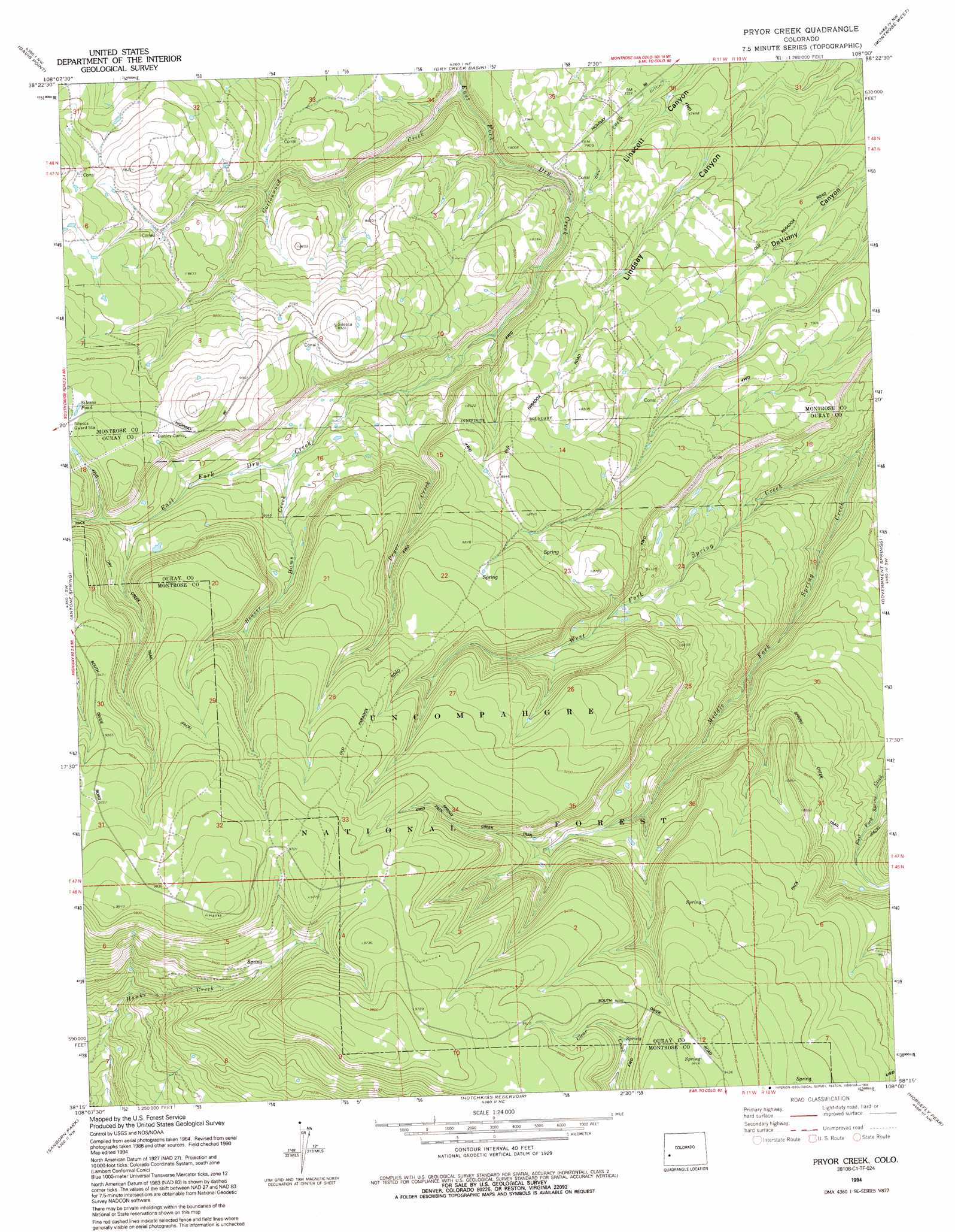
USGS Topo Quad 38108c1 - 1:24,000 scale
| Topo Map Name: | Pryor Creek |
| USGS Topo Quad ID: | 38108c1 |
| Print Size: | ca. 21 1/4" wide x 27" high |
| Southeast Coordinates: | 38.25° N latitude / 108° W longitude |
| Map Center Coordinates: | 38.3125° N latitude / 108.0625° W longitude |
| U.S. State: | CO |
| Filename: | o38108c1.jpg |
| Download Map JPG Image: | Pryor Creek topo map 1:24,000 scale |
| Map Type: | Topographic |
| Topo Series: | 7.5´ |
| Map Scale: | 1:24,000 |
| Source of Map Images: | United States Geological Survey (USGS) |
| Alternate Map Versions: |
Pryor Creek CO 1973, updated 1975 Download PDF Buy paper map Pryor Creek CO 1973, updated 1975 Download PDF Buy paper map Pryor Creek CO 1973, updated 1983 Download PDF Buy paper map Pryor Creek CO 1994, updated 1994 Download PDF Buy paper map Pryor Creek CO 2011 Download PDF Buy paper map Pryor Creek CO 2013 Download PDF Buy paper map Pryor Creek CO 2016 Download PDF Buy paper map |
| FStopo: | US Forest Service topo Pryor Creek is available: Download FStopo PDF Download FStopo TIF |
1:24,000 Topo Quads surrounding Pryor Creek
Cottonwood Basin |
Camel Back |
Hoovers Corner |
Olathe |
Red Rock Canyon |
Moore Mesa |
Davis Point |
Dry Creek Basin |
Montrose West |
Montrose East |
Ute |
Antone Spring |
Pryor Creek |
Government Springs |
Colona |
Norwood |
Sanborn Park |
Hotchkiss Reservoir |
Horsefly Peak |
Ridgway |
Oak Hill |
Gurley Canyon |
Placerville |
Sams |
Mount Sneffels |
> Back to 38108a1 at 1:100,000 scale
> Back to 38108a1 at 1:250,000 scale
> Back to U.S. Topo Maps home
Pryor Creek topo map: Gazetteer
Pryor Creek: Canals
Dry Creek Ditch elevation 2349m 7706′Pryor Creek: Lakes
Silesca Pond elevation 2790m 9153′Pryor Creek: Streams
Beaver Dams Creek elevation 2578m 8458′Cottonwood Creek elevation 2332m 7650′
Pryor Creek elevation 2486m 8156′
West Fork Spring Creek elevation 2252m 7388′
Pryor Creek: Trails
Dry Creek Trail elevation 2896m 9501′Paradox Road elevation 2822m 9258′
Spring Creek Trail elevation 2573m 8441′
Pryor Creek digital topo map on disk
Buy this Pryor Creek topo map showing relief, roads, GPS coordinates and other geographical features, as a high-resolution digital map file on DVD: