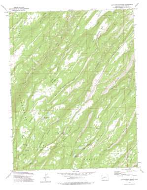
Cottonwood Basin Topo Map Colorado
To zoom in, hover over the map of Cottonwood Basin
USGS Topo Quad 38108e3 - 1:24,000 scale
| Topo Map Name: | Cottonwood Basin |
| USGS Topo Quad ID: | 38108e3 |
| Print Size: | ca. 21 1/4" wide x 27" high |
| Southeast Coordinates: | 38.5° N latitude / 108.25° W longitude |
| Map Center Coordinates: | 38.5625° N latitude / 108.3125° W longitude |
| U.S. State: | CO |
| Filename: | o38108e3.jpg |
| Download Map JPG Image: | Cottonwood Basin topo map 1:24,000 scale |
| Map Type: | Topographic |
| Topo Series: | 7.5´ |
| Map Scale: | 1:24,000 |
| Source of Map Images: | United States Geological Survey (USGS) |
| Alternate Map Versions: |
Cottonwood Basin CO 1973, updated 1976 Download PDF Buy paper map Cottonwood Basin CO 2011 Download PDF Buy paper map Cottonwood Basin CO 2013 Download PDF Buy paper map Cottonwood Basin CO 2016 Download PDF Buy paper map |
| FStopo: | US Forest Service topo Cottonwood Basin is available: Download FStopo PDF Download FStopo TIF |
1:24,000 Topo Quads surrounding Cottonwood Basin
> Back to 38108e1 at 1:100,000 scale
> Back to 38108a1 at 1:250,000 scale
> Back to U.S. Topo Maps home
Cottonwood Basin topo map: Gazetteer
Cottonwood Basin: Basins
Cottonwood Basin elevation 2333m 7654′Criswell Basin elevation 2245m 7365′
Potter Basin elevation 2294m 7526′
Cottonwood Basin: Cliffs
Peach Orchard Point elevation 2082m 6830′Cottonwood Basin: Dams
Big Monitor Number 1 Dam elevation 2313m 7588′Bullfrog Dam elevation 2427m 7962′
Harry White Number 2 Dam elevation 2363m 7752′
Hawkins Number 2 Dam elevation 2317m 7601′
Little Monitor Number 1 Dam elevation 2329m 7641′
Little Monitor Number 2 Dam elevation 2280m 7480′
Lower Ed Lee Number 2 Dam elevation 2320m 7611′
Middle Monitor Dam elevation 2306m 7565′
Twin Lakes Dam elevation 2369m 7772′
Upper Ed Lee Dam elevation 2446m 8024′
Cottonwood Basin: Reservoirs
Beaver Reservoir elevation 2366m 7762′Big Monitor Reservoir Number 1 elevation 2344m 7690′
Big Monitor Reservoir Number 2 elevation 2305m 7562′
Bullfrog Reservoir elevation 2427m 7962′
Castle Rock Reservoir elevation 2407m 7896′
Harry White Number 2 Reservoir elevation 2363m 7752′
Harry White Reservoirs elevation 2318m 7604′
Hawkins Reservoir Number 2 elevation 2317m 7601′
Lee Reservoirs elevation 2319m 7608′
Little Monitor Reservoir elevation 2303m 7555′
Little Monitor Reservoir Number 1 elevation 2329m 7641′
Little Monitor Reservoir Number 2 elevation 2280m 7480′
Lone Pine Reservoir elevation 2309m 7575′
Lower Ed Lee Number 2 Reservoir elevation 2320m 7611′
Middle Monitor Reservoir elevation 2306m 7565′
Middle Reservoir elevation 2307m 7568′
Round Park Reservoir elevation 2390m 7841′
Twin Lake elevation 2345m 7693′
Twin Lakes Reservoir elevation 2369m 7772′
Upper Ed Lee Reservoir elevation 2446m 8024′
Cottonwood Basin: Streams
Little Monitor Creek elevation 2030m 6660′Cottonwood Basin: Trails
Cottonwood Trail elevation 2405m 7890′Cottonwood Basin: Valleys
Mud Springs Gulch elevation 1881m 6171′Cottonwood Basin digital topo map on disk
Buy this Cottonwood Basin topo map showing relief, roads, GPS coordinates and other geographical features, as a high-resolution digital map file on DVD:


