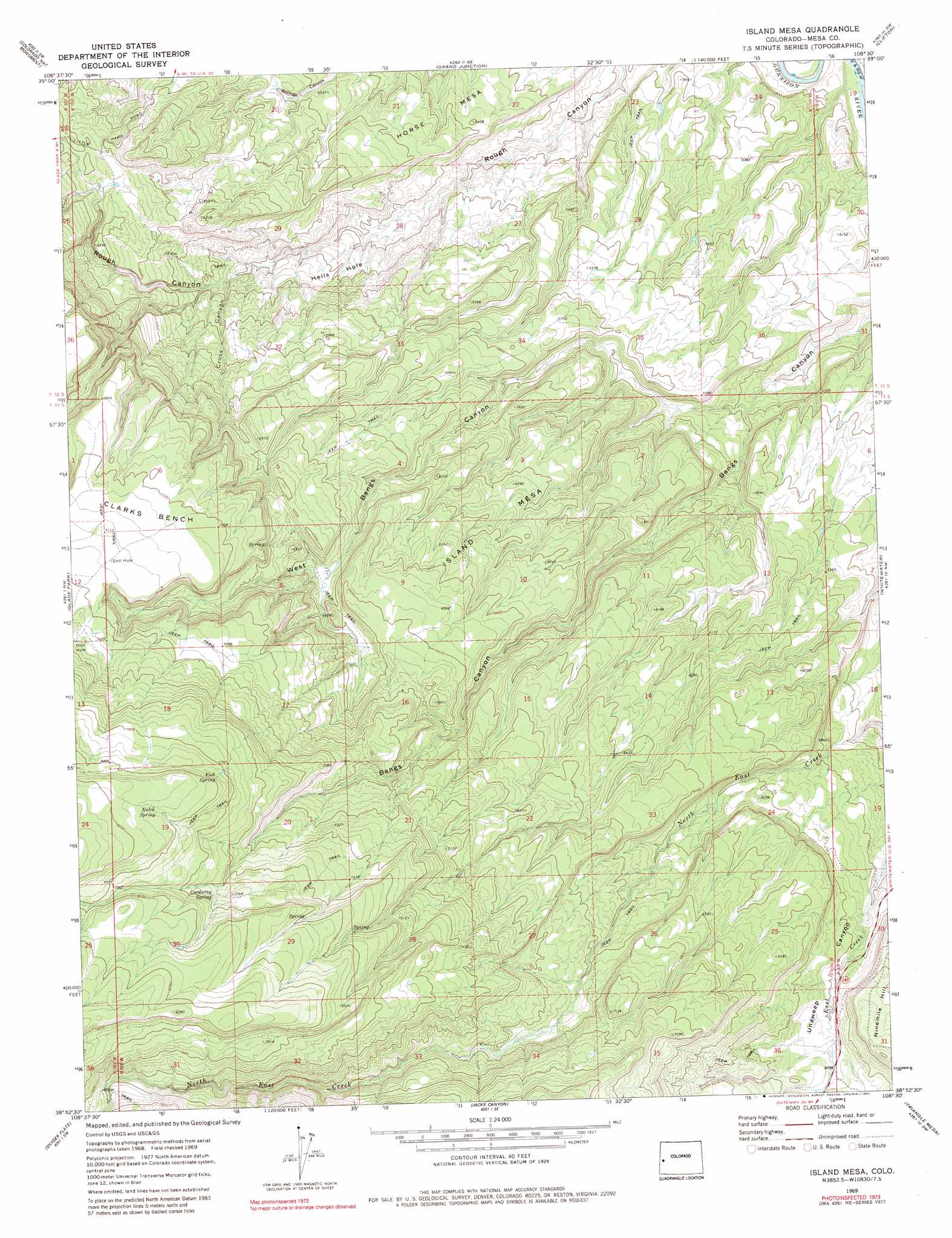
Island Mesa Topo Map Colorado
To zoom in, hover over the map of Island Mesa
USGS Topo Quad 38108h5 - 1:24,000 scale
| Topo Map Name: | Island Mesa |
| USGS Topo Quad ID: | 38108h5 |
| Print Size: | ca. 21 1/4" wide x 27" high |
| Southeast Coordinates: | 38.875° N latitude / 108.5° W longitude |
| Map Center Coordinates: | 38.9375° N latitude / 108.5625° W longitude |
| U.S. State: | CO |
| Filename: | o38108h5.jpg |
| Download Map JPG Image: | Island Mesa topo map 1:24,000 scale |
| Map Type: | Topographic |
| Topo Series: | 7.5´ |
| Map Scale: | 1:24,000 |
| Source of Map Images: | United States Geological Survey (USGS) |
| Alternate Map Versions: |
Island Mesa CO 1969, updated 1973 Download PDF Buy paper map Island Mesa CO 1969, updated 1973 Download PDF Buy paper map Island Mesa CO 1969, updated 1980 Download PDF Buy paper map Island Mesa CO 1969, updated 1980 Download PDF Buy paper map Island Mesa CO 2010 Download PDF Buy paper map Island Mesa CO 2013 Download PDF Buy paper map Island Mesa CO 2016 Download PDF Buy paper map |
1:24,000 Topo Quads surrounding Island Mesa
Mack |
Fruita |
Corcoran Point |
Round Mountain |
Cameo |
Battleship Rock |
Colorado National Monument |
Grand Junction |
Clifton |
Palisade |
Payne Wash |
Glade Park |
Island Mesa |
Whitewater |
Juniata Reservoir |
Fish Creek |
Snyder Flats |
Jacks Canyon |
Triangle Mesa |
Dominguez |
Pine Mountain |
Casto Reservoir |
Keith Creek |
Escalante Forks |
Good Point |
> Back to 38108e1 at 1:100,000 scale
> Back to 38108a1 at 1:250,000 scale
> Back to U.S. Topo Maps home
Island Mesa topo map: Gazetteer
Island Mesa: Basins
Hells Hole elevation 1632m 5354′Island Mesa: Springs
Corduroy Spring elevation 2340m 7677′End Spring elevation 2409m 7903′
Notch Spring elevation 2462m 8077′
Island Mesa: Summits
Horse Mesa elevation 1649m 5410′Island Mesa elevation 1940m 6364′
Island Mesa: Valleys
Cross Canyon elevation 1660m 5446′West Bangs Canyon elevation 1574m 5164′
Island Mesa digital topo map on disk
Buy this Island Mesa topo map showing relief, roads, GPS coordinates and other geographical features, as a high-resolution digital map file on DVD: