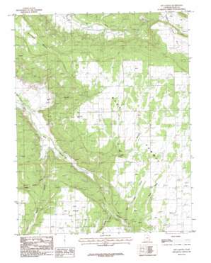
Sop Canyon Topo Map Utah
To zoom in, hover over the map of Sop Canyon
USGS Topo Quad 38109a2 - 1:24,000 scale
| Topo Map Name: | Sop Canyon |
| USGS Topo Quad ID: | 38109a2 |
| Print Size: | ca. 21 1/4" wide x 27" high |
| Southeast Coordinates: | 38° N latitude / 109.125° W longitude |
| Map Center Coordinates: | 38.0625° N latitude / 109.1875° W longitude |
| U.S. State: | UT |
| Filename: | o38109a2.jpg |
| Download Map JPG Image: | Sop Canyon topo map 1:24,000 scale |
| Map Type: | Topographic |
| Topo Series: | 7.5´ |
| Map Scale: | 1:24,000 |
| Source of Map Images: | United States Geological Survey (USGS) |
| Alternate Map Versions: |
Mt Peale 4 SW UT 1954, updated 1955 Download PDF Buy paper map Sop Canyon UT 1987, updated 1987 Download PDF Buy paper map Sop Canyon UT 2010 Download PDF Buy paper map Sop Canyon UT 2014 Download PDF Buy paper map |
1:24,000 Topo Quads surrounding Sop Canyon
> Back to 38109a1 at 1:100,000 scale
> Back to 38108a1 at 1:250,000 scale
> Back to U.S. Topo Maps home
Sop Canyon topo map: Gazetteer
Sop Canyon: Capes
Iron Canyon Point elevation 2102m 6896′Sop Canyon: Mines
Rim Canyon Mine elevation 2148m 7047′Sop Canyon: Springs
Sop Spring elevation 2082m 6830′Sop Canyon: Summits
Deerneck Mesa elevation 2213m 7260′West Summit elevation 2246m 7368′
Sop Canyon: Valleys
Bear Trap Canyon elevation 2006m 6581′Buck Draw elevation 2013m 6604′
East Canyon Wash elevation 1807m 5928′
Iron Spring Canyon elevation 2000m 6561′
Pine Hollow elevation 1801m 5908′
Sop Canyon elevation 1830m 6003′
South Canyon elevation 1818m 5964′
Wild Horse Draw elevation 1853m 6079′
Sop Canyon digital topo map on disk
Buy this Sop Canyon topo map showing relief, roads, GPS coordinates and other geographical features, as a high-resolution digital map file on DVD:


