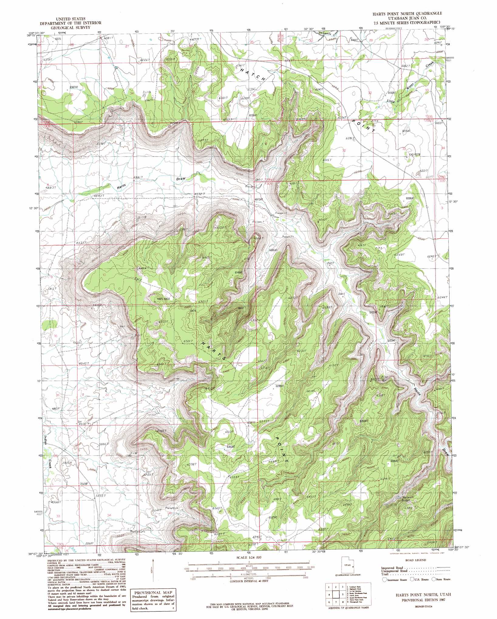
Harts Point North Topo Map Utah
To zoom in, hover over the map of Harts Point North
USGS Topo Quad 38109b5 - 1:24,000 scale
| Topo Map Name: | Harts Point North |
| USGS Topo Quad ID: | 38109b5 |
| Print Size: | ca. 21 1/4" wide x 27" high |
| Southeast Coordinates: | 38.125° N latitude / 109.5° W longitude |
| Map Center Coordinates: | 38.1875° N latitude / 109.5625° W longitude |
| U.S. State: | UT |
| Filename: | o38109b5.jpg |
| Download Map JPG Image: | Harts Point North topo map 1:24,000 scale |
| Map Type: | Topographic |
| Topo Series: | 7.5´ |
| Map Scale: | 1:24,000 |
| Source of Map Images: | United States Geological Survey (USGS) |
| Alternate Map Versions: |
Carlisle 4 NE UT 1954, updated 1956 Download PDF Buy paper map Harts Point North UT 1987, updated 1987 Download PDF Buy paper map Harts Point North UT 2011 Download PDF Buy paper map Harts Point North UT 2014 Download PDF Buy paper map |
1:24,000 Topo Quads surrounding Harts Point North
Musselman Arch |
Shafer Basin |
Trough Springs Canyon |
Kane Springs |
Mount Tukuhnikivatz |
Monument Basin |
Lockhart Basin |
Eightmile Rock |
La Sal Junction |
La Sal West |
The Loop |
North Six-Shooter Peak |
Harts Point North |
Hatch Rock |
Sandstone Draw |
Druid Arch |
South Six-Shooter Peak |
Harts Point South |
Photograph Gap |
Church Rock |
House Park Butte |
Cathedral Butte |
Shay Mountain |
Monticello Lake |
Monticello North |
> Back to 38109a1 at 1:100,000 scale
> Back to 38108a1 at 1:250,000 scale
> Back to U.S. Topo Maps home
Harts Point North topo map: Gazetteer
Harts Point North: Arches
Aqueduct Arch elevation 1768m 5800′Harts Point North: Ridges
Harts Point elevation 1990m 6528′Harts Point North: Valleys
Bobbys Hole Canyon elevation 1621m 5318′Harts Point North digital topo map on disk
Buy this Harts Point North topo map showing relief, roads, GPS coordinates and other geographical features, as a high-resolution digital map file on DVD: