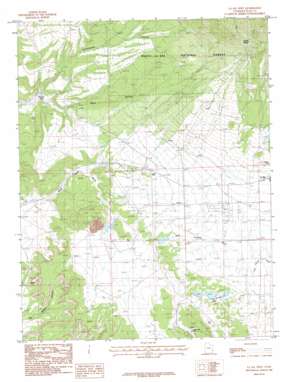
La Sal West Topo Map Utah
To zoom in, hover over the map of La Sal West
USGS Topo Quad 38109c3 - 1:24,000 scale
| Topo Map Name: | La Sal West |
| USGS Topo Quad ID: | 38109c3 |
| Print Size: | ca. 21 1/4" wide x 27" high |
| Southeast Coordinates: | 38.25° N latitude / 109.25° W longitude |
| Map Center Coordinates: | 38.3125° N latitude / 109.3125° W longitude |
| U.S. State: | UT |
| Filename: | o38109c3.jpg |
| Download Map JPG Image: | La Sal West topo map 1:24,000 scale |
| Map Type: | Topographic |
| Topo Series: | 7.5´ |
| Map Scale: | 1:24,000 |
| Source of Map Images: | United States Geological Survey (USGS) |
| Alternate Map Versions: |
Mt Peale 2 SE UT 1954, updated 1955 Download PDF Buy paper map La Sal West UT 1987, updated 1987 Download PDF Buy paper map La Sal West UT 1987, updated 1987 Download PDF Buy paper map La Sal West UT 1987, updated 1987 Download PDF Buy paper map La Sal West UT 2001, updated 2004 Download PDF Buy paper map La Sal West UT 2011 Download PDF Buy paper map La Sal West UT 2014 Download PDF Buy paper map |
| FStopo: | US Forest Service topo La Sal West is available: Download FStopo PDF Download FStopo TIF |
1:24,000 Topo Quads surrounding La Sal West
> Back to 38109a1 at 1:100,000 scale
> Back to 38108a1 at 1:250,000 scale
> Back to U.S. Topo Maps home
La Sal West topo map: Gazetteer
La Sal West: Arches
Wilson Arch elevation 1882m 6174′La Sal West: Basins
Browns Hole elevation 1834m 6017′La Sal West: Dams
Lower Bankhead Dam elevation 1950m 6397′Rattlesnake Ranch Number Two Dam elevation 1990m 6528′
Rio Algom Lower Tailings Pond Dam elevation 2024m 6640′
Rio Algom Upper Tailings Pond Dam elevation 2036m 6679′
Upper Bankhead Dam elevation 1949m 6394′
La Sal West: Mines
Alice Mine elevation 2043m 6702′Beaver Shaft elevation 2159m 7083′
Hecla Shaft elevation 1987m 6519′
Homestake Mine elevation 2064m 6771′
Lisbon Mine elevation 2040m 6692′
La Sal West: Post Offices
La Sal Post Office elevation 2132m 6994′La Sal West: Reservoirs
Lower Bankhead Reservoir elevation 1950m 6397′Rattlesnake Ranch Number Two Reservoir elevation 1990m 6528′
Rio Algom Lower Tailings Pond elevation 2024m 6640′
Rio Algom Upper Tailings Pond elevation 2036m 6679′
Upper Bankhead Reservoir elevation 1949m 6394′
Upper Rattlesnake Ranch Number One Reservoir elevation 1998m 6555′
La Sal West: Valleys
Buck Hollow elevation 1789m 5869′Cottonwood Canyon elevation 1822m 5977′
Lackey Basin elevation 2441m 8008′
La Sal West digital topo map on disk
Buy this La Sal West topo map showing relief, roads, GPS coordinates and other geographical features, as a high-resolution digital map file on DVD:


