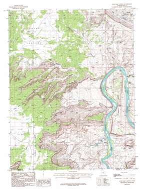
Gold Bar Canyon Topo Map Utah
To zoom in, hover over the map of Gold Bar Canyon
USGS Topo Quad 38109e6 - 1:24,000 scale
| Topo Map Name: | Gold Bar Canyon |
| USGS Topo Quad ID: | 38109e6 |
| Print Size: | ca. 21 1/4" wide x 27" high |
| Southeast Coordinates: | 38.5° N latitude / 109.625° W longitude |
| Map Center Coordinates: | 38.5625° N latitude / 109.6875° W longitude |
| U.S. State: | UT |
| Filename: | o38109e6.jpg |
| Download Map JPG Image: | Gold Bar Canyon topo map 1:24,000 scale |
| Map Type: | Topographic |
| Topo Series: | 7.5´ |
| Map Scale: | 1:24,000 |
| Source of Map Images: | United States Geological Survey (USGS) |
| Alternate Map Versions: |
Moab 4 SW UT 1952, updated 1954 Download PDF Buy paper map Elk Ridge 4 SW UT 1954 Download PDF Buy paper map Gold Bar Canyon UT 1985, updated 1986 Download PDF Buy paper map Gold Bar Canyon UT 1985, updated 1986 Download PDF Buy paper map Gold Bar Canyon UT 2010 Download PDF Buy paper map Gold Bar Canyon UT 2014 Download PDF Buy paper map |
1:24,000 Topo Quads surrounding Gold Bar Canyon
> Back to 38109e1 at 1:100,000 scale
> Back to 38108a1 at 1:250,000 scale
> Back to U.S. Topo Maps home
Gold Bar Canyon topo map: Gazetteer
Gold Bar Canyon: Arches
Gemini Bridges elevation 1545m 5068′Gold Bar Arch elevation 1524m 5000′
Ottingers Triple Arch elevation 1563m 5127′
Pinto Arch elevation 1392m 4566′
The Jug Handle elevation 1209m 3966′
Gold Bar Canyon: Bars
Gold Bar elevation 1205m 3953′Gold Bar Canyon: Basins
Jackson Hole elevation 1240m 4068′Gold Bar Canyon: Bends
Bliss Bottom elevation 1205m 3953′Jackson Bottom elevation 1212m 3976′
Lake Bottom elevation 1208m 3963′
Gold Bar Canyon: Cliffs
The Billboard elevation 1394m 4573′Gold Bar Canyon: Flats
Arths Pasture elevation 1605m 5265′Gold Bar Canyon: Parks
Dead Horse Point State Park elevation 1792m 5879′Dead Horse Point State Park elevation 1802m 5912′
Gold Bar Canyon: Rapids
J L Eddy elevation 1202m 3943′Gold Bar Canyon: Ridges
Amasa Back elevation 1396m 4580′Gold Bar Canyon: Streams
Dry Fork elevation 1414m 4639′Gold Bar Canyon: Valleys
Bootlegger Canyon elevation 1209m 3966′Bull Canyon elevation 1208m 3963′
Day Canyon elevation 1432m 4698′
Day Canyon elevation 1293m 4242′
Gold Bar Canyon elevation 1214m 3982′
Little Canyon elevation 1205m 3953′
Little Valley elevation 1693m 5554′
Long Canyon elevation 1203m 3946′
Gold Bar Canyon digital topo map on disk
Buy this Gold Bar Canyon topo map showing relief, roads, GPS coordinates and other geographical features, as a high-resolution digital map file on DVD:


