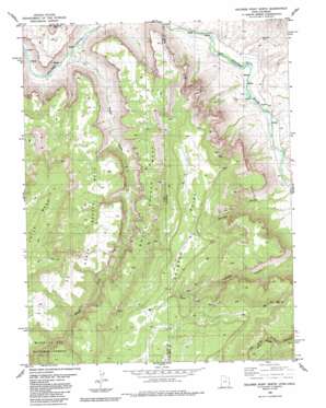
Dolores Point North Topo Map Utah
To zoom in, hover over the map of Dolores Point North
USGS Topo Quad 38109f1 - 1:24,000 scale
| Topo Map Name: | Dolores Point North |
| USGS Topo Quad ID: | 38109f1 |
| Print Size: | ca. 21 1/4" wide x 27" high |
| Southeast Coordinates: | 38.625° N latitude / 109° W longitude |
| Map Center Coordinates: | 38.6875° N latitude / 109.0625° W longitude |
| U.S. States: | UT, CO |
| Filename: | o38109f1.jpg |
| Download Map JPG Image: | Dolores Point North topo map 1:24,000 scale |
| Map Type: | Topographic |
| Topo Series: | 7.5´ |
| Map Scale: | 1:24,000 |
| Source of Map Images: | United States Geological Survey (USGS) |
| Alternate Map Versions: |
Mt. Waas 4 NE CO 1954, updated 1955 Download PDF Buy paper map Dolores Point North CO 1985, updated 1986 Download PDF Buy paper map Dolores Point North CO 1985, updated 1986 Download PDF Buy paper map Dolores Point North CO 2001, updated 2004 Download PDF Buy paper map Dolores Point North CO 2011 Download PDF Buy paper map Dolores Point North CO 2013 Download PDF Buy paper map Dolores Point North CO 2016 Download PDF Buy paper map |
| FStopo: | US Forest Service topo Dolores Point North is available: Download FStopo PDF Download FStopo TIF |
1:24,000 Topo Quads surrounding Dolores Point North
> Back to 38109e1 at 1:100,000 scale
> Back to 38108a1 at 1:250,000 scale
> Back to U.S. Topo Maps home
Dolores Point North topo map: Gazetteer
Dolores Point North: Mines
Ajax One Mine elevation 2057m 6748′Austin Mine elevation 2027m 6650′
Bonanza Mine elevation 2270m 7447′
Captain Jinks Mine elevation 2172m 7125′
Gilmore Lode elevation 2158m 7080′
Hubbard Mine elevation 2111m 6925′
John Brown Mine elevation 2289m 7509′
Johnnie Mae Mine elevation 2178m 7145′
La Sal Group Mine elevation 2124m 6968′
La Salle Group Mine elevation 2124m 6968′
Lost Dutchman Mine elevation 2282m 7486′
Lost Indian Mine elevation 2027m 6650′
Lumsden Mine elevation 2092m 6863′
Mark Mine elevation 2283m 7490′
North Beaver Mesa Mine elevation 1993m 6538′
Pack Rat Mine elevation 2105m 6906′
Rae Marie Mine elevation 1363m 4471′
Shakin Quakie Mine elevation 2105m 6906′
Smith Mine elevation 2147m 7043′
Sunspot Mine elevation 2172m 7125′
Sunspot Mine elevation 2171m 7122′
Upper John Brown Mine elevation 2292m 7519′
Winfield-McCormick Mine elevation 1924m 6312′
Yellow Cat Mine elevation 2105m 6906′
Dolores Point North: Springs
Dolores Point Spring elevation 2119m 6952′DP Spring elevation 1885m 6184′
Dolores Point North: Streams
Beaver Creek elevation 1324m 4343′Dolores Point North: Summits
Dolores Point elevation 2273m 7457′Dolores Point elevation 2273m 7457′
South Beaver Mesa elevation 2040m 6692′
Dolores Point North: Valleys
Gateway Canyon elevation 1441m 4727′Dolores Point North digital topo map on disk
Buy this Dolores Point North topo map showing relief, roads, GPS coordinates and other geographical features, as a high-resolution digital map file on DVD:


