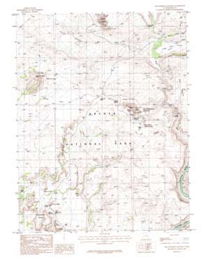
The Windows Section Topo Map Utah
To zoom in, hover over the map of The Windows Section
USGS Topo Quad 38109f5 - 1:24,000 scale
| Topo Map Name: | The Windows Section |
| USGS Topo Quad ID: | 38109f5 |
| Print Size: | ca. 21 1/4" wide x 27" high |
| Southeast Coordinates: | 38.625° N latitude / 109.5° W longitude |
| Map Center Coordinates: | 38.6875° N latitude / 109.5625° W longitude |
| U.S. State: | UT |
| Filename: | o38109f5.jpg |
| Download Map JPG Image: | The Windows Section topo map 1:24,000 scale |
| Map Type: | Topographic |
| Topo Series: | 7.5´ |
| Map Scale: | 1:24,000 |
| Source of Map Images: | United States Geological Survey (USGS) |
| Alternate Map Versions: |
Moab 4 NE UT 1959, updated 1961 Download PDF Buy paper map The Windows Section UT 1985, updated 1986 Download PDF Buy paper map The Windows Section UT 1985, updated 1986 Download PDF Buy paper map The Windows Section UT 1996, updated 2002 Download PDF Buy paper map The Windows Section UT 2011 Download PDF Buy paper map The Windows Section UT 2014 Download PDF Buy paper map |
1:24,000 Topo Quads surrounding The Windows Section
> Back to 38109e1 at 1:100,000 scale
> Back to 38108a1 at 1:250,000 scale
> Back to U.S. Topo Maps home
The Windows Section topo map: Gazetteer
The Windows Section: Arches
Beckwith Arch elevation 1537m 5042′Bench Arch elevation 1478m 4849′
Cliff Arch elevation 1525m 5003′
Cloister Arch elevation 1465m 4806′
Cove Arch elevation 1659m 5442′
Double Arch elevation 1613m 5291′
Elephant Arch elevation 1593m 5226′
Eye of the Whale Arch elevation 1519m 4983′
Flatiron Arch elevation 1343m 4406′
Football Arch elevation 1504m 4934′
Hole-in-the-Fin Arch elevation 1506m 4940′
Hole-in-the-Wall elevation 1273m 4176′
Little Bridge elevation 1539m 5049′
North Window elevation 1639m 5377′
Pothole Arch elevation 1586m 5203′
Queue Jughandle Arch elevation 1539m 5049′
Ribbon Arch elevation 1699m 5574′
Ring Arch elevation 1376m 4514′
Schmidt Arch elevation 1367m 4484′
South Windows elevation 1616m 5301′
Surprise Arch elevation 1539m 5049′
Tapestry Arch elevation 1422m 4665′
Turret Arch elevation 1593m 5226′
Twin Arch elevation 1539m 5049′
Twisted Doughnut Arch elevation 1462m 4796′
Webbing Arch elevation 1539m 5049′
The Windows Section: Areas
Garden of Eden elevation 1540m 5052′Herdina Park elevation 1512m 4960′
Petrified Sand Dunes elevation 1366m 4481′
Rock Pinnacles elevation 1505m 4937′
The Windows Section elevation 1539m 5049′
The Windows Section: Bars
Nose Bridge elevation 1627m 5337′The Windows Section: Bridges
Courthouse Wash Bridge elevation 1251m 4104′The Windows Section: Cliffs
The Great Wall elevation 1382m 4534′The Windows Section: Flats
Willow Flats elevation 1480m 4855′The Windows Section: Parks
Arches National Park elevation 1499m 4917′The Windows Section: Pillars
Adam and Eve elevation 1557m 5108′Balanced Rock elevation 1536m 5039′
Buccaneer Rock elevation 1590m 5216′
Courthouse Towers elevation 1463m 4799′
Devils Golf Ball elevation 1610m 5282′
Duck-on-the-Rock elevation 1607m 5272′
Ham Rock elevation 1661m 5449′
Jacks Mummy elevation 1606m 5269′
Owl Rock elevation 1603m 5259′
Parade of Elephants elevation 1567m 5141′
Queen Nefertiti Rock elevation 1445m 4740′
Queen Victoria Rock elevation 1351m 4432′
Sausage Rock elevation 1350m 4429′
Sheep Rock elevation 1316m 4317′
The Lovers elevation 1303m 4274′
The Organ elevation 1352m 4435′
The Phallus elevation 1439m 4721′
The Poodle elevation 1439m 4721′
Three Gossips elevation 1318m 4324′
The Windows Section: Rapids
Salt Wash Rapids elevation 1218m 3996′The Windows Section: Springs
Freshwater Spring elevation 1352m 4435′Salt Spring elevation 1250m 4101′
Salt Spring elevation 1348m 4422′
The Windows Section: Summits
Elephant Butte elevation 1722m 5649′Tower of Babel elevation 1361m 4465′
The Windows Section: Valleys
Cache Valley elevation 1300m 4265′Cache Valley Wash elevation 1300m 4265′
Cove of Caves elevation 1569m 5147′
Jackass Canyon elevation 1210m 3969′
Park Avenue elevation 1293m 4242′
Salt Valley elevation 1304m 4278′
Salt Valley Wash elevation 1305m 4281′
Winter Camp Wash elevation 1305m 4281′
The Windows Section digital topo map on disk
Buy this The Windows Section topo map showing relief, roads, GPS coordinates and other geographical features, as a high-resolution digital map file on DVD:


