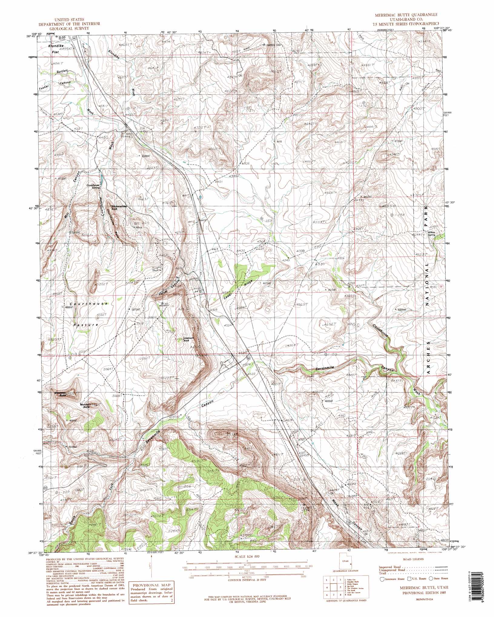
Merrimac Butte Topo Map Utah
To zoom in, hover over the map of Merrimac Butte
USGS Topo Quad 38109f6 - 1:24,000 scale
| Topo Map Name: | Merrimac Butte |
| USGS Topo Quad ID: | 38109f6 |
| Print Size: | ca. 21 1/4" wide x 27" high |
| Southeast Coordinates: | 38.625° N latitude / 109.625° W longitude |
| Map Center Coordinates: | 38.6875° N latitude / 109.6875° W longitude |
| U.S. State: | UT |
| Filename: | o38109f6.jpg |
| Download Map JPG Image: | Merrimac Butte topo map 1:24,000 scale |
| Map Type: | Topographic |
| Topo Series: | 7.5´ |
| Map Scale: | 1:24,000 |
| Source of Map Images: | United States Geological Survey (USGS) |
| Alternate Map Versions: |
Moab 4 NW UT 1952 Download PDF Buy paper map Merrimac Butte UT 1985, updated 1986 Download PDF Buy paper map Merrimac Butte UT 1985, updated 1986 Download PDF Buy paper map Merrimac Butte UT 2011 Download PDF Buy paper map Merrimac Butte UT 2014 Download PDF Buy paper map |
1:24,000 Topo Quads surrounding Merrimac Butte
Hatch Mesa |
Crescent Junction |
Thompson |
Sagers Flat |
White House |
Dee Pass |
Valley City |
Klondike Bluffs |
Mollie Hogans |
Cisco Sw |
Dubinky Wash |
Jug Rock |
Merrimac Butte |
The Windows Section |
Big Bend |
Mineral Canyon |
The Knoll |
Gold Bar Canyon |
Moab |
Rill Creek |
Upheaval Dome |
Musselman Arch |
Shafer Basin |
Trough Springs Canyon |
Kane Springs |
> Back to 38109e1 at 1:100,000 scale
> Back to 38108a1 at 1:250,000 scale
> Back to U.S. Topo Maps home
Merrimac Butte topo map: Gazetteer
Merrimac Butte: Arches
Jacks Arch elevation 1584m 5196′Slickensides Arch elevation 1384m 4540′
Uranium Arch elevation 1589m 5213′
Merrimac Butte: Flats
Courthouse Pasture elevation 1527m 5009′Merrimac Butte: Ridges
Cedar Ridge elevation 1373m 4504′Merrimac Butte: Springs
Courthouse Spring elevation 1381m 4530′Lower Courthouse Spring elevation 1354m 4442′
Willow Spring elevation 1403m 4603′
Merrimac Butte: Summits
Courthouse Rock elevation 1546m 5072′Merrimac Butte elevation 1551m 5088′
Monitor Butte elevation 1664m 5459′
Merrimac Butte: Valleys
Bartlett Wash elevation 1360m 4461′Corral Canyon elevation 1358m 4455′
Klondike Wash elevation 1366m 4481′
Mill Canyon elevation 1369m 4491′
Sevenmile Canyon elevation 1276m 4186′
South Fork Sevenmile Canyon elevation 1397m 4583′
Tusher Canyon elevation 1367m 4484′
Merrimac Butte: Wells
Cedar Ridge Well elevation 1331m 4366′Dalton Well elevation 1342m 4402′
Merrimac Butte digital topo map on disk
Buy this Merrimac Butte topo map showing relief, roads, GPS coordinates and other geographical features, as a high-resolution digital map file on DVD: