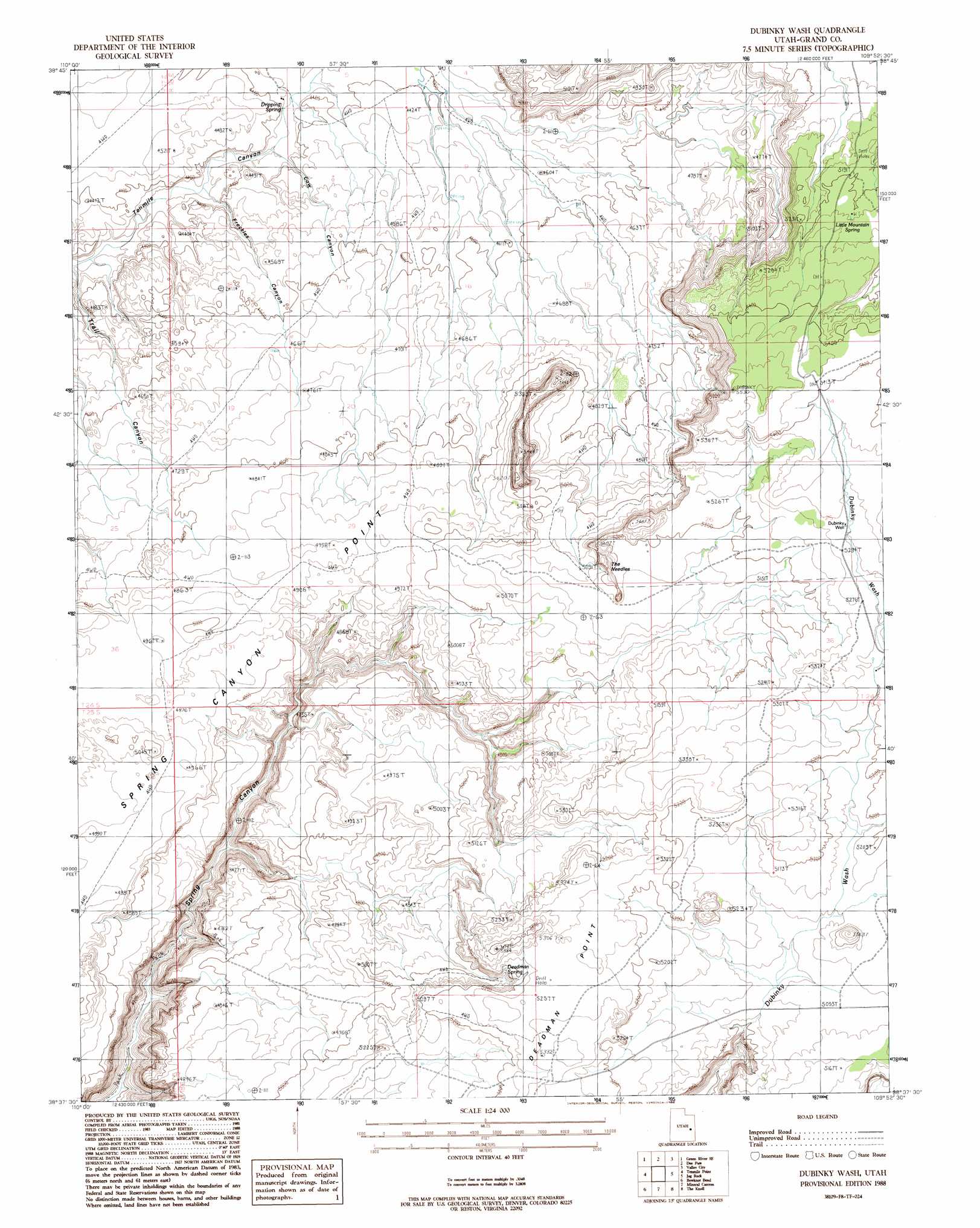
Dubinky Wash Topo Map Utah
To zoom in, hover over the map of Dubinky Wash
USGS Topo Quad 38109f8 - 1:24,000 scale
| Topo Map Name: | Dubinky Wash |
| USGS Topo Quad ID: | 38109f8 |
| Print Size: | ca. 21 1/4" wide x 27" high |
| Southeast Coordinates: | 38.625° N latitude / 109.875° W longitude |
| Map Center Coordinates: | 38.6875° N latitude / 109.9375° W longitude |
| U.S. State: | UT |
| Filename: | o38109f8.jpg |
| Download Map JPG Image: | Dubinky Wash topo map 1:24,000 scale |
| Map Type: | Topographic |
| Topo Series: | 7.5´ |
| Map Scale: | 1:24,000 |
| Source of Map Images: | United States Geological Survey (USGS) |
| Alternate Map Versions: |
Moab 3 NW UT 1952, updated 1954 Download PDF Buy paper map Dubinky Wash UT 1988, updated 1988 Download PDF Buy paper map Dubinky Wash UT 2010 Download PDF Buy paper map Dubinky Wash UT 2014 Download PDF Buy paper map |
1:24,000 Topo Quads surrounding Dubinky Wash
Green River |
Green River Ne |
Hatch Mesa |
Crescent Junction |
Thompson |
Horse Bench East |
Green River Se |
Dee Pass |
Valley City |
Klondike Bluffs |
Moonshine Wash |
Tenmile Point |
Dubinky Wash |
Jug Rock |
Merrimac Butte |
Keg Knoll |
Bowknot Bend |
Mineral Canyon |
The Knoll |
Gold Bar Canyon |
Sugarloaf Butte |
Horsethief Canyon |
Upheaval Dome |
Musselman Arch |
Shafer Basin |
> Back to 38109e1 at 1:100,000 scale
> Back to 38108a1 at 1:250,000 scale
> Back to U.S. Topo Maps home
Dubinky Wash topo map: Gazetteer
Dubinky Wash: Springs
Deadman Spring elevation 1540m 5052′Dripping Spring elevation 1323m 4340′
Little Mountain Spring elevation 1597m 5239′
Dubinky Wash: Summits
Tenmile Butte elevation 1451m 4760′The Needles elevation 1663m 5456′
Tombstone Butte elevation 1672m 5485′
Dubinky Wash: Valleys
Cow Canyon elevation 1317m 4320′Freckles Canyon elevation 1312m 4304′
Freckles Canyon elevation 1309m 4294′
Dubinky Wash: Wells
Dubinky Well elevation 1613m 5291′Dubinky Wash digital topo map on disk
Buy this Dubinky Wash topo map showing relief, roads, GPS coordinates and other geographical features, as a high-resolution digital map file on DVD: