Blue Chief Mesa Topo Map Utah
To zoom in, hover over the map of Blue Chief Mesa
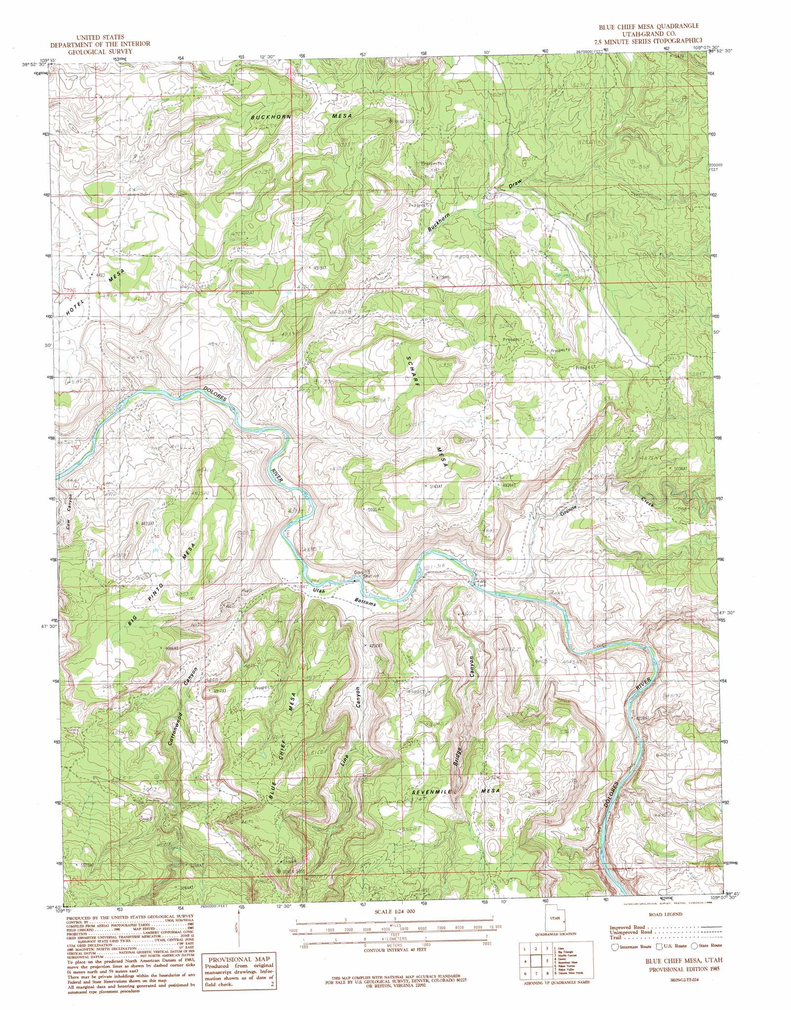
USGS Topo Quad 38109g2 - 1:24,000 scale
| Topo Map Name: | Blue Chief Mesa |
| USGS Topo Quad ID: | 38109g2 |
| Print Size: | ca. 21 1/4" wide x 27" high |
| Southeast Coordinates: | 38.75° N latitude / 109.125° W longitude |
| Map Center Coordinates: | 38.8125° N latitude / 109.1875° W longitude |
| U.S. State: | UT |
| Filename: | o38109g2.jpg |
| Download Map JPG Image: | Blue Chief Mesa topo map 1:24,000 scale |
| Map Type: | Topographic |
| Topo Series: | 7.5´ |
| Map Scale: | 1:24,000 |
| Source of Map Images: | United States Geological Survey (USGS) |
| Alternate Map Versions: |
Mt. Waas 1 SW UT 1954, updated 1956 Download PDF Buy paper map Blue Chief Mesa UT 1985, updated 1986 Download PDF Buy paper map Blue Chief Mesa UT 2011 Download PDF Buy paper map Blue Chief Mesa UT 2014 Download PDF Buy paper map |
1:24,000 Topo Quads surrounding Blue Chief Mesa
Cisco Springs |
Danish Flat |
Agate |
Westwater |
Sieber Canyon |
White House |
Cisco |
Big Triangle |
Marble Canyon |
Bieser Creek |
Cisco Sw |
Dewey |
Blue Chief Mesa |
Steamboat Mesa |
Two V Basin |
Big Bend |
Fisher Towers |
Fisher Valley |
Dolores Point North |
Gateway |
Rill Creek |
Warner Lake |
Mount Waas |
Dolores Point South |
Juanita Arch |
> Back to 38109e1 at 1:100,000 scale
> Back to 38108a1 at 1:250,000 scale
> Back to U.S. Topo Maps home
Blue Chief Mesa topo map: Gazetteer
Blue Chief Mesa: Capes
The Slide elevation 1511m 4957′Blue Chief Mesa: Flats
Utah Bottoms elevation 1280m 4199′Blue Chief Mesa: Streams
Granite Creek elevation 1284m 4212′Blue Chief Mesa: Summits
Big Pinto Mesa elevation 1551m 5088′Blue Chief Mesa elevation 1761m 5777′
Buckhorn Mesa elevation 1688m 5538′
Scharf Mesa elevation 1606m 5269′
Sevenmile Mesa elevation 1752m 5748′
Blue Chief Mesa: Valleys
Bridge Canyon elevation 1287m 4222′Buckhorn Draw elevation 1271m 4169′
Cottonwood Canyon elevation 1278m 4192′
Line Canyon elevation 1278m 4192′
Blue Chief Mesa digital topo map on disk
Buy this Blue Chief Mesa topo map showing relief, roads, GPS coordinates and other geographical features, as a high-resolution digital map file on DVD: