White House Topo Map Utah
To zoom in, hover over the map of White House
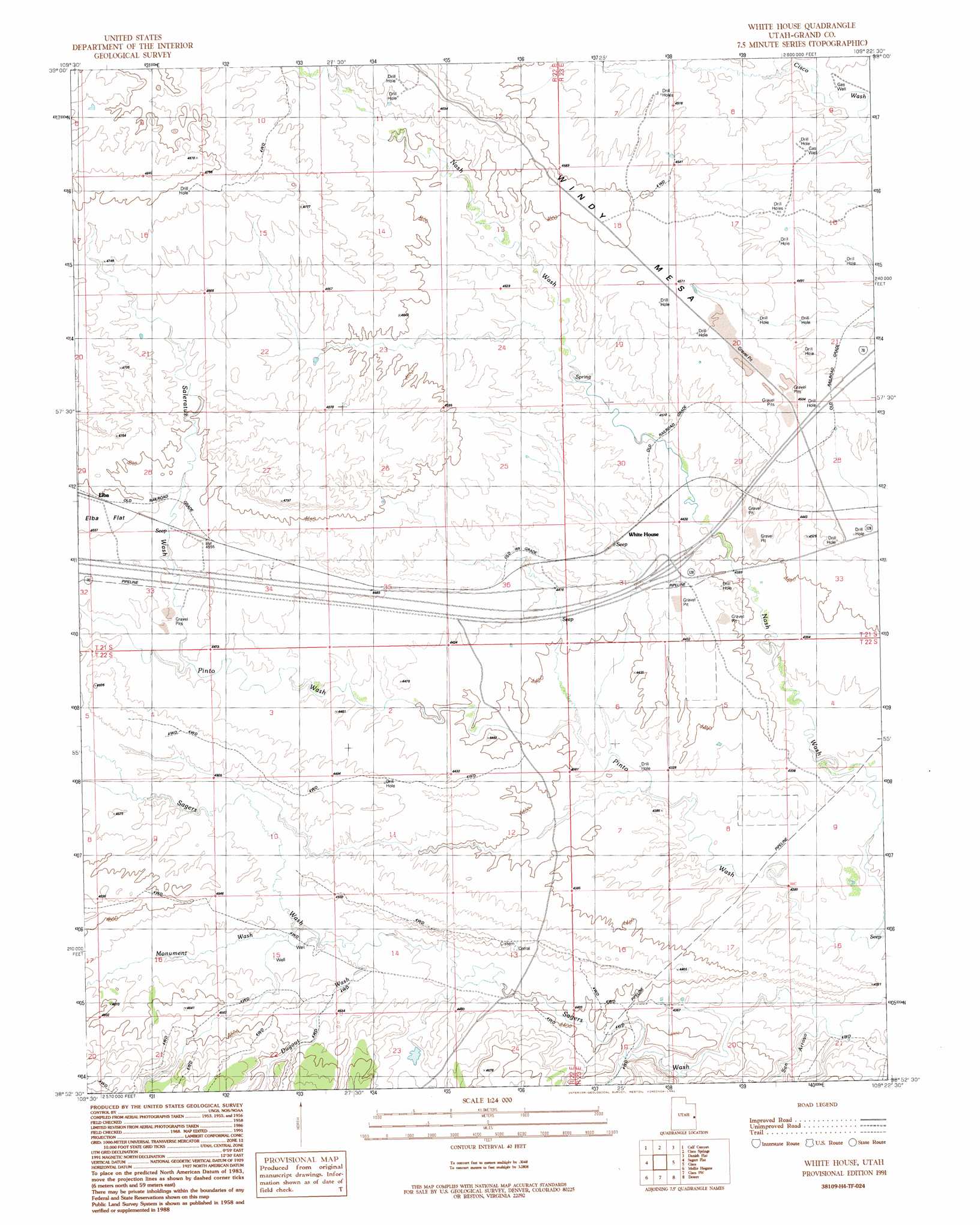
USGS Topo Quad 38109h4 - 1:24,000 scale
| Topo Map Name: | White House |
| USGS Topo Quad ID: | 38109h4 |
| Print Size: | ca. 21 1/4" wide x 27" high |
| Southeast Coordinates: | 38.875° N latitude / 109.375° W longitude |
| Map Center Coordinates: | 38.9375° N latitude / 109.4375° W longitude |
| U.S. State: | UT |
| Filename: | o38109h4.jpg |
| Download Map JPG Image: | White House topo map 1:24,000 scale |
| Map Type: | Topographic |
| Topo Series: | 7.5´ |
| Map Scale: | 1:24,000 |
| Source of Map Images: | United States Geological Survey (USGS) |
| Alternate Map Versions: |
White House UT 1991, updated 1991 Download PDF Buy paper map White House UT 2010 Download PDF Buy paper map White House UT 2014 Download PDF Buy paper map |
1:24,000 Topo Quads surrounding White House
Bogart Canyon |
Tepee Canyon |
Flume Canyon |
Antone Canyon |
Harley Dome |
Sego Canyon |
Calf Canyon |
Cisco Springs |
Danish Flat |
Agate |
Thompson |
Sagers Flat |
White House |
Cisco |
Big Triangle |
Klondike Bluffs |
Mollie Hogans |
Cisco Sw |
Dewey |
Blue Chief Mesa |
Merrimac Butte |
The Windows Section |
Big Bend |
Fisher Towers |
Fisher Valley |
> Back to 38109e1 at 1:100,000 scale
> Back to 38108a1 at 1:250,000 scale
> Back to U.S. Topo Maps home
White House topo map: Gazetteer
White House: Summits
Windy Mesa elevation 1414m 4639′White House: Valleys
Dugout Wash elevation 1359m 4458′Monument Wash elevation 1367m 4484′
Saleratus Wash elevation 1367m 4484′
San Arroyo elevation 1301m 4268′
White House digital topo map on disk
Buy this White House topo map showing relief, roads, GPS coordinates and other geographical features, as a high-resolution digital map file on DVD: