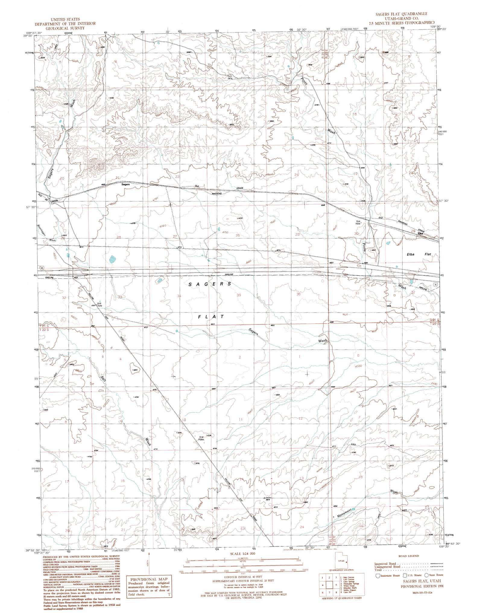
Sagers Flat Topo Map Utah
To zoom in, hover over the map of Sagers Flat
USGS Topo Quad 38109h5 - 1:24,000 scale
| Topo Map Name: | Sagers Flat |
| USGS Topo Quad ID: | 38109h5 |
| Print Size: | ca. 21 1/4" wide x 27" high |
| Southeast Coordinates: | 38.875° N latitude / 109.5° W longitude |
| Map Center Coordinates: | 38.9375° N latitude / 109.5625° W longitude |
| U.S. State: | UT |
| Filename: | o38109h5.jpg |
| Download Map JPG Image: | Sagers Flat topo map 1:24,000 scale |
| Map Type: | Topographic |
| Topo Series: | 7.5´ |
| Map Scale: | 1:24,000 |
| Source of Map Images: | United States Geological Survey (USGS) |
| Alternate Map Versions: |
Sagers Flat UT 1991, updated 1991 Download PDF Buy paper map Sagers Flat UT 2011 Download PDF Buy paper map Sagers Flat UT 2014 Download PDF Buy paper map |
1:24,000 Topo Quads surrounding Sagers Flat
Floy Canyon North |
Bogart Canyon |
Tepee Canyon |
Flume Canyon |
Antone Canyon |
Floy Canyon South |
Sego Canyon |
Calf Canyon |
Cisco Springs |
Danish Flat |
Crescent Junction |
Thompson |
Sagers Flat |
White House |
Cisco |
Valley City |
Klondike Bluffs |
Mollie Hogans |
Cisco Sw |
Dewey |
Jug Rock |
Merrimac Butte |
The Windows Section |
Big Bend |
Fisher Towers |
> Back to 38109e1 at 1:100,000 scale
> Back to 38108a1 at 1:250,000 scale
> Back to U.S. Topo Maps home
Sagers Flat topo map: Gazetteer
Sagers Flat: Flats
Elba Flat elevation 1393m 4570′Sagers Flat elevation 1430m 4691′
Sagers Flat: Populated Places
Elba elevation 1404m 4606′Sagers elevation 1474m 4835′
Sagers Flat: Valleys
Bootlegger Wash elevation 1472m 4829′Sagers Flat digital topo map on disk
Buy this Sagers Flat topo map showing relief, roads, GPS coordinates and other geographical features, as a high-resolution digital map file on DVD: