Hatch Mesa Topo Map Utah
To zoom in, hover over the map of Hatch Mesa
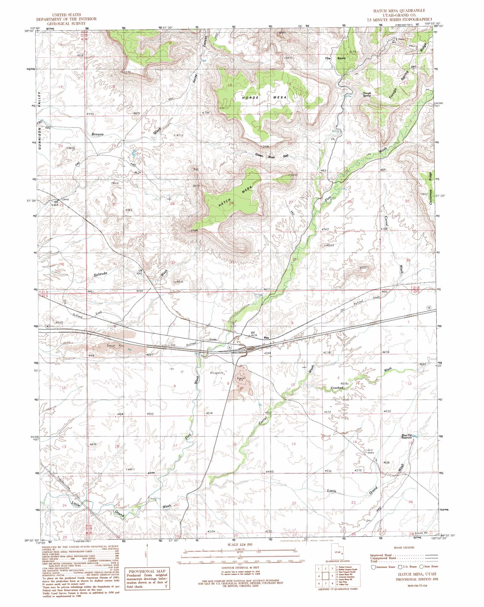
USGS Topo Quad 38109h8 - 1:24,000 scale
| Topo Map Name: | Hatch Mesa |
| USGS Topo Quad ID: | 38109h8 |
| Print Size: | ca. 21 1/4" wide x 27" high |
| Southeast Coordinates: | 38.875° N latitude / 109.875° W longitude |
| Map Center Coordinates: | 38.9375° N latitude / 109.9375° W longitude |
| U.S. State: | UT |
| Filename: | o38109h8.jpg |
| Download Map JPG Image: | Hatch Mesa topo map 1:24,000 scale |
| Map Type: | Topographic |
| Topo Series: | 7.5´ |
| Map Scale: | 1:24,000 |
| Source of Map Images: | United States Geological Survey (USGS) |
| Alternate Map Versions: |
Hatch Mesa UT 1991, updated 1991 Download PDF Buy paper map Hatch Mesa UT 2010 Download PDF Buy paper map Hatch Mesa UT 2014 Download PDF Buy paper map |
1:24,000 Topo Quads surrounding Hatch Mesa
Jenny Canyon |
Butler Canyon |
Bobby Canyon North |
Floy Canyon North |
Bogart Canyon |
Blue Castle Butte |
Tusher Canyon |
Bobby Canyon South |
Floy Canyon South |
Sego Canyon |
Green River |
Green River Ne |
Hatch Mesa |
Crescent Junction |
Thompson |
Horse Bench East |
Green River Se |
Dee Pass |
Valley City |
Klondike Bluffs |
Moonshine Wash |
Tenmile Point |
Dubinky Wash |
Jug Rock |
Merrimac Butte |
> Back to 38109e1 at 1:100,000 scale
> Back to 38108a1 at 1:250,000 scale
> Back to U.S. Topo Maps home
Hatch Mesa topo map: Gazetteer
Hatch Mesa: Basins
The Basin elevation 1535m 5036′Hatch Mesa: Gaps
Green River Gap elevation 1534m 5032′Hatch Mesa: Populated Places
Floy elevation 1413m 4635′Hatch Mesa: Reservoirs
Blue Flat Reservoir elevation 1426m 4678′Hatch Mesa: Ridges
Trough Spring Ridge elevation 1675m 5495′Hatch Mesa: Springs
Trough Spring elevation 1534m 5032′Hatch Mesa: Summits
Hatch Mesa elevation 1691m 5547′Horse Mesa elevation 1660m 5446′
Hatch Mesa: Valleys
Corral Wash elevation 1351m 4432′Crooked Wash elevation 1379m 4524′
Floy Wash elevation 1342m 4402′
Horse Canyon elevation 1426m 4678′
Hatch Mesa digital topo map on disk
Buy this Hatch Mesa topo map showing relief, roads, GPS coordinates and other geographical features, as a high-resolution digital map file on DVD: